Monday, July 24, 2017

Lake Valhalla and Mount McCausland

Lichtenberg Mountain and the Central Cascades rise over Lake Valhalla
8 miles round trip, 2000 feet elevation gain (7 miles round trip, 1300 feet elevation gain for just Valhalla)
Difficulty: Easy-moderate to Lake Valhalla, Moderate to Mount McCausland
Access: Gravel road in okay shape to the trailhead, Northwest Forest Pass required

Lake Valhalla is a deep blue gem with a small beach in the heart of Washington State's Central Cascades, just a stone's throw away from the popular winter ski area at Stevens Pass. The hike to the lake is fairly easy and includes a stretch of hiking along the Pacific Crest Trail. Hikers who reach the lake and want more can add a mile to their hike and reach the summit of Mount McCausland, which offers a fragmented 360-degree view of the Central Cascades. I found this to be an enjoyable but not outstanding hike; the lake was pretty and the summit views were beautiful, but nothing about this hike screamed uniqueness.

I hiked to Lake Valhalla with four friends and a dog on a nice July weekend day. We took the standard route towards Steven Pass, leaving Seattle on Highway 522 heading northeast and then taking US 2 east from Monroe. About four miles over Stevens Pass, we turned left onto Forest Service Road 6700 towards the Smithbrook Trailhead; this turn is easy to miss. We followed NF-6700 for the final three miles up a gravel road to the Smithbrook Trailhead; there were a few very large potholes on the road, but most cars should be able to handle this by driving sufficiently slowly. There were about 30 to 40 cars parked at the trailhead, which is not terrible for being less than 2 hours from Seattle on a nice summer weekend.

A word of warning about the drive back: I have twice been stuck in bad traffic on US 2 heading west this summer already; maybe best to avoid having to drive back to Seattle on US 2 in the middle of the afternoon on Sundays.

The trail started out flat, running parallel to the road, with sparse canopy coverage. Valerian and arnica bloomed near the trail. A hundred meters into the hike, the trail met the road at a switchback in the road. After leaving the road, the trail delved into the forest and began a steady ascent via switchbacks. A few blowdown blocked the trail in places but were all fairly easy to handle. Bugs were unfortunately pretty bad: mosquitoes and deer flies were everywhere and frequent application of bug spray failed to fully deter the onslaught of bloodsuckers.

Valerian and arnica
After about a mile and a half of following the Smithbrook Trail on a sustained but reasonably gentle uphill, we came to a junction with the Pacific Crest Trail at Union Gap. We took the left fork here, following the PCT south towards Lake Valhalla. The next mile of the PCT was generally flat and stayed in the forest. At about 2.5 miles from the trailhead and a mile past the junction, the PCT began to break out of the woods at spots, with decent views of Lichtenberg Mountain. The trail then began to climb again to reach the saddle between Lichtenberg Mountain and Mount McCausland at 3 miles. The unmarked trail towards Mount McCausland broke off to the right just north of the saddle, while the PCT continued through the saddle and descended towards the lake.

The lake was visible through the trees almost immediately after we passed through the saddle. The trail tread had generally been pretty smooth up to this point, but was a bit rockier in the final half mile descent from the saddle down to the lakeshore. Upon reaching a small basin just above the lake, a spur trail for lake access split off to the left from the PCT; we followed the spur all the way down to its end by the lakeshore.

First view of Lake Valhalla
There were a number of campsites by the lake, as well as a large rock by the lake signed "Day Use Only" and a small, sandy beach that one of my friends remarked was a much more pleasant spot than Alki. The overhanging rock pinnacle of Lichtenberg Mountain towered above the lake; we sat on logs on the beach and enjoyed the sun.

Lichtenberg Mountain towers over Lake Valhalla
Many hikers will find that Lake Valhalla is a sufficient and worthwhile destination; it certainly is a very reasaonble hike to access an alpine lake. Hikers who come away from the lake wanting more can add the one-mile round trip detour to the summit of Mount McCausland, the less dramatic of the two peaks bordering the lake. We elected to add McCausland to our hike, backtracking a half mile from Lake Valhalla to the saddle between Lichtenberg and McCausland and then following the unmarked spur trail north towards the summit of McCausland.

The path up McCausland was steep, gaining 600 feet in just half a mile. The hillside was dotted with huckleberry bushes and blooming heather, although other wildflowers were scarce. As there is no officially maintained trail up McCausland, there were multiple points at which the path split into multiple social paths; there's no signage here, so pick the paths that visually appear to best lead towards the summit.

Heather and huckleberries on the way up McCausland
As we climbed up, views  to the south widened. Lake Valhalla lay below us like a gem while the jagged and snowy high peaks of the Alpine Lakes Wilderness, including Mount Stuart, Cashmere Mountain, and the collection of glaciated peaks around Mounts Daniel and Hinman emerged.

Mount Stuart and Cashmere Mountain behind Lichtenberg Mountain
The steep and at times eroded trail flattened out at the summit ridge. A beautiful, flat stretch of trail winded through an alpine garden along the top of the mountain, with views of the Alpine Lakes Wilderness peaks to the south and of the Wild Sky Peaks (Baring, Gunn, Merchant, Fernow) to the the west.

Trail near the summit of McCausland
We followed the summit trail along the ridge to the true summit, which required one brief drop to a saddle and a final climb to a rocky, north-facing viewpoint. Here, there was a 200-degree or so view to the north of peaks of the Central and North Cascades. The most immediately apparent summit was that of Glacier Peak, which was nearly due north from here. To the right of Glacier Peak, we spotted many of the high peaks near the Chiwawa and Napeequa Rivers; I believe that we may have spotted Mount Maude and Seven Fingered Jack.

Glacier Peak and the North Cascades
Closer in, the mix of forested and meadow-filled ridges near Stevens Pass hid tiny Dow Lake; Mount Howard lay a little farther away. We took a look at the summit register, enclosed in a sturdy box, while we sat at the summit. We passed one group coming down the trail while we ascended, but otherwise had the summit to ourselves, a nice contrast to the slightly more crowded experience that we had down by the shores of Lake Valhalla.

East view from McCausland, Dow Lake below
Looking to the west and northwest, we also spotted many of the sharp peaks of the Wild Sky Wilderness and the Monte Cristo massif: Baring, Index, Merchant, and Gunn were all distinguishable and Kyes and Columbia in the Monte Cristo peaks were joined by the sharp point of Sloan Peak, which had temporarily hidden in the clouds during our visit.

Baring, Index, Merchant, and Gunn from McCausland
Monte Cristo peaks and Sloan

Sunday, July 23, 2017

Indian Henry's Hunting Ground

Avalanche lilies along the trail in Indian Henry's Hunting Grounds
11.5 miles round trip, 3600 feet elevation gain
Difficulty: Moderate-Strenuous
Access: Paved road to trailhead, Mount Rainier National Park entrance fee required

Indian Henry's Hunting Ground is a remarkable wildflower meadow to the southwest of Washington State's Mount Rainier that is perhaps one of the most underrated hiking destinations in Mount Rainier National Park. While lacking the name recognition of Rainier wildflower parks such as Paradise, Summerland, or Spray Park, the Hunting Ground puts on an equally colorful and lush wildflower show and as a bonus, typically sees only a fraction of the visitors that trample to those other spots. What the Hunting Ground lacks in wide, open grassy spaces, it makes up for in wildflower density, pretty ponds, and a historic ranger cabin along the Wonderland Trail. This hike is absolutely phenomenal when avalanche lilies bloom; visit during mid-summer to catch this unrivalled show of Northwest natural color. The catch? The Hunting Ground is a substantial day hike in from either Kautz Creek or Longmire, a much tougher destination to reach than many of the other previously mentioned wildflower hotspots.

I hiked this trail with a friend on a reasonably nice July day; although we had initially made plans to head to the North Cascades, overcast weather in the Sound and the promise of clear skies in the Paradise webcam drove us south to Mount Rainier. From Seattle, we took State Route 167 and then SR 512 south to Puyallup, exited onto SR 161 and followed it south past South Hill, Graham, and Eatonville to the junction with SR 7; we turned left and followed Highway 7 to Elbe and continued on Highway 706 from Elbe towards Mount Rainier. Passing Ashford, we entered the park and came to the Kautz Creek Trailhead, on the right side of the road, about 4 miles from the park entrance. There were maybe 40 or so parking spaces at the trailhead, which was ample considering that trail traffic was fairly low.

From the parking lot, we crossed the road and started off on the Kautz Creek Nature Trail boardwalk; following the boardwalk for just a few yards, we came to a trail junction to the right for the trail to Indian Henry's. We took the right fork, leaving the boardwalk for a wide, gentle trail through the forest. The first mile of the trail was nearly flat as it cut through the forest adjacent to Kautz Creek. At the end of the first mile, the trail descended slightly to cross through the sandy creekbed of Kautz Creek, crossing the creek itself via a well-built log bridge. Here, we caught our first view of the mountain (and our only view of the mountain uncloaked- Rainier decided to at least partially hide beneath the clouds for the rest of our hike).

The first mile of the hike illustrated the power of flooding and mudflows: Kautz Creek is perhaps best known for a massive 1947 mudflow triggered by heavy rains that buried the Longmire-Paradise Road. Sections where the creekbed is threatening to undercut the trail underlines the fickle nature of the creek and the fast-paced geological change that occurs in the park. Mudflows and floods play an active role in the park landscape and park access: in recent years, multiple glacial outburst debris flows have charged down Tahoma Creek, causing the long-term closure of Westside Road, and a 2006 flood on the Nisqually River destroyed a campground at Longmire. When Rainier erupts in the future, volcanic mudflows known as lahars will pose a major threat not just within the park but also to communities along the rivers leading out from the mountain such as Orting and even major Puget Sound cities like Tacoma.

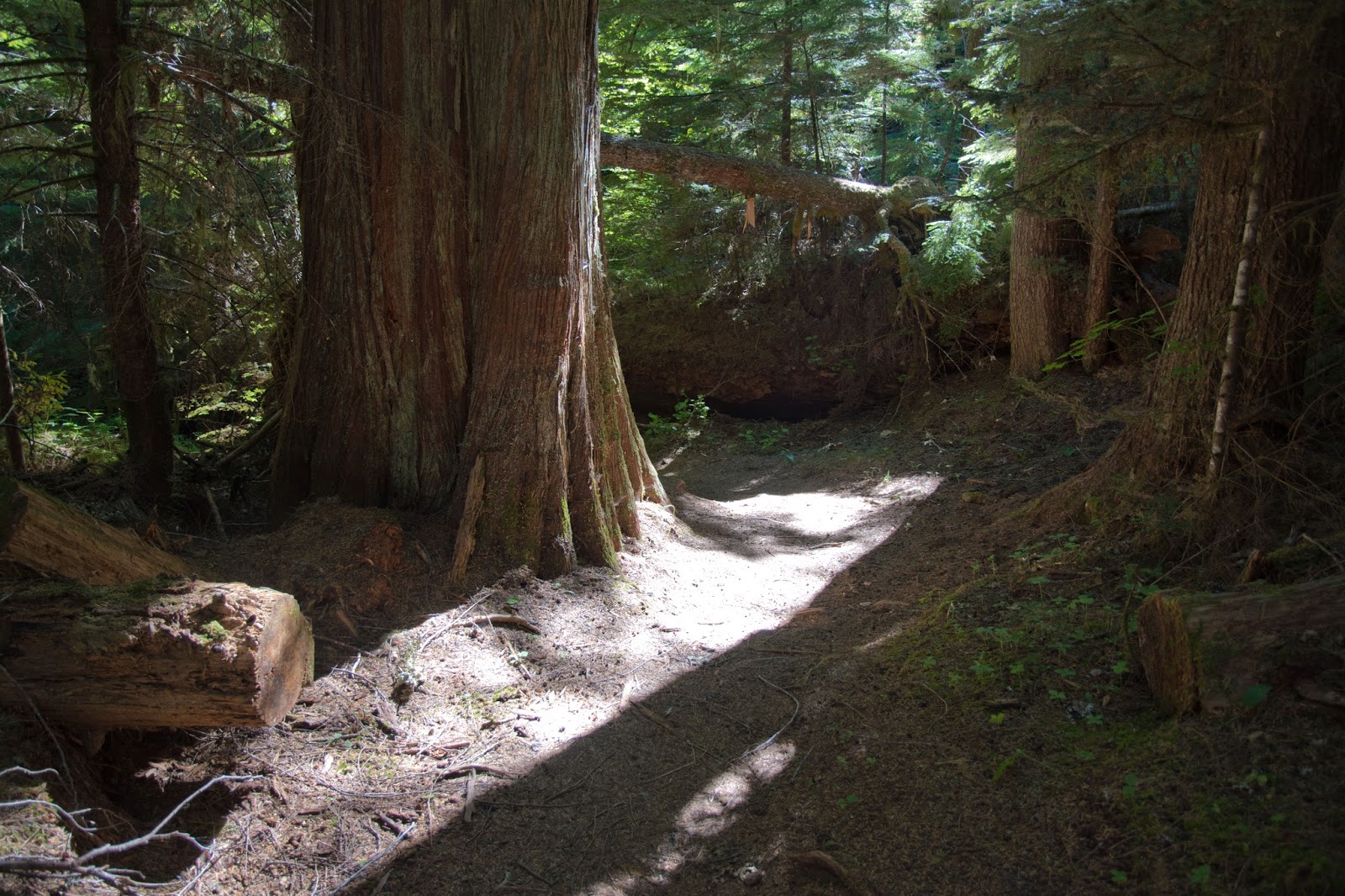
After crossing Kautz Creek, the trail delved into an old growth forest (one cedar was almost four feet in diameter!) and began a steady uphill climb. Soon, reaching the base of Mount Ararat, the trail embarked on an at times steep switchback ascent through the forest.

Massive cedar on the climb up to the Hunting Grounds
There's little to comment on here; the climb was relentless, with only occasional flat breaks, as it continued from one uphill stretch on to the next and then the next, cramming 2000 feet of elevation gain into the next two miles. At a little over three miles from the trailhead, at a sharp switchback, we found a small spur path that led a hundred paces off the trail to a southward view, the first real view of the hike. We spotted Mount Adams in the distance; closer in, my friend and I could see the pointed summit of High Rock and the jagged line of Sawtooth Ridge, where we had been just a week earlier.

High Rock and Sawtooth Ridge
Not long past the viewpoint, the trail flattened out a bit and we made three almost simultaneous discoveries: first, Mount Rainier appeared before us, mostly cloaked in clouds, for just the first time since crossing Kautz Creek; second, a small patch of snow lay on the trail, giving us a perfect spot to lie down and cool down after the long uphill; and third, both sides of the trails were lined avalanche lilies in full bloom. We had managed to nail the timing for our hike on the head and catch avalanche lilies in peak bloom along the trail.

Avalanche lilies
Past this brief flattening in the trail, we began an uphill climb again; but this time, the trail broke out into a semi-open slope at the base of an imposing rock ridge. As the trail attacked this slope with a switchback climb, good view of both Goat Rocks and Mount Adams emerged. The meadows here were bursting with color: I spotted phlox, tiger lilies, columbine, beargrass, arnica, valerian, and lupine.

Mount Adams comes into view
Then, very suddenly, at about four miles from the trailhead, we emerged into an open meadow atop a ridge. Innumerable beargrass and stately spruce were spread throughout the meadow; Liberty Cap and Point Success made brief appearances to the north as the clouds drifted in and out. Although we were still the better part of two miles from the end of our hike at the patrol cabin, this meadow marked our entry into Indian Henry's Hunting Ground.

Beargrass
The fields of beargrass were followed by dense patches of alpine daisies. My friend and I, who were been joined by a solo fellow hiker, made our way slowly through this most sublime of subalpine gardens.

Field of daisies in the Hunting Ground
I've visited many incredible subalpine wildflower meadows in the past; although Indian Henry's is perhaps not the best known, the wildflower show here is surely an equal to the blooms at Paradise and Spray Park. Mount Adams, Goat Rocks, and occasionally Rainier formed a snowy and majestic backdrop to boundless fields of beargrass, Indian paintbrush, lupine, arnica, and daisies.

Mount Adams rises above Indian Henry's Hunting Grounds
The mixed meadow-and-forest summit of Mount Ararat soon appeared before us. Downhill hikers informed us that they had spotted a bear on the slopes of Ararat, but we missed the ursine residents on our hike.

Mounts Ararat and Rainier rise above Indian Henry's Hunting Grounds
Pasqueflower (also known as Western Anemone) was rare but we spotted some along the trail that had already bloomed and gone to seed, leaving behind its distinctive, Dr. Seuss-like seedheads.

Pasqueflower seedheads
Reaching the foot of Mount Ararat, we started the final substantial uphill climb of the hike. The trail reentered a sparse forest interspersed with ridiculously colorful wildflower meadows: valerian, columbine, arnica, lupine, monkeyflower, and daisies dotted the switchbacks as we made our final 400-foot uphill push.

Wildflowers
Approaching the top of this climb, magenta paintbrush and avalanche lilies began crowding the trailside. Then, cresting a small hill, we saw the extraordinary sight of Mount Rainier, with Liberty Cap and Point Success just poking out from above the clouds and the Tahoma Glacier plunging down the Sunset Ampitheater, rising above a lush display of avalanche lilies.

Indian Henry's Hunting Grounds
Soon afterwards, the trail emerged onto an open slope on the east side of Mount Ararat, ascending gently through a meadow of beargrass and valerian with stunning open views of the Tatoosh Range, Goat Rocks, Satulick Mountain, and Mount Adams.

Tatoosh Range and Goat Rocks
At the end of the sloped meadow, the trail flattened out and then began its descent into the very heart of the Hunting Ground. While avalanche lilies earlier along the trail had been impressive, here they became absurd and overwhelming: the six-petaled white flowers with dainty golden hearts crowded every meadow on the last half mile through the Hunting Ground to the patrol cabin. Although not exactly colorful, to me there is something especially bright and optimistic about these early-blooming alpine flowers that make them one of my favorite of all alpine flowers.

Avalanche lilies
So many lilies!
Never in my life have I seen so many avalanche lilies blooming at once. My friend and I made estimates on how many were blooming; surely there were tens to hundreds of thousands dotting these slopes.

A carpet of avalanche lilies
The only thing more numerous than the avalanche lilies were the bugs. Mosquitoes and flies that had made the Hunting Grounds their home set upon us as if dining at an all-you-can-eat buffet; although we applied plenty of bug spray, both my friend and I were more or less eaten alive.

The Patrol Cabin at the Hunting Grounds
Luckily, we looked ahead and spotted the patrol cabin at the end of a long meadow, near the foot of Copper and Iron Mountains. Mount Rainier played peek-a-boo for a last time, with Point Success making a brief appearance before disappearing completely behind the clouds for the rest of our hike.

Indian Henry's Hunting Grounds
At 5.7 miles from the trailhead, we came to the junction between the Kautz Creek Trail and the Wonderland Trail. The 93-mile Wonderland Trail circumnavigates Rainier, passing through many beautiful alpine meadows- like Indian Henry's Hunting Ground- along the way. To reach the patrol cabin, we turned left at the Wonderland Trail junction, following it clockwise a hundred meters to a marked spur trail for the cabin and then following that spur trail to the cabin itself. The wildflowers were still just as spectacular here, with valerian and avalanche lilies contributing two different sources of star-like white dots on the green meadows and magenta paintbrush and lupine adding a dash of color.

Patrol Cabin
Indian Henry's Hunting Ground is named for So-to-lick, a Native resident of Mount Rainier who befriended many European visitors and guided many early climbers to the base of the mountain's glaciers; So-to-lick never attempted to summit the mountain as most regional Native peoples held the mountain, which they knew as Tahoma, to be a sacred peak. So-to-lick was bestowed the name "Henry" by a European American mail-carrier, Henry Windsor, who decided that learning someone else's three-syllable name was too difficult. The patrol cabin is a century-old log structure that is still currently staffed by park rangers who monitor the Wonderland Trail. We sat on the porch of the cabin for lunch, chatting with our new friend and the resident ranger. Our stay was unfortunately short, as the accumulation of bug bites on our arms and neck became a persuasive argument for starting our return.

Flowers at the cabin

Monday, July 17, 2017

High Rock

Mount Rainier from High Rock
3.5 miles round trip, 1400 feet elevation gain
Difficulty: Moderate; walk up the rock at the end may be challenging for some
Access: Bumpy gravel road to trailhead

High Rock is a lofty viewpoint in Washington State's Gifford Pinchot National Forest that delivers an outstanding view of Mount Rainier and the Cascade volcanoes near the Columbia River. Crowned with an old fire lookout, High Rock rises above the nearby forested ridges, making it one of the best viewpoints of Mount Rainier's southern aspect. The price of admission is a short but steep hike up from Towhead Gap and- perhaps more limiting- a very bumpy drive down a pothole-littered road to reach the trailhead. This is a fairly popular hike but still sees just a fraction of the crowds that pack the nearby national park on nice weekends.

I hiked this trail on a July Sunday with two friends; due to a forecast of cloudy morning weather clearing in the afternoon, we got a late start, waiting until almost noon to head out, a decision that was vindicated when the clouds burned off during our hike. From Seattle, we took State Route 167 and then SR 512 south to Puyallup, exited onto SR 161 and followed it south past South Hill, Graham, and Eatonville to the junction with SR 7; we turned left and followed Highway 7 to Elbe and continued on Highway 706 from Elbe towards Mount Rainier. Just past Ashford, we made a right turn onto Forest Service Road 52 and followed it across the Nisqually River for five miles until reaching Forest Service Road 84, which was poorly marked. We turned right onto NF-84 and followed it for 9 miles on gravel to the trailhead, turning off onto NF-8440 about two miles before the trailhead. Signage after turning onto NF-84 is extremely poor; I found that the best rule of thumb for reaching the trailhead was staying on the more major road at all junctions when there is a clear difference in road quality, and then taking the left fork the first two times and the right fork the last time at the three junctions where the two forks are of similar road quality. Make sure you figure out directions before you make the drive. While for the most part the gravel roads were pretty smooth, there was one section halfway through the drive where the road was filled with large potholes, some potentially capable of axle-busting if you don't slow down. Most cars should be able to handle these potholes as long as they go slow.

The trailhead was at Towhead Gap, a sharp bend in the road. Parking was alongside the road at the bend; there were perhaps 20 cars at the trailhead when we arrived. The lookout itself was visible from the trailhead. We hopped onto the main trail, which was indicated by a sign stating "High Rock Lookout 1.6 miles." The trail began an immediate ascent through the forest, generally following the top of the ridge.

Trail through the trees
Although there were no meadows, wildflowers dotted the side of the trail at multiple spots through the climb. Blooming flowers included tiger lilies, columbine, lupine, paintbrush, valerian, and daisies. While a few flies and bees skitted around the flowers and forest, there wasn't a major insect problem on the day of our hike.

Blooming wildflowers
Wildflowers on the trail
The trail climbed steadily for 1.3 miles before coming to the first viewpoint. The trail tread was mostly dirt, making the hiking pleasant for the most part, although the steepness of the grade may still make it a bit of challenge for some hikers. At the first viewpoint, the trail broke out of the woods and came to the edge of the cliffs that define Sawtooth Ridge. At this point, Mount Rainier was still covered in clouds, but we still had a beautiful view of the meadow-filled Tatoosh Range, the snow-covered Goat Rocks, and the mini-Rainier that is Mount Adams. We also spotted the lookout itself, which still appeared to be high above us.

First view of Mount Adams and Goat Rocks
In the last third of a mile, the trail passed through multiple small meadows near the summit. Here, beargrass was blooming profusely, complementing the array of wildflowers that we had seen earlier on the hike; we also spotted phlox growing in the rockier, more exposed spots near the trail. Mount St. Helens with its gaping crater appeared to the south through clearings in the forest.

Beargrass blooming
The trail made a tight switchback upon reaching a cliff just west of the summit. We stopped here for a bit to enjoy the views of the jagged cliffs of Sawtooth Ridge and the gradually clearing view of Mount Rainier before making the final push to the summit. The trail died out at the base of the summit block, a large, angled rock. Some hikers may find this final walk up the rock to be challenging; some people may regard this as a bit of a rock scramble. Regardless, a few minutes of walking up angled rock brought us to the lookout structure at the summit.

Approaching the lookout
The lookout was unfortunately in pretty bad shape; even though the inside of the lookout was open to the public, it was more or less empty and the outside of the lookout was pretty beaten up, with multiple windows smashed and glass littering the summit. It was unclear whether the damage to the lookout was due to vandalism or natural causes.

The 360-degree more than made up for the poor shape of the lookout. Mount Rainier towered to the north, with the extraordinary Tahoma Glacier pouring down between Liberty Cap and Point Success and Little Tahoma barely poking above the right side of the mountain. The forested Kautz Creek and Nisqually River valleys led outward from the mountain. Cora Lake lay nearly directly below us at the foot of massive cliffs.

Mount Rainier
To the south, we could see three more volcanoes: Mount St. Helens, Mount Adams, and Mount Hood. Goat Rocks, the tallest non-volcanic peaks in the southern part of the state, lay to the east.

The crater of Mount St. Helens is clearly visible from High Rock
The view to the west was defined by the craggy ramparts of Sawtooth Ridge. Beyond the ridge, we spotted the blue-green waters of Alder Lake and the even more distant sinewy waterways of the Puget Sound.

Sawtooth Ridge
This is one of the better hikes between Rainier and St. Helens and is a good alternative to hiking in the park for anyone who wishes to see Rainier up close. Come on a clear day to truly appreciate the far-reaching views from this summit.

Sunday, July 16, 2017

Lookout Mountain (Cascade River)

Eldorado and Forbidden Peak
10 miles round trip, 4500 feet elevation gain
Difficulty: Strenuous
Access: Paved road to trailhead, Northwest Forest Pass required

While the views of the North Cascades from Lookout Mountain Lookout are undeniably spectacular, the trail up to this summit is only for those who prefer their hikes served with a strong dose of misery. The never-ending ascent up Lookout Mountain is steep, often overgrown, littered with blowdown, and badly eroded at points, making this a very challenging hike for most; additionally, as the hike starts from the Cascade River Road, it's necessary to climb the full height of the mountain, which also means that most of the hike is confined to the forest. But hikers who endure through the travails of this hike will find a jaw-dropping view of some of the most famous peaks of the North Cascades, including an up-close encounter with majestic Eldorado Peak. This hike should not be confused with the other Lookout Mountain Lookout in the North Cascades, a much easier hike with less impressive views that lies on the other side of the watershed divide in the Methow Valley.

I hiked this trail on a beautiful and sunny July Saturday, leaving Seattle and taking I-5 north to Arlington, then Highway 530 east through Arlington and Darrington to Rockport, then Highway 20 east to Marblemount, then finally turning right onto the Cascade River Road at the Skagit River bridge and following the road 8 miles to the Lookout Mountain Trailhead. Parking was on a wide shoulder to the right (south side of the road), with about enough space for a dozen cars. The trail started across the road.

The trail wasted no time and immediately began climbing, passing an information board and trail register about fifty paces into the hike. The next 2 miles were relentless: the trail was a sustained switchback climb up a ridge through the forest that covered 2200 feet of elevation gain. The forest appeared to be old growth, with some absolutely massive Douglas firs reaching 4 feet in diameter and a Western cedar stump of a tree that must have once been 5 five in diameter. I didn't bother to count, but there were at least 30 switchbacks along this stretch of trail (and at least 50 on the entire hike). There were no views in the forest. The trail was littered with occasional blowdown but there were no true obstacles; the difficulty lay mainly in the length and sustained nature of the climb.

At 2 miles, the trail very suddenly broke out into a clearing and flattened out a bit. While the gentler uphill grade was welcome, the lack of trees was not: the forest was replaced with an overgrown bushy slope where stinging nettle and other pleasant vegetation reached just over my head. The trail was barely visible through this overgrown mess and was often rocky and uneven underfoot. Halfway through pushing through the nettle, I muttered to myself, "This is enjoyable. You like hiking! You are having fun."

"Trail"
The unpleasantness of this stretch was slightly offset by the presence of tiger lilies blooming alongside the "trail." I also spotted Dome Peak to the south through the clearing, a promise that the rewards ahead would justify the tough trail.

Tiger lilies in the overgrown clearing
Coming out of the clearing, the trail reentered the forest and continued ascending, albeit a little less aggressively than before. I spotted Lookout Mountain through the trees for the first time just before crossing a stream that fed into Lookout Creek. At a second stream crossing, a two-plank log bridge had partially collapsed, leaving just one intact plank for the crossing. At times, the trail here was routed on well-built and reasonably well-maintained boardwalks, which seemed incongruous with the poor state of the trail at other spots. The stream crossings were followed by one of the only flat stretches of the entire hike.

Three miles from the trailhead, the trail towards Monogram Lake branched off to the right of the trail. The junction is signed, but the post indicating the split is small and easy to miss; hikers who fail to see the post and continue to follow the most obvious trail will end up at the lookout. In the next mile past the signed junction, the trail continued to climb steadily through the forest; in this stretch, I had to negotiate multiple blowdowns, some of which were a bit of a pain to climb across or go around. Additionally, the trail was muddy or covered with running water at multiple points in this stretch.

Four miles from the trailhead and 3500 feet up the mountain, the trail emerged into a massive, verdant mountainside meadow. Wildflowers littered the mountainside, adding brilliant colors to the green slopes. Columbine, lupine, and valerian were in a blooming frenzy, crowding the sides of the trail. The wildflowers were complemented by extraordinary views down the Cascade River Valley: I could see directly downvalley to the peaks of the Ptarmigan Traverse, of which Dome Peak was the most prominent. Lookout Mountain itself and the lookout tower appeared almost directly above, seeming so close yet at the same time still so inaccessible.

Columbine blooming in the meadow
Valerian blooming in the clearing
At points, the trail through the meadow was in bad shape: in some areas, it was overgrown in a manner similar to the earlier clearing and in others, the trail was severely eroded and had become just a steep dirt patch through the meadow.

The trail continued climbing through the meadow, ascending via switchbacks as it aimed for the saddle just east of the Lookout Mountain summit. Views only improved during this ascent: nearby Little Devil Peak and its combination of rocky and meadow-filled slopes were prominent but steep, jagged, and regal face of Eldorado Peak stole the scene.

Eldorado Peak and the meadow
From the saddle, there was a final 500 feet of climbing left to reach the lookout. The trail alternated between passing through forest and meadows as it pushed up a final aggressive uphill climb. Approaching the summit, the trail passed through a few patches of remaining snow; these patches would not have been an issue for any hiker who has already made it that far.

The trail followed the mountainside down to the south ridge of Lookout Mountain, making a sharp turn once meeting the ridge to follow it to the summit. At the switchback on the ridge, the trail came to an absolutely arresting view: the south ridge dropped precipitously away beneath my feet to huge meadows with wildflowers and the mile-deep valley of the Cascade River was lined with snowbound mountains.

Cascade River Valley with the Ptarmigan Traverse peaks
As I followed the ridgeline for the final ascent to the summit, the scenery was outstanding and improved with every step. Little and Big Devil Peaks were both visible close to the east and the Picket Range emerged just beyond them to the north.

Big and Little Devil Peaks
The lookout, an elevated wooden cabin, also came into view. A final push through some snow patches brought me to the base of the lookout; I hopped on the staircase and a few seconds later found myself standing atop the tower, exhausted but exhilarated by the views.

The lookout
What views! Although incoming clouds had gobbled Mount Shuksan, the remaining panorama of North Cascades peaks was in sight. While everything was undeniably beautiful, two aspects of the view dominated over all others: the icy, grand ridge of Eldorado Peak and the frightening wall of the Pickets. I originally decided to hike Lookout Mountain for its view of Eldorado Peak and it did not disappoint on this count: this was by far the grandest view I'd had of the mountain nicknamed Queen of the Cascade River by legendary climber Fred Beckey.

The Pickets, that wall of spires north of the Skagit River, formed the piercing skyline to the northeast. The awe that these mountains must have inspired in early European explorers is apparent in the names that were bestowed: the Pickets include peaks named Challenger, Fury, and Terror. Nearby are the similarly poetically named Mount Triumph and Mount Despair.

Mount Despair, Mount Triumph, and the Pickets
The northwestern skyline featured Mount Baker and Mount Shuksan, although unfortunately Shuksan was socked away; this pair of very tall mountains was accompanied by the smaller but still beautifully glaciated forms of Bacon Peak, Hagan Mountain, and Mount Blum.

Mount Baker and Bacon Peak
To the west I could see directly down the Skagit River Valley: the Skagit River itself was visible winding its way through the broad bottom of the valley. Sauk Mountain and its many summits rose just north of the river. South of the valley, I spotted Mount Higgins near Oso, Whitehorse Mountain, and Three Fingers. The summit of White Chuck stuck out barely above closer, lower peaks.

Sauk Mountain rises above the Skagit River Valley
The rest of the view, to the south, was composed of peaks surrounding the Cascade River Valley. Lookout Mountain provides a rare vantage point for nearby Snowking Mountain and its heavily glaciated summit. Glacier Peak made a cameo, appearing just above one of the snowy ridgelines near Snowking. Dome Peak, Spire Peak, Mount Formidable, and Spider Mountain were the most identifiable of the line of peaks south of Cascade Pass that define the Ptarmigan Traverse. Johannesberg Mountain's sharp summit popped above Hidden Lake Peaks, the tops of Forbidden and Boston Peak emerged from behind Eldorado, and the top of Snowfield Peak was visible from the gap in between Big and Little Devil Peaks.

The lookout is maintained by volunteers and is in remarkably good shape: always unlocked, the lookout cabin is available for overnight stays on a first-come, first served basis. The cabin contains two twin mattresses and a folding chair; there's a stove and oven in the lookout as well but it didn't appear to be functional. While stays are free, the volunteers who run the lookout take donations and ask that hikers who stay the night leave the place cleaner than they find it. The lookout itself seemed of reasonably sturdy construction but the Forest Service recommends that to prevent the catwalks outside the lookout from collapsing, no more than 2 people should stand on each side of the lookout at a time.

Inside the lookout
I spent over an hour at the summit and saw only five other people: two hikers were spending the night, two more left shortly after I arrived, and a final hiker, a visitor from Chicago, arrived as I was about to leave. The hiker from Chicago, who, like me, was pretty beaten up from the hike up, told me that a ranger had recommended this hike to him: it surprised me that a ranger would recommend a hike of this difficulty over nearby hikes to similarly impressive views that are a notch or two easier. The warning that no more than two people should stand on one side of the lookout turned out to be fairly unnecessary while I was at the top; this is a reasonable place to find some solitude. I ran into twenty people or less over the course of the day, some of whom were headed to Monogram Lake and at least a few of whom gave up part of the way up this tiring mountain. The twenty or so blowdowns, muddy trail, overgrown trail, eroded trail, and endless switchbacks were rough- but for the chance to look at the regal face of Eldorado, it was more than worth it.