Thursday, December 31, 2020

Bristlecone-Rock Glacier

Add caption
5 miles round trip, 1100 feet elevation gain
Difficulty: Easy-moderate
Access: Paved road to trailhead, no fee required

The oldest known living tree on Earth- a bristlecone pine named Prometheus that was nearly 5000 years old- once grew in the cirque beneath Wheeler Peak in Nevada's remote Great Basin National Park. Prometheus has since been cut down, a tragic incident that spurred the protection of this land as Great Basin National Park. However, on the Bristlecone-Rock Glacier hike, you can still discover two unique sights in that cirque: the bristlecone pine forest of which Prometheus was once a member and the remnants of Nevada's last glacier that carved out this spectacular glacial bowl. For casual hikers visiting Great Basin National Park who aren't up for tackling the difficult hikes up Wheeler Peak or out to Magic Grove, this hike delivers the greatest rewards while demanding just a moderate effort.

The trail to the rock glacier is signed as leading to the glacier in some cases and the rock glacier in others; know that they refer to the same place. I will refer to it as the rock glacier in this post for consistency.

I hiked the Bristlecone-Rock Glacier Trail during a weeklong autumn road trip through Nevada to see the fall colors, arriving on the first day of October. Great Basin National Park is literally in the middle of nowhere- the trailhead is 4 hours from Salt Lake City and 5 hours from Las Vegas. The hamlet of Baker- population 68- is near the entrance of the park, while the closest town with full services is Ely, an hour away. I'll thus skip describing the route from any major city and instead just describe the route from Baker; Nevada Highway 488 leads from Baker to the entrance of the park. Upon entering the park, I turned right onto the Wheeler Peak Scenic Drive and followed it just a little over 12 miles to the Bristlecone Trailhead, a large parking area on the left side of the road just outside the entrance to the Wheeler Peak Campground. There's parking here for more than 40 cars and a vault toilet.

To start the hike, I crossed the road and started up the combined trail for the Sky Islands Forest Trail, the Bristlecone Trail, and the Alpine Lakes Loop. The first few meters of the trail were flat and wide for the ADA accessible Sky Islands Forest Trail but the Alpine Lakes Loop and the Bristlecone Trail broke off to the right very quickly. I took this right fork. This trail- wide and well maintained- began a gradual ascent and after a hundred meters it split apart again into the two directions of the Alpine Lakes Loop, with the right fork leading towards Stella Lake and the left fork leading to Teresa Lake and the Bristlecone Pine Grove. I took the left fork at this junction.

The trail climbed gently through a forest of spruce and fir for the next 2/3 of a mile before coming to the next junction. Here, the Alpine Lakes Loop continued towards Teresa Lake on the right; having seen from the summit of Wheeler Peak earlier that day that Teresa Lake had dried out, I skipped visiting the lake and instead took the left fork, which led to both the Bristlecone Pine Forest and the rock glacier.

The Bristlecone Trail dropped slightly from the junction as it crossed the dry creekbed of Lehman Creek. The trail then contoured around the northeast ridge of Wheeler Peak, staying fairly flat as it cut through forests on the slopes of the ridge. This stretch of trail delivered the first views of the hike: I could see across the Lehman Creek watershed to the colorful fall aspens growing on the slopes of Bald Mountain (there are no aspens directly along this trail). To the northeast, I looked out into the desert flats in Utah that are characteristic of much of the Great Basin.

Fall colors on aspens near the Wheeler Peak Scenic Drive
Looking out into the Great Basin
The trail made a sharp turn to the right as it entered the Wheeler Peak cirque. The trail began to steadily ascend as views of towering Doso Doyabi appeared ahead and the bristlecone pines came into sight.

Doso Doyabi rises above the bristlecone pine forest
The trail crossed a dry creekbed and then made a switchback and began a more aggressive ascent through rockier terrain as it began to pass a number of bristlecone pines. These trees live to be the oldest non-cloncal organisms in the world and inhabit the harsh upper reaches of the tallest ranges in the Great Basin. They do not typically grow to any impressive size due to the harsh environment, but over time the elements sculpt and twist the trees into unusual forms. Many older trees barely cling onto life, with just fragments of bark and a handful of needles giving life to a tree that had otherwise been reduced to a bare trunk. A number of dead trees dotted the grove as well: the dead trunks can last on these mountain slopes for thousands of years. 

Trunk of a dead bristlecone pine
Bristlecone pines have a range that is generally limited to the mountaintops of the many mountain ranges of the Great Basin. In the 1950s, Dr. Edmund Schulman of the University of Arizona visited the bristlecone pine groves of California's White Mountains and found- to his shock- that there were trees there a thousand years older than any giant sequoia, which were thought to be the oldest trees in the world at the time. Quickly, it became apparent that the oldest specimens in the White Mountains were easily over 4000 years old. In the following years, bristlecone pines became an object of academic fascination as the dendrochronological records in their trunks were used to validate radiocarbon dating and understand climate patterns of the past ten millenia.

In 1964, Donald Currey, a graduate student from UNC Chapel Hill, was doing field work in this very bristlecone pine grove in the cirque of Wheeler Peak, using tree cores to help build a dendrochronological record. Currey found one particularly wizened and ancient tree in the grove- named Prometheus- and tried to core it for his research. The record is a bit unclear on what happened next- either Currey's borer for extracting tree cores broke or Prometheus was too unwieldly for him to get a representative tree core sample- but his resulting choice was devastating. Seeking and then receiving permission from the Forest Service, Currey cut down Prometheus to analyze its rings. He counted 4862 rings. Factoring in the time it took to reach the height at which it was cut down, Prometheus may have been as much as 5000 years old. It remains the oldest confirmed non-clonal organism known on our Earth and until it was downed by a human, it lived here on the slopes of Wheeler Peak.

Bristlecone pines
The trail split into a short loop at 1.4 miles from the trailhead. The left fork here led hikers through the short Bristlecone Pine Interpretive Trail, while the right fork skirted the grove and was a shortcut to reach the rock glacier trail. I took the left fork here to pass through the heart of the grove and see a number of truly ancient trees, peers of the nearly-immortal Prometheus. The interpretive trail had a number of informative signs about the species and the grove as it made its way by some very gnarled trees. A particularly impressive tree lay at the top of the trail; while much of its trunk was dead and the dead wood had been scarred by fire, a few living branches still sporting bristlecone needles demonstrated that this 3200 year old tree was still alive and photosynthesizing.

3200-year old bristlecone pine
The tragedy of Prometheus helped bring the outcry and attention needed for federal protection of these rare and ancient beings. Today, the oldest known bristlecone pines are preserved in the Bristlecone Pine Natural Area in the White Mountains and here in Great Basin National Park.

Gnarled bristlecone trunk
At the top of the Bristlecone Pine loop, the Rock Glacier trail broke off to the left at a signed junction. I followed this trail, which passed a couple more bristlecone pines while it made a steady but gentle ascent through rocky terrain. A quarter mile past after leaving the Bristlecone Pine loop, I arrived at an interpretive sign at the end of a switchback where there were the first good views of Wheeler Peak at the head of the cirque and the rock glacier at its base. As recently as the early twentieth century, there was a true glacier here with crevasses that filled the head of the cirque, but that glacier has since retreated and there is now just some permanent patches of snow at the head of the cirque and a rock glacier, a mix of rock and ice that has some flow characteristics similar to how a true glacier moves. This was the last true glacier in Nevada before it became a victim of the changing climate that is wiping out glaciers from the Sierra Nevada and Colorado Rockies to Montana's Glacier National Park.

Wheeler Peak rising above the rock glacier
The trail made a quick set of switchbacks after the viewpoint and then continued up the valley into the depths of the cirque. The trail flattened out for a while as it followed the moraines left by the retreating glacier, but the terrain was very rocky here, making the trail much less pleasant to hike along. After the flatter stretch of the hike ended, the trail ventured onto more freshly deposited moraine, ascending steeply through piles of rocks that were likely just deposited in the glacial retreat of this past century. As the trail ascended through this moraine, views opened up outside the cirque: I had gained enough elevation that the peaks of the North Snake Range, including lofty Mount Moriah, had come into view.

Mount Moriah and the North Snake Range
The trail ended at a sign that simply read "Rock Glacier." There wasn't terribly much glacier to see here: a few patches of permanent snow at the base of Wheeler Peak's headwall marked where the glacier would have once originated. While there is apparently still a rock glacier here, it was not obviously distinguishable from the moraine around it. However, the views of the towering cliffs around the cirque here were still impressive and humbling. It was also very chilly: surrounded by high cliffs, this spot in the cirque almost never gets sunlight, explaining how the temperatures here were kept low enough to support a glacier in the middle of the Great Basin Desert.

Wheeler Peak towers over the rock glacier at the head of the cirque
After enjoying the views here, I traced my steps back, taking the other segment of the Bristlecone Pine loop on the descent and reaching the trailhead around sunset. As I drove down the Wheeler Peak Scenic Drive, I saw an incredible harvest moon rising over the Great Basin. I finished my day with dinner at Kerouac's in Baker- it's one of the only restaurants for miles around and luckily, it's even tastier than any place you'd find in Ely; in fact, Kerouac's may have the best food you can find in the triangle defined by Salt Lake City, Las Vegas, and Elko, Nevada.

This is an excellent hike. The handful of nice views along this trail are paired with the awe of seeing trees older than the monuments of Rome and Athens as well as the majesty of the great rocky cirque carved by Nevada's last glacier. There are better hikes in Great Basin National Park, but those hikes require strenuous efforts while the hike to the bristlecone pine grove and the rock glacier allows visitors to more easily access the sense of wonder which this landscape can imbue in us all.

Monday, December 28, 2020

Hickison Petroglyphs

Hickison Petroglyphs
0.6 miles loop, 50 feet elevation gain
Difficulty: Easy
Access: Good gravel road to trailhead, no fee required

The petroglyph site near Hickison Summit is just off of the Loneliest Road in America in the remote and desolate desert of Nevada's Great Basin. This short hike visits petroglyphs of abstract forms left by Desert Archaic peoples who lived in this desert as many as 8000 years ago (the petroglyphs themselves are likely younger). Unfortunately, there is a great deal of vandalism at the site that seriously detracted from my ability to find and appreciate true petroglyphs; still, the rock art was interesting and there was also a very nice viewpoint of the Toiyabe Range, one of the longest and tallest mountain ranges in central Nevada. This is a nice brief stop on the Loneliest Road but the less visually impressive nature of these petroglyphs may not appeal to all visitors.

I visited the Hickison Petroglyphs Recreation Area, which is run by the Bureau of Land Management, during a drive across Nevada on the Loneliest Road (US Route 50). The petroglyphs are quite remote: the closest nearby town is Austin, where there are few services. The site is about halfway between the more sizeable towns of Fallon and Ely, which are both over 120 miles away; this spot is about as lonely as it gets on the Loneliest Road. The recreation site is well labeled with a large BLM sign on the north side of US Route 50 and is thus easily reached by travelers going either direction on US Route 50. Upon taking the turnoff for Hickison Petroglyphs, I followed the good gravel road just under a mile to a cul-de-sac on the left side of the road with a vault toilet and parking for a handful of cars. There is a popular campground attached to this site but there's no water here.

The trail is a short, 0.4 mile loop with a 0.1 mile spur that leads out to a viewpoint of Big Smoky Valley and the Toiyabe Range. The BLM distributes interpretive brochures to help guide visitors through the site, but unfortunately there were no brochures at the site at the time of my visit. From the trailhead, I chose to do the hike clockwise, heading to the left. The trail traveled through a flat saddle between two hills; this side of the loop quickly approached some cliffs at the base of the hills on the eastern side of the saddle. The cliffs here were marked in many places, but most of the markings were recent graffiti and so it was difficult to recognize actual petroglyphs. However, I did find one panel of petroglyphs here that had an abstract and indecipherable design.

Hickison Petroglyphs
After 200 meters of hiking from the trailhead, a spur trail broke off to the left that led to the overlook. This flat trail led another 200 meters out to a rocky outcrop from which there was an excellent view of the Toiyabe Range to the west and Big Smoky Valley to the south. From here, I could see all the way down to Arc Dome and Toiyabe Dome, two major mountains in the southern part of the range; I had hiked Arc Dome, the highest peak in that range, the previous day. The Hickison Petroglyph Site itself lay at the junction of the Simpson Park Mountains and the Toquima Range.

Toiyabe Range and Big Smoky Valley from overlook
I returned to the loop, which turned and began heading back towards the parking area along another set of cliffs on the west side of the saddle. The cliffs here were covered with graffiti as well but I spotted another set of pecked symbols that appeared to be petroglyphs as well. The identity of Desert Archaic peoples who inhabited this landscape is unclear; they did so at a time when prehistoric lakes left by the last ice age were receding; the much wetter landscape then supported modes of substinence that may no longer be necessary in today's desert. Neither the creators of these petroglyphs nor the meanings of the pecked messages are clear, but these petroglyphs remain a communication between humans across millenia in this arid landscape.

Hickison Petroglyphs
As I approached the parking lot, I arrived at a massive boulder with complex etchings into its patina from multiple sides. Although their meanings were unclear, these final petroglyphs on the hike were quite impressive.

Petroglyphs on boulder
I liked this short hike both for the petroglyphs and the views, but I will also admit that this wasn't the most exciting hike in the Great Basin. Nonetheless, it's a good stop along the Loneliest Road if you're looking for a half-hour leg stretcher.

Wednesday, December 23, 2020

Wheeler Peak

Wheeler Peak rises at the heart of the Great Basin
8.6 miles round trip, 3000 feet elevation gain
Difficulty: Strenuous
Access: Paved road to trailhead, no fee required

Towering, 13063-foot Wheeler Peak is the highest peak in the Snake Range, the highest peak wholy within the state of Nevada, and the center of attention in the remote Great Basin National Park. The views from atop Wheeler Peak are astounding, encompassing the endless landscape of the Basin and Range as it stretches into Utah to the east and through Nevada to the west. Wheeler Peak itself is a dramatic peak, a lofty and rocky pyramid with a deep cirque cut into its northeast face that holds the remnants of Nevada's last surviving glacier. The hike to the summit, while not terrible considering the mountain's great height, is still quite difficult as it climbs through steep, rocky talus slopes into thin air and enormous views. Despite the remoteness of Great Basin National Park, this hike still sees plenty of traffic; it is one of the most popular trails in the park.

Boundary Peak in the White Mountains, on the opposite side of the state, is technically the highest point in the state of Nevada. However, Boundary Peak isn't much of a peak at all, being a subpeak of Montgomery Peak, a taller summit in California. Wheeler Peak is about 80 feet lower than the high point on Boundary Peak but it is an independent peak within the state of Nevada.

I hiked Wheeler Peak during a weeklong autumn road trip through Nevada to see the fall colors. Great Basin National Park is literally in the middle of nowhere- the Wheeler Peak Trailhead is 4 hours from Salt Lake City and 5 hours from Las Vegas. The hamlet of Baker- population 68- is near the entrance of the park, while the closest town with full services is Ely, an hour away. I'll thus skip describing the route from any major city and instead just describe the route in from Baker; Nevada Highway 488 leads from Baker to the entrance of the park. Upon entering the park, I turned right onto the Wheeler Peak Scenic Drive and followed it uphill for 12 miles to the Wheeler Peak Summit Trailhead, which is on the right side of the road at the high point of the road. There's parking for about 20 cars here; if it's full, you can also start the hike from the Bristlecone Trailhead near Wheeler Peak Campground, which actually shortens the hike by a half mile round trip but adds 200 feet of elevation gain. On the drive up to the Wheeler Peak Scenic Drive, I stopped at the Mather Overlook for beautiful views of Wheeler Peak, Doso Doyabi, and the colorful fall aspens mixed into the forested slopes of the Snake Range.

Wheeler Peak from Mather Overlook at sunrise
The hike up Wheeler Peak has a gentle initial phase with easy grades leading from the trailhead to a saddle between Wheeler Peak and Bald Mountain; from there, the trail becomes steep and rocky as it makes an aggressive push to the summit.

Leaving from the trailhead, the trail started out with a gentle ascent through aspen forests. During the last week of September and the first days of October each year, the aspen forests of the Snake Range explode with bright autumn colors as the trees prepare to shed their leaves for the winter. 

Aspens on the first mile of the Wheeler Peak Trail
As I hiked along this easy initial stretch of the trail, the aspen forests soon opened up for views of Wheeler Peak, the high and rocky mountain monarch of the park that was my destination for the day. The great cliffs of Wheeler Peak above its northeast cirque looked particularly impressive, especially coupled with the sheer cliffs of Doso Doyabi and a small, sharp peak between the two bigger summits.

Aspens displaying fall colors on the way to Wheeler Peak
A mile of easy and flat hiking brought me to a junction with the Alpine Lakes Loop Trail, which departs from the Bristlecone Trailhead. Hikers who start from that trailhead can join the main hike to Wheeler Peak here. At the junction, I took the right fork, which led me towards Stella Lake and Wheeler Peak. After just a tenth of a mile along the Alpine Lakes Loop Trail, I emerged into an open meadow and came to another trail junction. Here, I stumbled upon a herd of deer grazing their breakfast; having started hiking very early in the day, I got to see the deer before the hordes of hikers coming later in the day would scare them off.

Deer browsing meadows near Stella Lake
The junction in the meadow was the split between the Alpine Lakes Loop and the Wheeler Peak Trail. While ultimately you'll want to continue on the Wheeler Peak Trail, it is only 150 meters from this junction to Stella Lake, the prettiest of the lakes in the upper Lehman Creek drainage around Wheeler Peak. It's a pretty detour that adds just a few minutes to the hike and is an easy way to combine some of the best scenery from the Alpine Lakes Loop with the hike up Wheeler Peak. I stopped by Stella Lake on my way down from Wheeler Peak but it can be nice as a brief diversion whether you're going up or coming down.

Wheeler Peak rises above Stella Lake
To continue towards Wheeler Peak, I took the right fork at the junction in the meadow, which made a sharp turn to head north. The grade of this trail remained perplexingly gentle as it wandered north through increasingly open slopes, delivering nice views down the Lehman Creek watershed and out into the desert basins below. The trail made a gradual turn to the south again after its northward meander and continued with the very gentle uphill as it approached the saddle between Wheeler Peak and Bald Mountain. Views improved progressively, encompassing the colorful aspen forests below, Notch Peak rising in the middle of Utah's portion of the Great Basin, Stella Lake below the trail, and Wheeler Peak rising above it all.

Fall colors in the Snake Range, with Notch Peak rising over Utah's Great Basin in the distance
Wheeler Peak and Doso Doyabi over Stella Lake
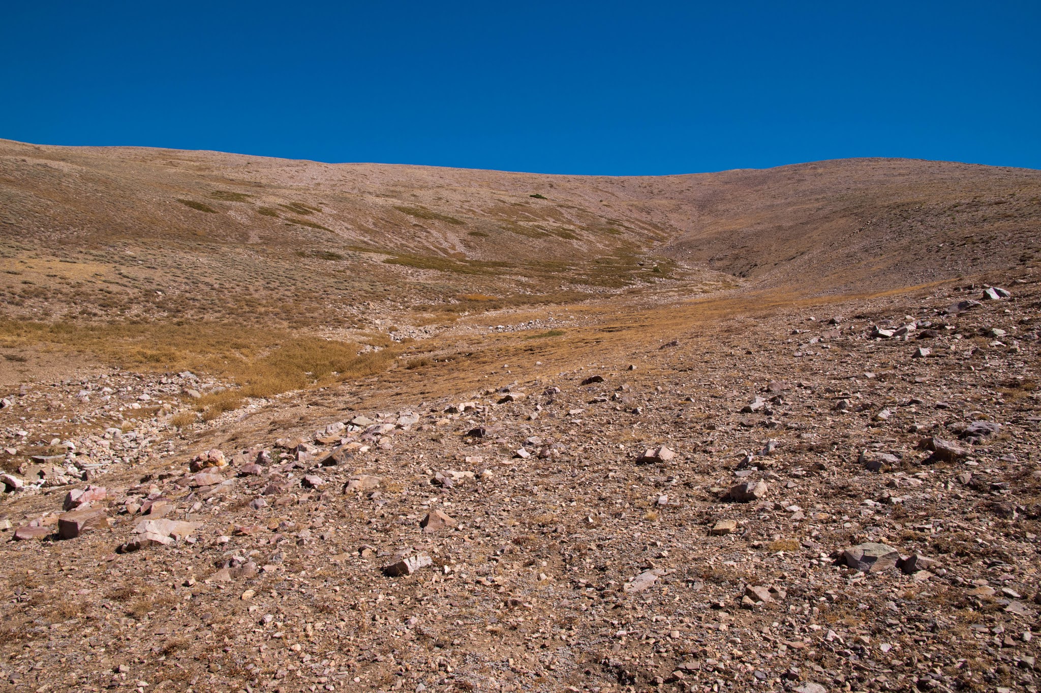
After about 1.1 miles of hiking from the last junction near Stella Lake, the Wheeler Peak trail came to the broad saddle between Bald Mountain and Wheeler Peak. At this point, I was now about 2.4 miles from the trailhead, but due to the extremely mild grade of the trail I had ascended only about 700 feet. The final 1.8 miles of trail from here to the summit had to cover the remaining 2200 feet of uphill.

Upon leaving the saddle, the trail immediately switched gears, embarking on a steep climb up the North Ridge of Wheeler Peak. I passed the last few trees just a few minutes above the saddle and soon I was out in the open, rocky world of the upper mountain. Wheeler Peak was no longer visible from here but I made a steady trek upwards along the steep and rocky trail towards a false summit. At times, the trail utilized switchbacks for the ascent; some of these switchbacks approached the east end of the North Ridge, where there were views of stark, rocky upper reaches of Wheeler Peak and Doso Doyabi .

Wheeler Peak and Doso Doyabi
This rapid elevation gain into open, rocky slopes also delivered new and wide-ranging views to the west, north, and east. To the west, the Schell Creek Range rose across Spring Valley and its wind farm; a bit of Steptoe Valley was visible at the foot of the Egan Range and Currant Mountain and the White Pine Range was visible beyond the Egans. Unfortunately, a layer of haze hovered above these mountains, a sign that the smoke from the California wildfires had begun to make its way deep into the Great Basin. To the north and east were more sweeping views of the Great Basin and some of its tallest peaks, including North Schell Peak, Mount Moriah, and Ibapah Peak in Utah.

View east to the Egan Range
After a thousand foot ascent from the saddle, the trail flattened out briefly on a shoulder of Wheeler Peak's North Ridge. Wheeler Peak- which had a humped summit from this angle- came back into view and was visible ahead of me for the remainder of the climb. At this point in the ascent, the wind had become relentless, with a sustained gale sweeping Wheeler Peak's upper slopes. A number of wind shelters had been built along the shoulder, a testament to the frequency of brutal gusts at this elevation.

Summit of Wheeler Peak rises ahead
After passing through the shoulder on the ridge, the trail reverted to a steep grade as it began the final thousand-foot ascent. The trail was very steep in parts here, directly cutting uphill through steep talus slopes in parts as it climbed just over a thousand feet in 0.7 miles. Footing was sometimes loose and unstable due to the rockiness of the trail here. After a long and sustained push, I finally found myself walking onto the summit ridge and to the highest point of Wheeler Peak, which is surrounded by rocky wind shelters to offer hikers refuge from the ripping winds that blast this exposed, lofty summit, the highest peak in a 230-mile radius.

The 360-degree panorama from the summit of Wheeler Peak was incredible. Central to this view were the high, rocky peaks of the Snake Range that extended to the south. Wheeler Peak was separated from the great cliffs of Baker Peak by another deep cirque; although the glacier here had long vanished, there were small patches of permanent snow hanging onto the steep north face of Baker Peak. The symmetrical form of Pyramid Peak lay beyond Baker Peak and Johnson Peak connected the crest of the Snake Range to the limestone massif of Mount Washington. Eagle Peak was an outlier from the range, rising at the eastern edge of the mountains. If you travel widely through the Great Basin, you'll note that the Snake Range is perhaps the most heavily forested range of the many mountain ranges in Nevada. While many of the other ranges in the Great Basin have no arboreal vegetation or can only muster a few aspen and bristlecone pine groves, the slopes of the Snake Range are coated in forests of spruce and fir, pinyon and ponderosa pines, and juniper. The interspersed aspen groves were showing off spectacular fall color.

View of the Snake Range south of Wheeler Peak
To the north, the Snake Range died down as lower peaks like Bald Mountain dropped to the lower elevations of Sacramento Pass. The North Snake Range rose beyond Sacramento Pass, culminating in the high cone of Mount Moriah. Ibapah Peak, an ultraprominent peak just across the border in Utah, rose beyond Mount Moriah. Stella Lake and Teresa Lake were both visible below Wheeler Peak in the upper watershed of Lehman Creek; while Stella Lake still had a fair amount of water, Teresa Lake had dried up after an arid summer.

Schell Creek Range, Mount Moriah, and Ibapah Peak
From the top of Wheeler Peak, the immensity of the Great Basin was clear: in every direction, layer upon layer of desert basins and mountains stretched to the horizon. Looking far off into the distance, I could just make out the form of the Wasatch Range near Mount Nebo, almost 150 miles east from here and on the eastern boundary of the Great Basin. While some haze decreased visibility to the west, on a good day one should be able to see to the Toquima and Toiyabe Ranges about 150 miles west. Almost everything in sight lay within the vastness of the Great Basin.

If you are unfamiliar with the geography of Nevada, you might wonder: what is this Great Basin that has lent its name to this national park? The Great Basin is a contiguous set of endorheic watersheds in the desert between the Rocky Mountains and the Sierra Nevada- this means its an area where rainfall and snowmelt never reaches the ocean, instead flowing down into desert basins and then evaporating. The Great Basin covers almost all of Nevada and about half of Utah, as well as sizeable portions of California and Oregon and a bit of Idaho and Wyoming. It's not a single basin but a collection of many basins; most of these basins, including all of those visible from Wheeler Peak, are dry, but some of these basins lie near the snowy peaks of the Sierra Nevada and the Wasatch Range and receive enough water and snowmelt to support permanent lakes in the desert like Pyramid Lake, Mono Lake, or the Great Salt Lake. 

The many basins characteristic of the Great Basin are part of the Basin and Range physiographic province, a region of parallel mountain ranges that covers all of Nevada but stretches far south into Arizona and northern Mexico. The Basin and Range is the result of extensional plate tectonics on the North American Plate. The Rocky Mountains formed during the Laramide Orogeny, a period tens of millions of years ago caused by the subduction of the Farallon Plate- part of the Pacific Ocean- beneath the North American Plate. After the Farallon Plate had been fully subducted beneath the North American Plate, the compression on the western edge of the North American Plate let up. As a result, the North American Plate began to extend between the Rockies and the Pacific; extension led to faulting, which caused faulted blocks to lift up relative to one another to compensate for the extending crust, creating many parallel mountain ranges. Erosion and sediment deposition filled the gaps between the ranges with the flat basins of today's Great Basin.

Eagle Peak and the many basins and ranges of Utah
After enjoying the views at the true summit, I followed the summit ridge to the dropoff on its eastern end. Here was the most dramatic scenery visible from the summit: the ridge ended with a cliff drop into the deep, rocky chasm between Wheeler Peak and Doso Doyabi. This gaping maw is the cirque carved by the mighty glacier that once must have flowed down the slopes of the Snake Range. Today, the last remnants of that glacier still fill the corners of the cirque as a permanent snowfield and a rock glacier- this is the last glacier remaining in the state of Nevada, if it is still really a glacier.

Doso Doyabi rises over the rock glacier with the Great Basin laid out in the distance
From the mid-19th century until 2019, Doso Doyabi was named Jeff Davis Peak. Colonel Edward Steptoe (the very same Steptoe of Eastern Washington's Steptoe Butte fame) scouted the area during his 1854 travels through Utah and the Great Basin while investigating the deaths of the Gunnison survey party and decided to name the most impressive peak in this part of the Great Basin after the serving Secretary of War at the time. The name fell out of favor upon the outbreak of the Civil War and after the Wheeler Survey reached the area in 1869, the second-tallest peak in Nevada was renamed Wheeler Peak. Somehow, the name Jeff Davis Peak was simply repurposed for the peak on the other side of the cirque from Wheeler Peak, the third highest point in the state of Nevada. This name remained until a recent decision by the Nevada State Board on Geographic Names to instead use the name Doso Doyabi, Shoshone for "white mountain."

While the deserts and mountains of Nevada are still largely far off the tourist beaten path, Wheeler Peak is an exception. As the crowning summit of Great Basin National Park, this mountain attracts a fair share of visitors- while I saw one and zero other hikers on Arc Dome and North Schell Peak, respectively, and only saw one other hiker on my trip to Magic Grove in Great Basin National Park, there were around 50 hikers on Wheeler Peak during my visit on an autumn weekday. Despite the relative popularity of this hike, Wheeler Peak is still an incredible destination and a highly recommended hike for visitors to the Great Basin.

Friday, December 18, 2020

Ward Charcoal Ovens

Ward Charcoal Ovens and Wheeler Peak
0.6 miles loop, 50 feet elevation gain
Difficulty: Easy
Access: Good gravel road to trailhead, Nevada State Parks admission fee required

The beehive-shaped kilns of Ward Charcoal Ovens State Historic Park in eastern Nevada make a nice, brief stop from driving the Loneliest Road in America to learn some local history and appreciate views of the desert and mountains of the Great Basin. There are a number of hiking options at Ward Charcoal Ovens, ranging from the short walk from the parking lot to the ovens to hikes a few miles long through this park at the foot of the Egan Range. I did the 0.6-mile loon Interpretive Loop, which first visits the ovens and then travels through the sagebrush desert to Willow Creek, where there is year-round water flowing in this desert environment. Interpretive signage along the trail provides a chance to learn about local ecology and the history of the former mining town of Ward.

I visited the Ward Charcoal Ovens during an autumn road trip through Nevada, coming at sunrise to see the site without crowds. The state park is a short drive from the town of Ely, the seat of White Pine County and, with a population of about 4000, one of the largest towns in eastern Nevada. From Ely, I took US Route 50- the Loneliest Road in America- east. Route 50 left Ely and headed south through Steptoe Valley; it soon encountered a sign that indicated the Ward Charcoal Ovens were 10 miles on the right. I ignored this initial junction and continued on Route 50 until coming to a second sign for Ward Charcoal Ovens, this time 7 miles to the right; this time I turned and followed this well-maintained dirt road 5 miles to the east. At a T-intersection with Cave Valley Road, I turned left and soon arrived at Ward Charcoal Ovens State Historic Park. After passing the turnoff for the campground and crossing Willow Creek, I made a right turn at the junction for the day use area and followed this road to its dead end at a large day use parking area with a vault toilet.

After paying the day use fee, I walked over to the charcoal ovens, which were just 200 feet from the parking area via a paved path. There are six charcoal ovens here in a row, all of which have the rough appearance of beehives and are exceptionally well preserved. The 30-foot tall ovens were built in 1876 during the mining boom in the nearby town of Ward at the foot of the Egan Range. Ward was one of the many silver rushes across Nevada- the Silver State- and a town complete with post office rose about two miles from these kilns at the foot of the Egan Range. High temperatures were needed to smelt the silver ore: as wood itself would not burn hot enough, these charcoal ovens were built to burn wood into charcoal that could then be used for smelting the silver ore. The Egan Mountains were stripped of the junipers and pines growing on their slopes to feed these six charcoal ovens, which fueled the brief mining craze here. The fine masonry of these kilns is result of Italian craftsman who built the ovens from tuff quarried off a nearby hill. Within three years, the kilns were abandoned; the town of Ward was eventually moved across Steptoe Valley to a new mining operation.

Ward Charcoal Ovens
Visitors can wander inside the ovens, which have a cavernous feel. The concave walls are perfect for echoes and once reflected and concentrated heat while wood was being reduced to charcoal. The utility of these ovens declined after much of the wood in the Egan Range was stripped away to make the charcoal. After the town of Ward was abandoned, livestock herders occasionally used the ovens as shelter; intepretive signage at the site also suggests that the ovens might have been hideouts for bandits at some point.

Interior of a charcoal oven
Such charcoal ovens were once common throughout Nevada and the Great Basin (another famous set can be found in the Panamint Range in Death Valley National Park). Smelting ore was necessary for most mining operations and Nevada wouldn't be named the Silver State if mining hadn't played such a critical role in the state's history. Nevada's silver history started with the famed Comstock Lode near Virginia City, which took the center of attention of precious metals prospecting away from the Sierra foothills near Sacramento to the vast deserts of the Great Basin. Today, Nevada still produces the most silver of any state other than Alaska. Every town on the Loneliest Road east of Fallon is reliant on mining: silver operations at Austin and Eureka and open-pit copper mining near Ely either created or today sustain those towns.

Charcoal ovens
The interpretive trail breaks off to the right (north) at the far end of the row of six charcoal ovens, crossing the south fork of Willow Creek, which is really just a trickle. The trail stayed to the right when a jeep track breaks off to the left soon afterward and headed north on a very gentle ascent along a dirt path through sagebrush and sparse junipers. Along the way, an interpretive sign pointed out a nearby hillside from which the tuff for building the charcoal ovens was quarried. There were nice views of the Egan Range nearby: the juniper and pinyon pine forests on its lower slopes had clearly recovered since the heyday of charcoal production here. A quarter mile from the charcoal ovens, I came to Willow Creek, a year-round stream that flowed down from the Egan Range. While a trail appeared to cross the river here, I took a right turn to follow a trail on the creek's south bank to continue the interpretive loop. There appeared to be picnic facilities on the other side of Willow Creek for anyone wishing to use them.

Sunrise and moonset over the Egan Range and Willow Creek
I followed Willow Creek downhill for about 200 meters, watching the creek tumble as it flowed towards the floor of Steptoe Valley, where its water would evaporate in the desert sun. The trail then turned right and returned south towards the charcoal kilns. Gazing east, I could see high profile of Wheeler Peak, the tallest peak in this part of Nevada, rising above a low pass in the Schell Creek Range. The sun had not come out where I stood yet, but when it did, the morning's first light emerged from right behind Wheeler Peak.

The sun rises from behind Wheeler Peak
Interpretive signs along the final stretch of trail pointed out the location of the former mining town of Ward and detailed the physiography and ecology of the Great Basin. The trail ended by returning to the charcoal kilns, just a few steps away from the parking lot.

This is a short hike that visits some impressively built charcoal ovens that allow visitors to reflect on Nevada's rich mining history. The views of the Egan Range and Wheeler Peak make it a scenic hike as well and the charcoal ovens themselves are quite fun to explore; I recommend this stop for visitors who are driving the Loneliest Road or are in the area to visit Great Basin National Park.

Tuesday, December 15, 2020

North Schell Peak

View south along the Schell Creek Range
7 miles round trip, 3100 feet elevation gain
Difficulty: Moderate-strenuous; some route-finding required
Access: Rocky road to trailhead, no fee required

11880-foot North Schell Peak is the little-visited but scenic high point of the Schell Creek Range in the Great Basin of eastern Nevada, less than an hour's drive from Ely, the main town in this part of the state. There is no official trail leading to this high summit, but the peak can be reached via well-defined social paths and some relatively easy route-finding. The rewards from the summit are sweeping views of the High Schells and of the endless basins and ranges that define this area of Nevada and Utah. North Schell Peak has much of the spectacular scenery that can be seen on the nearby Wheeler Peak hike but has almost no crowds; in fact, you're very likely to have this peak to yourself if you hike here. North Schell is also one of 57 ultraprominent peaks- mountains with over 5000 feet of topographic prominence- in the contiguous United States. In the autumn, the slopes of the Schell Creek Range along this hike explode with fiery fall colors, making it a particularly nice time to visit.

I hiked North Schell Peak on the last day of September during a road trip through Nevada's Great Basin to see fall colors. North Schell Peak is very remote- it's a long drive from any major metropolitan area, about 3.5 hours from Salt Lake City and 4.5 hours from Las Vegas. However, it's not a terribly long drive from Ely, the main town in White Pine County and the only place you can find full services for over 120 miles in any direction. From Ely, I took US Highway 93 north from the town past McGill and then turned right onto Duck Creek Road; look out for signs for Humboldt National Forest and Duck Creek. Turning onto Duck Creek Road, I followed it east as it followed Duck Creek through a water gap in the lower range of the Schell Creek Range into Duck Creek Valley. After 8 miles along the Duck Creek Road, I turned left onto a gravel road leading up to Timber Creek Campground. This 4 mile long gravel road was quite rocky in places, making the drive a little slow; there were great views of the Schell Creek Range ahead of the road. As the road entered the mountains, aspens with bright fall color surrounded the road. I followed the road into Timber Creek Campground, passing the group sites and then parking near site 6, the last campsite. The road continues past this point to the true trailhead but is quite rough; as I did not have a high clearance vehicle, I chose to park at the campground and hiked the final half mile of road to the true trailhead. If you make it up to the actualtrailhead at the end of the road, you'll save a mile of hiking round trip and cut off 200 feet of elevation gain. 

Leaving from the upper end of Timber Creek Campground, I followed the gravel road uphill for 0.6 miles to reach the true trailhead. The road ascended through an aspen grove and then leveled out a bit as it emerged onto open slopes with aspens lining the banks of Timber Creek to the right and the peaks of the High Schells rising ahead. An aspen forest covered the lower slopes of the High Schells and at the end of September the forest had burst into bright color.

Fall aspens
Following the rocky gravel road for 0.6 miles past a former Scouts camp, I arrived at the true trailhead, where there was ample parking but not a single car. At the trailhead, there is only one signed trail, which heads off to the right and south; I ignored the signed trail and instead continued following the obvious road trace to the left, a continunation of the gravel road that led up from Timber Creek Campground. While large rocks blocked vehicles from following the road trace any further, it was straightforward to follow on foot. This road led through a beautiful forest of aspens. Aspens- found throughout the American West- are clonal trees, meaning that groves are often composed of genetically identical trunks that spring from a common root system. Aspen colonies often grow to massive sizes and can last for millenia; by some measures, aspens are the most massive and oldest organisms on the planet. Pando, an aspen colony in Utah, covers over 100 acres, weighs over 6 million kg, and may have lived as long as 80000 years, although no single trunk is particularly massive or old.

Aspens 
Aspen trunks typically last less than a century. During the early to mid-twentieth century, aspen trunks in Nevada and California were often used as message boards and canvasses for Basque sheepherders. Immigrants from the Basque regions of France and Spain often took to tending sheep in the mountain grasslands of the Great Basin and carved dated records of their presence along with political messages, poems, self-portraits, and images of women. These Basque arborglyphs can be found throughout the Great Basin and a number of them are found along this hike in the aspen groves of the Schell Creek Range. However, it can be difficult to distinguish sheepherder arborglyphs now as it has become quite popular for contemporary visitors to add their name to the bark record; it's a little difficult to tell whether these modern efforts are vandalism or simply the continuation of a tradition of historical and perhaps artistic significance. 

Basque arborglyphs
The trail paralleled Timber Creek, which still had some flow even during fall after a particularly dry year. Soon, the road trace died out into a single track trail, which followed the creek out of the aspen groves and onto open slopes. North Schell Peak rose directly above to the right, its slopes adorned with colorful aspens. Looking back from time to time back down the stream valley, there were ever-improving views encompassing a progressively wider swath of the Schell Creek Range and the fall aspen forests on its slopes.

Aspens along the north branch of Timber Creek
The trail initially ascended at a moderate but steady grade. After following the road trace a half mile up from the trailhead, Timber Creek forked; the trail led up along the left fork of the creek. From here, the grade of the trail steepened as it continued to ascend along the creekbed, which at this elevation was dry. Views of the southern end of Timber Creek Valley and the High Schells continued to improve.

Aspens in the Schell Creek Range
The trail passed in and out of a number of aspen groves in the stream valley and soon also entered a grove of bristlecone pines, which mainly covered the slopes on the left (west) bank of the stream valley. The bristlecone pines growing closer to the trail did not have the gnarled, windswept appearance for which the pines are known.

Schell Creek Range
After following the trail a mile and a half up from the trailhead at the end of the road, the trail made a sharp turn left, crossing the creek and then heading up the opposite slope. Here, I left the existing trail to make my way cross-country to the summit. Looking to my right, I could see up to the crest of the High Schells. The ridge to the southeast- the West Ridge of North Schell Peak- provided a straightforward route to ascend to the crest; North Schell Peak was just off to the right of the stretch of the crest visible from here. I headed uphill largely by following this ridge; although unmarked, the route was fairly straightforward as the mountain slopes were so open here. The terrain was initially fairly friendly, with patchy grass and soil intermixed with small rocks, but the ridge soon devolved into talus slopes, which were more strenuous to navigate and made the going a little slower.

Looking up to the crest of the Schell Creek Range
As I ascended along the ridge, views slowly began opening up to the west. First, I was able to gaze over the nearby ridge; then I could see past the Duck Creek Range to Steptoe Valley and the Egan Range. As I climbed further, range after range unfurled to the east: the Diamond Range near Eureka, Mount Jefferson and the high Toquimas, and then finally Toiyabe Dome and Arc Dome, the high summits of the Toiyabe Range 150 miles distant.

View west across the Great Basin to Arc Dome and Mount Jefferson
The ascent up the West Ridge of North Schell Peak took a little while, with about a thousand feet of elevation gain over the uneven terrain of talus fields, but it was as far as route-finding went it ended up being fairly straightforward. Once the ridge started leveling out as I approached the crest, I could see a large cairn in the saddle between a local high point on the crest and North Schell Peak, which was to the south (right). I aimed towards the saddle on the crest. The views on the upper slopes of the High Schells were incredible: I could see back into aspen-filled the valley of Timber Creek below and the rocky spine of the Schell Creek Range stretched to the south. Wheeler Peak- the tallest peak in this part of the Great Basin- poked out above the saddle between North Schell Peak and the unnamed but impressive peak to its south.

Wheeler Peak and the Schell Creek Range
Arriving at the saddle on the crest, a new set of views opened to the east. The Snake Range lay on the other side of Spring Valley. North Schell Peak rose directly to the south along the crest of the High Schells. Here, a social path reemerged, marking the final part of the hike to the summit. The trail initially ascended along the ridge but then stayed just below the ridgeline for a stretch as it passed a number of false summits before it finally made the brief, sharp climb to the mountain's high point.

North Schell Peak, Mount Moriah in the distance
At 11880 feet, North Schell Peak is one of the tallest and most prominent peaks in all of the Nevada. The summit views, stretching in all directions, encompassed many of Nevada's other great peaks, missing just Charleston Peak near Vegas and Boundary Peak in the White Mountains. From this lofty viewpoint, layer upon layer of mountains stretched out in all directions, impressing upon me the immense scale of the Great Basin. The Schell Creek Range- the second longest of Nevada's many parallel mountains ranges, following the Toiyabe Range- stretched to the horizon to both the north and the south, with an impressive crest of more tall peaks to the south. 

Looking north along the Schell Creek Range, Ruby Mountains in the distance
To the west, the view of far-off mountain ranges extended as far as the Toiyabe and Toquima Ranges, with Mount Jefferson and Arc Dome- the two highest peaks in the central part of the state, both of which are also ultraprominent peaks- poking above their peers. The Egan Range and the Grant Range were among the layers of mountains visible closer by. To the north, the Ruby Mountains formed a major mountain wall. Far to the south, a distant wall of smoke was visible over southern Nevada, a result of major wildfires burning in California.

View down the Timber Creek watershed
To the east was a great dry lakebed in the center of Spring Valley. Mount Moriah rose on the other side of this playa, the tallest peak of the northern Snake Range. Moriah is an impressive mountain over 12000 feet tall but just misses out on ultraprominence. Wheeler Peak, the 13063-foot giant at the heart of Great Basin National Park, rose dramatically from the South Snake Range, with the great cliffs that rise above its northeast cirque visible from this angle. To the northeast, Ibapah Peak, another ultraprominent summit, rose out of the Utah portion of the Great Basin.

Ibapah Peak and the Utah Great Basin
If you've never been to Nevada or Utah, you might wonder: what is the Great Basin? What's up with all these mountain ranges in Nevada? The two answers are closely interconnected. The Great Basin is a contiguous set of endorheic watersheds in the desert between the Rocky Mountains and the Sierra Nevada- this means its an area where rainfall and snowmelt never reaches the ocean, instead flowing down into desert basins and then evaporating. The Great Basin covers almost all of Nevada and about half of Utah, as well as sizeable portions of California and Oregon and a bit of Idaho and Wyoming. It's not a single basin but a collection of many basins; some of these basins lie near the snowy peaks of the Sierra Nevada and the Wasatch Range and receive enough water and snowmelt to support permanent lakes in the desert like Pyramid Lake, Mono Lake, or the Great Salt Lake. Most of the basins are usually dry, with dusty dry lake beds like Spring Valley, although these dry lakes may flood seasonally. 

The many basins characteristic of the Great Basin are part of the Basin and Range physiographic province, a region of parallel mountain ranges that covers all of Nevada but stretches far south into Arizona and northern Mexico. The Basin and Range is the result of extensional plate tectonics on the North American Plate. The Rocky Mountains formed during the Laramide Orogeny, a period tens of millions of years ago caused by the subduction of the Farallon Plate- part of the Pacific Ocean- beneath the North American Plate. After the Farallon Plate had been fully subducted beneath the North American Plate, the compression on the western edge of the North American Plate let up. As a result, the North American Plate began to extend between the Rockies and the Pacific; extension led to faulting, which caused faulted blocks to lift up relative to one another to compensate for the extending crust, creating many parallel mountain ranges. Erosion and sediment deposition filled the gaps between the ranges with the flat basins of today's Great Basin.

When I checked the summit register, it appeared that perhaps as few as ten people a month summit this remote but beautiful peak. The views from North Schell Peak are far-ranging and the aspens at its base make the peak an attractive fall destination. I highly recommend this hike for those with appropriate route-finding experience who want to experience more of Nevada's Great Basin than just Wheeler Peak and Great Basin National Park.