Showing posts with label Pacific Crest Trail. Show all posts

Wednesday, August 2, 2023

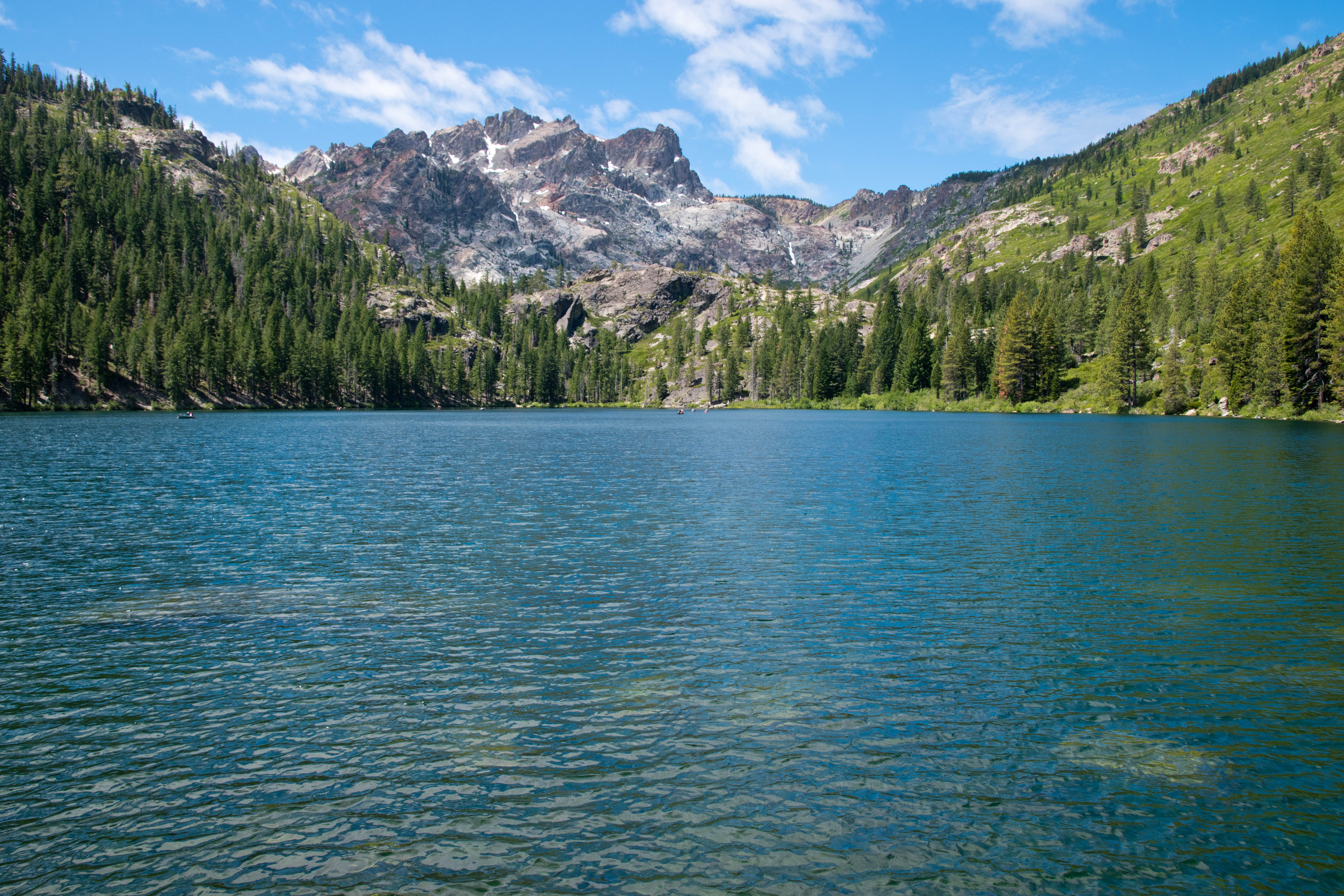
Lake Aloha

Lake Aloha
7.5 miles round trip, 1200 feet elevation gain with boat shuttle (otherwise, 12 miles round trip)
Difficulty: Moderate
Access: Paved road to trailhead, no parking fee required, Echo Lakes boat taxi fee optional

The 2021 Caldor Fire heavily affected the Echo Lakes area and the Desolation Wilderness. Check current conditions before attempting this hike.

The shimmering blue, island-dotted waters of Lake Aloha is the most iconic landscape of the Desolation Wilderness in California's Sierra Nevada and is one of the highlight hikes around Lake Tahoe. The approach from Echo Lakes- which is the most popular approach for day hikers- follows the Pacific Crest Trail and gives hikers the option to shorten the hike using a boat shuttle. This route is packed with scenic delights en route and delivers hikers to Lake Aloha with the least overall elevation gain. For those with a full day to hike out to Lake Aloha, this is certainly not to be missed when visiting the Tahoe area. 

I hiked to Lake Aloha with Anna and her mother, who was visiting us at the time, during a July visit to Lake Tahoe. The weather was unusually warm during our visit, hitting 90 degrees in the Tahoe area itself during hike, which made this hike somewhat more difficult than it actually is; the hot weather also portended the disaster that the Caldor Fire would wreck on this landscape later that same summer.

From South Lake Tahoe, we reached the trailhead by following US Highway 50 south and west from town, passing Meyers and climbing uphill towards Echo Summit. Towards the top of the long Meyers Grade hill, the unmarked Old Meyers Grade Road split off to the right from the highway; we took this right turn. Old Meyers Grade Road continued climbing uphill via a few switchbacks until leveling out after crossing Johnson Pass and coming to a junction after 0.8 miles with the poorly marked Echo Lakes Road shortly after the pass; the Echo Lakes Sno-Park parking area lies directly across from the Echo Lakes Road turnoff. We turned onto Echo Lakes Road and followed it past Berkeley Camp to Echo Chalet. The hiker parking lot above Echo Chalet was already completely full by the time we arrived just after 9 AM, so plan to arrive early on summer weekends if you hope to find parking. 

From the trailhead at Echo Chalet, there are two ways to reach Lake Aloha. The lowest effort approach is to take a boat taxi from Echo Chalet to the dock at the far end of Upper Echo Lake, which shaves off just over 2 miles each way for the hike. For those who want to reach the lake on their own two feet, the Pacific Crest Trail also runs directly past the front of Echo Chalet before following the northeast shore of Lower and Upper Echo Lakes towards Lake Aloha. As I took the boat, I'll describe that option here; based on my admittedly secondhand knowledge, the PCT option should not pack in too much more elevation gain as it should simply follow the lakeshore. The Echo Lakes boat taxi usually operates 9 AM to 5 PM between Memorial Day and Labor Day from Echo Lakes Chalet and typically costs $20/person, each way; current information on the service can be found here. There is no scheduled service; boats embark whenever there are at least three paying customers, and service back from Upper Echo Lake must be requested by 4:30 PM.

Lower Echo Lake
We boarded a boat taxi and set off across Lower Echo Lake, a long and beautiful reservoir nestled between forested slopes broken by slabs of granite. Within ten minutes, we were across Lower Echo Lake and transiting through the narrow passage connecting the Upper Lake with the Lower Lake. This scenic and shallow passageway sometimes becomes too shallow for travel by late summer, complicating plans for travelers hoping to use the boat shuttle. We passed by many vacation homes- the lake is a popular spot for Californians to retreat during the summer.

Narrow strait connecting the Echo Lakes
The boat continued across Upper Echo Lake, which was especially scenic with the pointed granite summit of Ralston Peak rising behind the lake. After 20 minutes, we arrived at the dock at the far end of Upper Echo Lake; we disembarked and followed a hundred meter-long trail that led uphill to a junction with the Pacific Crest Trail.

Ralston Peak rising above Upper Echo Lake
Upon meeting up with the Pacific Crest Trail, we turned left and followed the PCT northbound towards Lake Aloha and Canada. The PCT ascended gently through a rocky forest and broke out onto a rocky outcrop a third of a mile after leaving the boat dock. Here, we were rewarded with lovely views back over Echo Lakes, with Upper Echo Lake looking especially beautiful with its placid blue waters dotted with forested islands.

Echo Lakes from the PCT
The trail alternated between forest and open granite while making its continual ascent, entering the Desolation Wilderness at 0.7 miles, until breaking out into the open granite for good around a mile from the boat dock. At 1.1 miles, we came to the junction with the spur trail down to Tamarack Lake. We took this spur on our way in, descending along a 200-meter long trail that led down to the shore of shallow Tamarack Lake at the foot of Ralston Peak. This was a pretty although ordinary lake; Ralston Peak's sharp pyramid behind the lake was the nicest part of the view. Mosquitoes were horrendous around this lake in July.

Ralston Peak above Tamarack Lake
Returning to the PCT, we followed the trail northbound as it continued a steady climb. Views over Echo Lake and Tamarack Lake were increasingly impressive over the next mile as we ascended. On a hot and sunny day, this stretch of the trail was quite challenging as we were being baked constantly by the sun with no shade; luckily, the ascent moderated shortly after the trail went through a set of switchbacks and we returned to the forest at 1.8 miles from the boat dock after reaching the summit between the Echo Lakes basin and the Lake Aloha watershed.

Tamarack Lake viewed from the PCT
The trail wandered through a mix of pleasant conifer forests and small meadows over the next mile and a half over rolling terrain with mild ascents and descents. While less scenic than the climb up from Echo Lakes, this stretch of the hike was also easier and more shaded, which made it somewhat more pleasant. We passed numerous trail intersections over this stretch for paths branching off to Lake of the Woods and Lake Lucille; at each junction, we stayed on the PCT northbound.

Meadows and forest along the PCT in Desolation Wilderness
Although generally confined to the forest, this stretch of trail did offer occasional views to the north across Glen Alpine Valley to Mount Tallac, one of the most noteworthy peaks in the Lake Tahoe region. At one point, the trail passed just above small Lake Margery, offering one of the nicest views on this stretch of the hike.

Mount Tallac and Lake Margery
At 3.2 miles, the PCT began a gentle but sustained descent through the forest as it dropped into the basin containing Lake Aloha. The trees were dense enough here that there was little sign of the lake until we were almost at its shores; at 3.5 miles, when we could see the lake through the trees, we took a spur trail to the left of the main trail and descended to the shoreline of the lake itself. 

Lake Aloha is one of the Northern Sierra's most stunning sights. The great granite ridge of the Crystal Range, which encompasses Pyramid Peak, Mount Agassiz, and Mount Price, rose above the sparkling waters of Aloha, which was dotted with numerous stark granite islands. Snow often adorns the bases of the granite cliffs of the Crystal Range, although during the drought year of 2021 there was little snow left by July.

Pyramid, Agassiz, and Price rising above Lake Aloha
Lake Aloha is not a natural lake, but rather a reservoir formed by a dam across Pyramid Creek built in 1875 that flooded Desolation Valley. PG&E managed this dam and its associated hydroelectric project at the start, although the lake is today overseen by the El Dorado Irrigation District. As the water in Lake Aloha is drawn down for hydroelectric generation, lake levels fluctuate through the season and across years; when lake levels are low, more islands are visible in the middle of the reservoir. Desolation Valley once contained the Medley Lakes, a set of natural lakes scattered across this granite landscape, before all of the Medley Lakes were merged into the single Lake Aloha by the building of the dam. That this lake is not fully natural and is still being actively managed for human uses is a bit incongruous with the fact that Desolation Wilderness is supposed to be a federally protected wilderness area, but certainly the lake's unnatural origin does not detract much from its incredible beauty.

Island-dotted Lake Aloha
We enjoyed lunch and then backtracked to the boat dock, rushing to make sure that we made it back by the 4:30 last call for the boat taxi. The phone booth at the dock was not operational when we arrived but we had enough cell service to successfully call Echo Chalet and arrange a boat to come across the lake to pick us up.

Lake Aloha is a highlight destination in the Tahoe area. While this means that parking can be hard at Echo Chalet, surprisingly the hike itself did not feel overcrowded and there was plenty of room to spread out along the lakeshore. While you shouldn't expect solitude, you can still look forward to a reasonably calm and quiet experience at Lake Aloha despite the area's incredible scenery and popularity.

Friday, July 22, 2022

Sierra Buttes Lookout

Sierra Buttes Fire Lookout
5 miles round trip, 1600 feet elevation gain
Difficulty: Moderate
Access: Good paved but narrow road to trailhead, no fee required

Sierra Buttes is one of the most prominent peaks in the northern section of California’s Sierra Nevada, with a massive eastern headwall that makes it one of the most scenically impressive mountains in the state north of Tahoe. The fire lookout perched atop its highest point is reached by a hair-raising walk up a steel staircase and delivers fabulous views of Northern California, from the Coast Range to the Cascades to the Great Basin Desert. The ridge hike to this summit packs in views of forested peaks and jewel-like lakes, with plenty of wildflowers in early summer; while this hike doesn’t quite live up to the scenery standard set by the High Sierra further south, it is one of the most enjoyable and worthwhile hikes in its part of the state.

There are many ways to get to ascend Sierra Buttes; by far the easiest route involves driving a 4WD high clearance vehicle to the base of the lookout and simply ascending three flights of steel stairs to the summit. Most visitors, however, will find a hike ascent along the mountain’s north ridge from Packer Saddle to be the most rewarding, as this route packs in plenty of views along its moderate climb to the mountaintop. My friends and I, who were visiting Sierra Buttes after a holiday weekend stay in North Lake Tahoe, took the hike up from Packer Saddle; we also paid a brief visit to Lower Sardine Lake, a highly worthwhile stop on the drive in that provided us a beautiful view of the great headwall on the eastern side of the mountain. Packer Saddle is just over an hour driving from Truckee and at least 2.5 hours of driving from Sacramento.

Sierra Buttes and Lower Sardine Lake
We followed Gold Lakes Highway uphill for 1.3 miles from Highway 49, passing some jaw-dropping views of the precipitous east face of the Sierra Buttes. At the junction with the Sardine Lakes Road, we turned left; after crossing a bridge, we then turned right onto Packer Lake Road (although it’s also worth it to drive to the end of the road to see Sardine Lakes!). After turning onto Packer Lake Road, we drove uphill along a very well-maintained paved road with clear lane markings for 2.5 miles to Packer Lake Campground; past the campground, the road became very steep and narrower but remain paved, ascending through hairpin switchbacks until reaching the top of a ridge at 4.5 miles past the turnoff from Sardine Lakes Road. The paved road ended here; a final quarter mile of good gravel road descended along the ridge to the trailhead at Packer Saddle, where there was room to park about 20 cars. There is no fee and no restroom at the trailhead.

We headed south along an old service road from the trailhead at Packer Saddle. This road climbed steeply through the pine forest, quickly gaining the top of the ridge while making a stiff ascent. Blooming wildflowers around the trail provided interest and made the climb a little easier: paintbrush and lupine were particularly common here during our early July visit.

After a half mile of hiking from the trailhead, the trail narrowed to a single track and came to a flatter section of the ridge; at the fork between the wider road and the single track, I took the right fork for the single track trail (a rock barrier blocking the left fork clearly indicates not to head in that direction). Here, wildflowers bloomed profusely over an open ridgetop: the blooms of golden wyethia were particularly widespread and beautiful. The lower density of trees here also opened views off to both sides of the ridge as well as providing the hike’s first view of the lookout atop Sierra Buttes. When the flowers bloom here in spring and early summer, this is an absolutely beautiful stretch of trail that is certainly among the highlights of this hike.

Flower-filled ridgeline
Wyethia in bloom
At just under one mile from the trailhead, the flat trail ended at a junction with the Pacific Crest Trail, which crossed over the Sierra Buttes Trail here. Oddly enough, the PCT never follows any section of the north ridge of Sierra Buttes, missing out on many of the great views offered by this mountain. After passing the trail junction, we began to ascend at a steady grade along the ridge. The ridge was forested to the west but generally open to the east, providing views of the Sierra Buttes ahead and to the forested mountains in the east. Towards the top of this ascent, at 1.2 miles from the trailhead, we caught some nice views of the two Tamarack Lakes in the basin below.

Overlooking Tamarack Lakes
The trail reentered the forest on the west slope of Sierra Buttes and continued climbing steadily upward. At 1.6 miles from the trailhead, a short spur leading left at a switchback brought us to a spectacular viewpoint above Young America Lake. This small lake was cradled in a rocky cirque directly below us and had a spectacular blue-green color when it was lit by the sunlight. From this spot, we also had a jaw-dropping view of the massive northeastern headwall of Sierra Buttes.

Young America and Sardine Lakes
Shortly beyond that first viewpoint of Young America Lake, the trail reemerged along a clearing on a flatter stretch of the ridge. The views of Young America Lake were slightly blocked here, but the view of the great cliffs of Sierra Buttes and the small lookout perched atop the highest pinnacle were quite spectacular. The trail came to another junction at 1.8 miles; I continued following the single-track trail closest to the ridge, eschewing the wider 4WD road that came up from the right.

Sierra Buttes and the summit lookout
The trail continued climbing steeply through the forest after the junction, making multiple switchbacks as it pushed towards the summit. At 2.1 miles, the single-track trail merged with the 4WD road that leads to the summit. It’s important to make note of this junction: it is easy for hikers to miss this turn on the way down. Joining the 4WD road, we continued to head uphill through a series of switchbacks. This wide, rutted gravel road soon broke out of the forest onto the windswept alpine slopes of the upper mountain, opening up incredible views to the north and west. At the northern end of various switchbacks here, we caught incredible views of the vertical eastern headwalls of the Sierra Buttes and saw the lookout perched precariously atop the mountain’s highest pinnacle.

Jackson Meadows Reservoir and Sierra Crest
Views to the south opened up as the 4WD road ended at the base of the Sierra Buttes’ summit block. From here, a three-part steel staircase climbed a final 150 feet to the very highest point of the mountain. It’s extraordinary that this ladder was installed in such a precarious place. Some hikers will find the staircase to be too much; rest assured that reaching this point still guarantees sweeping views of the Central Valley, the Coast Range, Lassen Peak to the north, and the crest of the Sierra Nevada to the south.

Looking up to the Sierra Buttes Lookout
The final ascent up the three steel staircases to reach the summit were the most thrilling stretch of this hike. While the staircases may look terrifying to some, I found them fairly straightforward to go up and down in person; the last of these staircases, which is airier underneath than the first two, is a bit more likely to trigger acrophobia. At the end of the ladders, a final ten meters of uphill through a stone pile brought me to the foot of Sierra Buttes lookout. A short steel staircase brought me to the fire lookout’s upper deck, the highest point of the hike on top of this 8591-foot high summit. Not everyone will be okay with the ladders: three of the five in our group went up the ladders, while two decided to stick to the base and enjoy the views from there.

Starting up the staircase
Looking down from the top of the staircase
I made my way gingerly around the upper deck of Sierra Buttes lookout, with a steel lattice floor being all that separated me from a thousand-foot vertical drop down the east face of the mountain. The airiness of this drop was thrilling.

Eastern headwall of Sierra Buttes
The 360-degree view achieved by going around the deck of the lookout was too packed with peaks and landmarks for me to note them all, but I’ll give it a go. To the south, we could see along the crest of the Sierra Nevada towards snow-covered mountains near Donner Pass and Lake Tahoe, while the drier but still noteworthy peaks of the Carson Range were visible further east. Jackson Meadows Reservoir was visible amidst the forested slopes of the Sierra. Sierra Valley, a flat basin to the east over Yuba Pass, was somewhat visible, with layered mountains of the Basin and Range visible beyond it. The Sardine Lakes were visible directly below the lookout to the east.

To the west lay the vast Central Valley. Sutter Buttes- a tiny, isolated range of hills in the middle of the valley- stood out from the flat farmland. Across the valley rose the Coast Ranges, which rose from more hill-like forms in the south to more impressive heights in the north, with Snow Mountain, a 7000-foot peak directly across the valley, especially notable. Mount Diablo was visible far to the south- it was crazy to think that I could see this Bay Area icon from both Sierra Buttes and from where I lived, nearly a five-hour drive away. The Yuba River's deep canyon was cut into the forested slopes of the Sierra Nevada below me to the west, while the Sierra Nevada became progressively more tame as it headed north, the rocky peaks fading into forested and rounded ridges. Lassen Peak, a great plug dome volcano and the southernmost peak of the Cascades, broke that monotony to the north; on a clear day, I imagine that Mount Shasta, the greatest of the California Cascade volcanoes, would be visible from here, but it was a bit too cloudy on the day of my visit.  

Looking west into the Yuba River watershed
Sardine Lakes below, Sierra Valley in the distance
Lassen Peak
Mount Diablo across Central Valley
Sutter Buttes, Coast Ranges, Central Valley
The inside of the fire lookout is still furnished with a refrigerator and a stovetop, from the days when Sierra Buttes Fire Lookout was an active fire lookout. At the time of writing (but likely for not too much longer), the Sierra Buttes and the Yuba River watershed remain one of the few mountainous areas of Northern California that have not been hit by the megafires devastating California: the 2021 Caldor Fire, the 2020 North Complex, and the 2021 Dixie Fire devastated the Feather and American River watersheds to the north and south of the Sierra Buttes, respectively. For the moment, the view from the lookout still covers a landscape that is largely green and remains covered with conifers.

The hike to the fire lookout atop Sierra Buttes is one of the premier hikes of the northern Sierra Nevada. The trail combines a good workout with stellar views, a fun staircase ascent, and lots of wildflowers. While this is a relatively popular hike for the region- we saw upwards of twenty hiking groups over the course of the day- it is still reasonably peaceful and far quieter than the busy trails of the Tahoe region. Highly recommended.

Friday, April 2, 2021

Table Mountain (Columbia River Gorge)

Mount Hood the Columbia River Gorge from Table Mountain
16 miles loop, 4200 feet elevation gain
Difficulty: Strenuous
Access: Paved road to trailhead, Northwest Forest Pass required

Soaring cliffs of columnar basalt make Table Mountain one of the most impressive peaks on the Washington side of the Columbia River Gorge. The views from this peak are stellar, sweeping over the length of the gorge and extending to the four nearby Cascade volcanoes; however, the approach to Table Mountain via the Pacific Crest Trail somehow manages to be long, a bit boring, and extraordinarily steep all at the same time. Experienced hikers may not mind the slog to get to Table Mountain's great views, but novice hikers and visitors to the Columbia River Gorge may be better off doing a more rounded and rewarding hike like nearby Hamilton Mountain. Hikers who do choose to come will find a trail that's relatively quiet despite its proximity to Portland and observe firsthand the landsape created by the Bonneville Landslide.

The long trail to Table Mountain can be broken down into a lengthy 6.5 mile approach to the base of Table Mountain and a extremely steep loop that ascends to Table Mountain's summit, visits some viewpoints, and returns to its base in 3 miles. Although Table Mountain is just 3420 feet high, the hike starts just above sea level and the undulating trail on the approach makes the cumulative elevation gain much more substantial. The approach trail spends most of its time traveling through clearcuts.

I hiked Table Mountain during an early November trip to the Columbia River Gorge. From Portland, I took I-205 north across the Columbia River into Washington and exited onto Washington Highway 14 heading east. I followed Highway 14 past Camas, Washougal, and North Bonneville to the Bonneville Trailhead, which was on the north (left) side of the highway just across from the entrance to the Washington side of the Bonneville Dam. The trailhead was well signed from the road and had a vault toilet and parking for about 20 cars; I put up my Northwest Forest Pass here after parking.

I started the hike out on the Tamanous Trail, a gravel path which initially paralleled a railroad track in a clearing before cutting to the right and beginning a gentle ascent into the forest as the railroad disappeared into a tunnel. The trail ascended about 200 feet to gain the top of a low, wooded ridge and then followed this ridge north to reach a junction with the Pacific Crest Trail at 0.6 miles. The forest on the Tamanous Trail was reasonably nice, with some scattered deciduous trees providing nice pockets of fall color during my November visit.

Forest along the Pacific Crest Trail
Reaching the PCT, I took the left fork to follow the famed trail northbound. You might think that being on the PCT should mean that there might be some better scenery, but you would be wrong; what followed was perhaps the least scenic stretch of the PCT in Washington State. For the next 1.7 miles, the PCT passed through a series of clearcuts, so the trail surroundings alternated between tree stumps, crowded growth of 10-foot tall conifers, and forest that looked to be fourth or fifth growth at this point. Occasional views of Table Mountain, the pyramidal rocky peak with a massive basalt southeast face that was my destination of the day, were the saving grace of this stretch of hike. The trail occasionally crossed the logging roads that run through this area and there was no sustained elevation gain or loss, although there were plenty of little ups and downs as the trail traveled through an undulating landscape.

At 2.4 miles from the trailhead, I crossed a logging road and came upon Gillete Lake, one of the many small pothole lakes that dot the landscape near Table Mountain. There were nice views here of Table Mountain rising above the lake and the scene was quite pleasant despite much of the surrounding area being clearcut. Power lines ran directly above the lake, ferrying hydroelectricity from the Bonneville Dam to points east. The trail descended and circled around the lake to the north, where a spur path led to the lakeshore.

Gillette Lake and Table Mountain
Leaving Gillette Lake, the trail crossed Gillette Creek and then continued through the patchwork landscape of clearcuts. Land ownership is quite complex along the PCT in this area: there is a mix of federal, state, and private land here, with different land managers subscribing to different forestry practices. After a gentle ascent up from Gillette Lake, the PCT followed a logging road for a hundred meters before a single-track trail split off to the right of the road; be sure to pay attention for the trail here. Passing by another pond, another logging road, and more clearcut, the trail reached a well built bridge over Greenleaf Creek at 3.5 miles from the trailhead.

Bridge over Greenleaf Creek
Greenleaf Creek marked the boundary of Gifford Pinchot National Forest and the conclusion of the clearcuts that dominated the early stretches of the hike. From here on, the surroundings felt much more natural. The trail switchbacked uphill for a bit before leveling out as it contoured along the side of a hill, passing a clearing with a view of the Columbia River Gorge. This stretch of the trail, which was forested but had partial views out to the gorge, was quite pleasant. At 4.5 miles, I passed a junction with the Two Chiefs Trail, which was an old road trace. 

Views of the Columbia River Gorge from the forested PCT
The trail was fairly flat until I reached the 5 mile mark of the hike, where the trail crossed a creek and then began a switchback climb up to a low ridge. Once atop the ridge, the PCT headed north while ascending steadily, eventually intesecting a road trace; the trail and the road trace paralleled each other briefly, so following either path is fine. The trail and the road trace soon combined as I reached the base of Table Mountain and the PCT began climbing more steeply along the lower slopes of Table Mountain.

At 6.4 miles from the trailhead, the PCT came to a junction with the Heartbreak Ridge Trail, which was marked by a large information board. From here, the Heartbreak Ridge Trail broke off to the right, headed towards the summit of Table Mountain. I hiked a loop here to get up and down Table Mountain: I chose to ascend the Heartbreak Ridge Trail and then to do a counterclockwise loop around the summit viewpoints before descending on the West Table Mountain Trail and then following the PCT back to this junction. That loop only covers about 3 miles of hiking but includes over 1600 feet of elevation gain.

I turned right at the junction to start up the Heartbreak Ridge Trail. After 6.4 miles of flat to moderate hiking, the trail became serious here: this is one of the steepest trails in the Columbia River Gorge. This not just an aggressive ascent: the trail is brutally steep, eschewing switchbacks in favor for a direct, full-on assault of Table Mountain's slopes. The trail ascended a net of 1400 feet in one mile along the Heartbreak Ridge Trail and that eye-popping stat doesn't even begin to really explain the steepness: perhaps it is more useful to note that there is a relatively flat 0.4 mile stretch in the middle of this hike that actually includes some downhill, meaning that the 1400 feet of elevation gain is packed into about just 0.6 miles, a grade as steep as the trail to Aasgard Pass in the Enchantments.

The Heartbreak Ridge Trail made its first 700 feet of ascent in 0.3 miles in the forest before flattening out to reach a brushy saddle. Here, the first of this hike's multiple excellent views opened up. This saddle between Table Mountain and the lower Sacaquawea Rock had a stunning view of the mountain's immense basalt cliffs, perhaps the most massive vertical cliff of columnar basalt in the United States. The Columbia River flowed in the gorge down below, bending around Oregon's Mount Defiance to the east. Sacaquawea Rock was another sharp and impressive basalt outcrop just to the south.

Basalt cliffs of Table Mountain
After I passed the saddle, the trail descended briefly- surely the advertised heartbreak, after such a strenuous ascent- before it went right back into the relentless uphill. The final 700 feet of uphill on the Heartbreak Ridge Trail were covered in another 0.3 miles, meaning there was no time for switchbacks, with the trail plowing straight uphill first through the forest and then through a talus slope. There's not much of a real trail through the talus slope, so I picked my way through the rocks while following a number of poles that marked the route. After the trail returned to the forest, it curved to the left and continued the morale-destroying uphill until it ended at an intersection. Here, the left fork promised a return to the PCT on the West Table Mountain Trail, while the right fork led towards the Gorge Overlook. I took the right fork. While the grade on this trail was still quite steep- ascending 150 feet in 200 meters- it felt like a relief after coming off the brutal ascent of the Heartbreak Ridge Trail. At the top of this short uphill, I arrived on Table Mountain's flat summit plateau and came to the Table Mountain Trail. While the left fork here led to the high point of Table Mountain, I took the right fork first to head to an overlook over the Columbia River Gorge.

The side trail to the Gorge Overlook was tremendously scenic. The trail followed the top of a ridge that was open to the south, providing sweeping views to the southwest over the Columbia River Gorge. Towards the end of the ridge, the trail narrowed as it passed directly above the massive basalt cliffs of Table Mountain's southeast face. The trail ended when the ridge did, above the steep, thousand-foot cliffs at the top of Table Mountain's great basalt pyramid.

Atop the great cliffs of Table Mountain
The view from here was jaw-dropping; this is one of the most commanding views in the entire Columbia River Gorge. The view of the individual basalt columns on the cliffs was extraordinary. There was so much air below the viewpoint as Table Mountain's slopes plunged to the forested landscape of the Bonneville Landslide below. The Bonneville Dam held back the Columbia River and Mount Hood rose above the Oregon side of the Gorge. Views stretched west towards Larch Mountain, although forest on the northeast side of Table Mountain's ridge blocked views to the east.

Mount Hood and the Bonneville Dam
This is perhaps the best viewpoint from which to appreciate the immensity of the Bonneville Landslide, an enormous mass wasting event in the Columbia River Gorge in parts of Table Mountain and nearby Greenleaf Mountain collapsed into the gorge. This landslide- or perhaps a series of landslides- is a geoloically recent event, having occurred sometime between 1100 and 1700 CE. The slide brought down massive amounts of rock from the two peaks, filling the valley below and blocking the flow of the Columbia River. Native peoples have oral records of this event, which created a massive natural dam on the Columbia that became known as the Bridge of the Gods. The great erosive power of the Columbia eventually wore away this dam, forming the Bonneville rapids; those rapids then made this site an attractive spot for the lowest dam on the Columbia River.

The source of these massive landslides may be linked to past megathrust earthquakes in the Pacific Northwest, perhaps the 1700 Cascadia earthquake that was the last known quake of such magnitude on the Cascadia subduction zone. As the Juan de Fuca Plate is still actively subducting beneath the North American Plate, it is all but certain that more such earthquakes will rock the Northwest.

After enjoying the view from the Gorge Overlook, I headed north along the Table Mountain Trail to explore other areas of the summit. As the mountain's name suggests, the summit area is a flat plateau. I hiked to the north end of the mountain, passing Table Mountain's high point along the way in a forested area. When the main trail began to loop around at the north end of the mountain, I took the spur trail that led me to the edge of the peak's north ridge. From here, there were great views to the north and east. The views to the north encompassed the three great volcanoes of southern Washington State: Mount St. Helens, Mount Rainier, and Mount Adams, rising above the forested ridges of the South Cascades. All had donned their winter snowcoats by early November.

Looking north to St. Helens, Rainier, and Adams
To the east, I could see the Columbia River flowing out of the deep gorge near Mount Defiance into the gentler landscape near Cascade Locks and Stevenson. Eagle Creek is almost directly across the Columbia River from Table Mountain on the Oregon side: that watershed was responsible for two very destructive historical wildfires. One of the worst wildfires- the Yacolt Burn- was sparked on the Oregon side of the Gorge near Eagle Creek in September 1902. The fire leaped the gorge and set ablaze a half million acres of forest in southwest Washington, casting smoke clouds that completely darkened the skies over Portland and Seattle and depositing a half inch of ash in the Portland streets. In September 2017, another fire was sparked near Eagle Creek when a teenage hiker threw fireworks into bone dry forest, igniting a 50000 acre inferno that burned much of the Oregon side of the Columbia River Gorge and that once again rained ash in Seattle and Portland. As of early 2021, many of the trails damaged during that fire- including the once famed Eagle Creek Trail- have still not reopened.

Mount Defiance rises over the Columbia River Gorge
After thoroughly enjoying the summit views, I completed the loop around the summit, following the West Table Mountain Trail along the west side of the mountaintop and past a large basalt ledge with good views of the volcanoes. Past the ledge, the West Table Mountain Trail started its steep descent. Shortly afterwards, I passed an intersection with a trail that led to the left back towards the Heartbreak Ridge Trail; I continued forward on the West Table Mountain Trail, which descended steeply through forest along the mountain's western south ridge. This descent was just as steep as the Heartbreak Ridge Trail: in 0.8 miles, the West Table Mountain Trail dropped 1200 feet to rejoin the PCT. As I descended, the trail broke back out into the open along the top of the rocky ridge, delivering some final views on the hike. In addition to lovely views of Mount Hood and the Columbia River Gorge here, I also had nice views east to Heartbreak Ridge, along which I had ascended. I could see the high overlook over the Gorge atop Table Mountain's cliffs as well as the sharp profile of Sacaquawea Rock.

Descent along the West Table Mountain Trail
Mount Hood and the Columbia River Gorge from the West Table Mountain Trail
The trail was composed of loose rock along much of the West Table Mountain Trail, making footing treacherous and forcing me to pay total attention on the trail. Tackling such a steep downhill grade with poor footing was just as difficult as the lung-busting ascent. When I finally exited the talus slope, I had a final steep descent through the forest before the West Table Mountain Trail ended at a junction with the PCT.

Back on the PCT, I breathed a sigh of relief as I returned to a properly graded trail. I followed the PCT gently downhill through the forest on the lower slopes of Table Mountain and passed the Heartbreak Ridge junction after a half mile; from there, I retraced my steps for the final, long 6.4 miles back to the trailhead. I saw just a single other hiker all day, although I'm sure that this hike will be a bit more popular than that in summer. I rewarded my long day's effort when I returned to Portland with dinner at Bollywood Theatre (it was okay) and by watching Alex Honnold climb El Capitan in Free Solo.

The views atop Table Mountain are magnificent, but I'm still not prepared to recommend this hike to most people. The neverending approach and its ugly clearcuts and the brutal steepness of the Heartbreak Ridge and West Table Mountain Trails combined to make this a tough hike. I'm glad I saw Table Mountain's sweeping panoramas but I'm in no hurry to return to this corner of the Columbia River Gorge.

Tuesday, May 12, 2020

Sourdough Gap (Mt. Rainier)

Mount Rainier rises above Crystal Lake
6.5 miles round trip, 1100 feet elevation gain
Difficulty: Easy-moderate
Access: Paved road to trailhead, Northwest Forest Pass required

The hike from Chinook Pass to Sourdough Gap in Washington State follows an easy stretch of the Pacific Crest Trail and offers pretty views of lakes, Mount Rainier, and mountain meadows. This pleasant hike starts at a high elevation highway pass, negating the need for a lengthy ascent to reach the Cascades' alpine parklands. The trail passes calm Sheep Lake along the way before climbing gently through meadows to Sourdough Gap; the hike ends not at the gap but just beyond, at a viewpoint over shimmering Crystal Lake. This is a good introduction to hiking from an easily accessed trailhead.

I hiked Sourdough Gap with two friends in August immediately after my thesis defense; having been couped up all month, this was my celebratory hike. We left Seattle on I-5 south, then took Highway 18 east towards Auburn; we exited onto Highway 164, which we followed through the Muckleshoot Reservation to Enumclaw, and then turned left on Highway 410 and followed it into the mountains to Mount Rainier National Park, bearing left at Cayuse Pass to continue along 410 to Chinook Pass. We stopped briefly just short of the pass at a viewpoint over Tipsoo Lake to admire Rainier rising over that small but pretty lake, then continued just over the pass where two parking areas flanked either side of the road. Both parking areas are fine for starting this hike and require a Northwest Forest Pass; those who truly insist on not paying $5 to the US Forest Service can park at Tipsoo Lake in the national park and add a half mile or so each way to this hike.

Mount Rainier rising over Tipsoo Lake
The trail left from the parking area on the left (west/north) side of the road and quickly joined up with the Pacific Crest Trail. The Pacific Crest Trail is the most well known of the West Coast's long distance trails- a 2600-mile jaunt through deserts, the Sierra Nevada, Oregon forests, and the rugged North Cascades from the Mexican border to Canada. While most worthwhile day hike segment along the PCT in Washington State are strenuous to some degree, the hike to Sourdough Gap is an exception, providing a worthwhile and pretty excursion with just a little elevation gain.

We took the right fork upon meeting the PCT to head northbound. The first mile of the hike was more or less flat as it traversed the open slopes above the headwaters of the Rainier Fork American River. There were nice views into the forested U-shaped valley and across to Naches Peak. Looking down the valley, we could see all the way to Goat Peak, one of my favorite hikes for seeing western larch in the autumn. The Highway 410 corridor is one of the easiest and best places to see western larch change color each fall: larches were mixed into the forest of the American River Valley below. Highway 410 was also our constant companion, running just below us on the same slope as it descended towards Yakima. Berry bushes dotted the side of the trail, making for good snacking opportunities in late summer and early fall.

Looking down American River Valley from Chinook Pass
Trail from Chinook Pass
After a mile, the trail made a sharp left turn and entered the forest, climbing gently over the course of the next three-quarters of a mile to reach Sheep Lake, about 1.8 miles from the trailhead. This is a small, pretty lake ringed by slightly rocky ridges that is quite popular with day hikers. The trail wrapped around the eastern end of the lake, crossing the lake's outlet stream. After passing the outlet, a side trail broke off to the left and followed the lakeshore to a set of campsites on the lake's far end. There is an excellent huckleberry patch back here, brimming with fat and delicious blue Cascade huckleberries, the prized Vaccinium deliciosum. This berry's sweet and intense flavor is a favorite of bears, humans, and other mountain residents at the end of summer.

Sheep Lake
Returning to the trail, we followed the PCT beyond Sheep Lake, ascending at a moderate grade through a patchwork of meadows and forest. A few final wildflowers were still blooming in the meadows, but I imagine that during the peak wildflower bloom in July and early August there would've been quite a show here. After making a sharp switchback and swinging west, grand views opened to the south. Sheep Lake lay in the basin below, with Naches Peak and Yakima Peak rising above Chinook Pass beyond that. In the distance, Mount Adams and Mount St. Helens rose out of the many forested layers of ridges of the southern Cascades.

Sheep Lake and Mount Adams
The trail reached Sourdough Gap a mile after leaving Sheep Lake. Passing through the gap, we entered the Morse Creek drainage, with decent views of the valley and the ridge bounding the valley to the north. Here, the PCT began to descend slightly through fields of huckleberry, meeting the Crystal Lake Trail at the end of its first switchback. While the PCT continued switchbacking and dropping downhill, we followed the Crystal Lake Trail instead, which continued cutting across a mountain slope to reach an unnamed saddle. Crossing the saddle, we entered the Crystal Lake basin in Mount Rainier National Park. Crystal Peak and the Palisades came into view.

Entering the Crystal Lake basin
The trail descended slightly upon entering the basin through meadows that were past peak bloom but that were still filled with western anemone seedheads. The sharp peak that rises over Sourdough Gap looked particularly dramatic from this angle, adding interest to the scenery.

Western Anemone
Following the trail just a bit farther, we came to a beautiful view of Mount Rainier and Crystal Lake. Crystal Lake's glittering waters filled the basin below, with Crystal Peak rising above. Rainier rose above the shoulder of Crystal Peak, crowned on this summer day with a lenticular cloud. This angle provided a direct view of Rainier's east face, dominated by the massive Emmons Glacier, which is the largest glacier in the contiguous United States. From this angle, Little Tahoma blended into the mountain itself. Rocky features bound the Emmons and Winthrop Glaciers on both sides: Gibraltar Rock and Disappointment Cleaver to the south, the Willis Wall to the north.

Mount Rainier rises above Crystal Lake
There's no formal turnaround point for this hike. The Crystal Lake Trail offered good views as it crossed the high slopes of the basin near the saddle; we stopped at a point with a clear view of the lake and turned around before the trail made a wide bend to descend towards the lake below.

This was a popular and easy but enjoyable hike with nice views. While not a showstopper, it's a nice way to see some pretty scenery near Rainier while exploring a short, easy stretch of the PCT.

Thursday, October 5, 2017

Cutthroat Pass via PCT

Autumn larches near Cutthroat Pass
10 miles round trip, 2000 feet elevation gain
Difficulty: Moderate
Access: Paved road to trailhead, Northwest Forest Pass required

The hike along the Pacific Crest Trail from Rainy Pass up to Cutthroat Pass in Washington State's North Cascades visits open alpine terrain that is spectacular at any time but particularly so when the alpine larches turn color each fall. Of the three hikes to high passes in the Rainy Pass area- Easy Pass, Maple Pass, and Cutthroat Pass- this hike is the gentlest and delivers the densest collection of larch trees. The pass itself delivers sweeping views of the North Cascades that include many of the highest peaks in Washington State. Once at Cutthroat Pass, there are a number of options for further exploration in the glorious alpine slopes to make a trip up to the pass even more memorable. It's rare to have a trail that is so friendly on both the car and the knees; it's even rarer to find a hike so spectacular that, for the moment, has avoided the overcrowding issues beginning to afflict the Maple Pass Loop on the other side of Highway 20.

Looking for more larch hikes? Consider Easy PassLake Ingallsthe Enchantments, or Grasshopper Pass.

I hiked this trail on a sunny early October day to see the larches. From Seattle, I took I-5 north to Burlington, then followed Highway 20 east across North Cascades National Park until reaching Rainy Pass, where I made a left turn to park in the Pacific Crest Trail North parking area on the east side of the road. The trailhead parking area had just one true parking spot left when I arrived, though the lot was big enough that there would've been plenty of room for additional parallel parking. This contrasted with an earlier trip to Maple Pass, when the lot was overflowing on a weekday.

From the trailhead, I followed the Pacific Crest Trail north towards Cutthroat Pass. The 2000-foot elevation gain on this hike was spread out well over the course of the 5 miles to the pass, meaning that the trail started with a gentle but steady incline as it began climbing through the forest on the southwest slopes of Cutthroat Peak. The trail generally maintained a comfortable dirt tread with only occasionally rocky spots. Occasional breaks in the trees yielded partial views of Black Peak, the high spire across the valley. A little under a mile into the hike, the trail crossed a small stream that made two pretty, cascading drops just above the crossing point.

Small cascade at a stream crossing along the trail
Continuing onward, the trail came to a slightly open view of Black Peak and other summits lining the Granite Creek valley. After passing this partial clearing, the trail turned to the north, entering into the valley between Cutthroat and Porcupine Peaks.

Black Peak view from early on the trail
After an initial ascent during the first mile from the trailhead and the flat half-mile that followed, I reached the two principal creek crossings of the hike; the second of these crossings spanned Porcupine Creek. Late in the season, both of these crossings were very easy but I can imagine that Porcupine Creek could be a more difficult crossing with high water early in the season.

Autumn color near a stream crossing
After crossing Porcupine Creek, the trail continued ascending through the forest; at 2 miles, it made a short switchback and then began the long, gradual ascent towards Cutthroat Pass along the side of Porcupine Peak. At this point, I reached the snow line: an inch or two of snow had fallen in the high peaks of the North Cascades just a couple of days earlier. As I hiked, chunks of snow and snow that had refrozen into ice pellets sloughed off the branches of nearby trees. The ice pellets were falling to the ground with some force, so I almost regretted not bringing a helmet; in the end, I made it safely through the forest without getting a golf-ball sized ice pellet to the head.

Soon after beginning the ascent, the trail entered the first of a number of clearings. In each of the clearings, fiery reds and yellows of berry bushes and other understory vegetation lit up the slopes of the mountain. Larches in varying stages of color change dotted the upper slopes of Cutthroat Peak across the valley; Cutthroat Pass itself was visible at the head of the valley, coated in snow.

Pacific Crest Trail approaching Cutthroat Pass
Larches line the high slopes of Cutthroat Peak
A little over two miles after crossing Porcupine Creek (about 3.7 miles from the trailhead), the trail entered a larch forest as the base of Cutthroat Pass. The trail made another crossing over Porcupine Creek here, which was fairly meaningless in October as there was no water flowing at the time of my hike. Many of the larches in the valley had not yet reached peak fall color and instead assumed a scale of shades from lime green to bright yellow. The snow from a few days earlier provided an exceptional contrast to both the bright colors of the larches and dark rock of Cutthroat Peak.

Larches of varying shades
The deep crimson of the berry bushes also contributed to the spectacular collection of colors on the hike.

Autumn and winter colors
While this final stretch of trail is likely also the steepest of the hike, the climb from the start of the larch forest up to the pass was still fairly easy, with wide, gently-graded switchbacks guiding hikers up along the PCT to the pass.

As I ascended the switchbacks, views began to widen. Soon, I could see nearby Corteo and Porcupine Peaks rising above the scraggly larches.

Corteo and Porcupine Peaks rise above a forest of autumn larches
Continued ascent brought continuously improving views: before long, Frisco Peak and Dome Peak joined the party, with faraway Dome Peak and nearby Sinister Peak visible through Maple Pass.

Approaching Cutthroat Pass
Dome Peak and the larches
I ran into a group of three PCT thru-hikers just short of the pass; they were just a few days away from finishing the whole trek, with a good weather forecast holding for their journey along one of the most scenic stretches of this trail. I asked them whether they had any favorite spots on the trail and all three answered, unequivocally, that Washington had been the most scenic of the three states. Gazing out at the snow-and-larch-covered slopes near Cutthroat Pass, I agreed that it was difficult to think of a more beautiful landscape.

Fresh snow and autumn larches on the shoulder of Cutthroat Peak
While larches lower on the trail were not at peak color yet, the ones at the pass had more or less all turned golden, displaying the miracle of autumn color of these deciduous conifers.

The larches with Frisco, Dome, and Corteo Peaks
When I arrived at the pass, I was pleasantly surprised by how easily I had arrived. While 2000 feet of elevation gain is still 2000 feet of elevation gain, this trail handled it remarkably well, maintaining a gentle grade throughout; this is a 10 mile hike, but it is on the easy side for being a 10 mile hike.

At the pass, views opened up to the south and east. A wide valley was spread out below, with the ridge between Cutthroat and Hinkhouse Peaks defining its perimeter. The high slopes of the valley were lined with golden larches and shallow Cutthroat Lake was visible at the bottom of the valley. Behind Hinkhouse Peak rose the stark ridges of the high peaks surrounding Washington Pass: Silver Star, Kangaroo Ridge, Copper Point, Liberty Bell, Early Winters Spire. To the east, down the valley of Early Winters Creek I spotted the form of the fire lookout atop the double-humped summit of Goat Peak, near Mazama.

View down to Cutthroat Lake from Cutthroat Pass
Silver Star Mountain
From the pass, I followed a social trail up to the top of a small knoll just south of the pass, on the ridge leading towards Cutthroat Peak. Although the elevation gain on the ascent up this hill was minimal- less than a hundred feet- the improvement in views was substantial. Notably, the tops of Black Peak, Goode Mountain, and Mesahchie Peak appeared above the ridges of nearby Corteo and Porcupine Peaks; these are all giants of the North Cascades and among the hundred tallest mountains in Washington State.

Dome Peak, Goode Mountain, and Black Peak from the knoll above Cutthroat Pass
The knoll also provided a good view of Cutthroat Peak and its subsidiary summit, Molar Tooth. Larches at peak color reached high onto the slopes of Molar Tooth and the upper slopes of Cutthroat Peak itself was lined with golden color, too.

Larches on the shoulder of Molar Tooth
As I still had some daylight to spare, I decided to extend my hike from Cutthroat Pass by following the PCT a mile farther north towards Granite Pass. This added two miles round trip to the ten-mile round trip hike to Cutthroat Pass; there was minimal additional elevation gain, as the PCT was mostly flat in that mile. If you have the time to hike this one-mile stretch of the PCT, you should do so: it is surely ranks amongst the more scenic one-mile stretches of the whole 2,650-mile trail. After departing Cutthroat Pass, the trail stayed high, cutting across the slopes of the unnamed peak north of the pass. The trail passed above gorgeous groves of glittering larches and through rouge patches of huckleberry bushes with nonstop views of Cutthroat Peak, Liberty Bell, Kangaroo Ridge, and Silver Star.

Fall colors along the PCT between Cutthroat and Granite Passes
After the trail rounded a south ridge, the sharp pinnacles of the Needles entered the viewshed. The trail traversed precariously beneath rocky cliffs on the ridge, passing through a rare section of this hike that didn't have a smooth trail tread. As I heard rockfall multiple times on this hike, I nervously rushed through this section to avoid being smashed by a boulder.

The larch forests continued on this side of the ridge, filling the upper slopes of the mountain just below the trail and also adorning the high basins on Hinkhouse Peak across the valley. Most of the trees were at or approaching peak color. While I still can't get over the sheer quantity of larches near Harts Pass and on the Grasshopper Pass hike, the larches along the PCT between Cutthroat and Granite Pass were the most that I have seen anywhere else in the state, substantially more than the smattering of larches that I saw along the Maple Pass Trail and at Easy Pass.

Larch forest near Granite Pass
I did not follow the PCT all the way to Granite Pass, instead aiming for the small knob directly south of the pass. The PCT wrapped around the south side of the knob, so once I was directly downhill on the PCT from the saddle just west of the knob, I picked up a social trail and followed it first up to the saddle and then up to the top of the knob. Being atop this knob- and thus being atop the ridge- opened up incredible views to the north. Below me, larches covered the broad saddle of Granite Pass. Above Granite Pass rose the sky-shattering spire of Tower Mountain; behind Tower, I spotted the more muted pinnacle of Golden Horn. Mount Hardy also cut a dramatic profile when viewed from this angle. I easily spotted the path of the PCT, which was hewn onto the mid-slopes of Tower Mountain after it dropped down from Granite Pass. In the far distance, I made out the profiles of some sharp mountains that I believe must have been Colonial Peak and the Pickets.

The Tower and Golden Horn rise above Granite Pass
I always gush with superlatives whenever I return from a larch hike in the North Cascades and this time is no different. I'll probably eventually temper down the grand claims about this hike in later edits, but as you can tell, I found the scenery along this hike to be very moving. This is already a hike with excellent scenery; come on a clear day when the larches are golden and you'll experience something extraordinary.