Thursday, December 15, 2016

Granite Park

Glacier lilies below the Garden Wall at Granite Park
8 miles round trip, 2500 feet elevation gain
(11 miles round trip, 3500 feet elevation gain to Grinnell Glacier Overlook)
Difficulty: Moderate- fairly hefty elevation gain but do you notice when everything is so beautiful?
Access: Glacier National Park entrance fee ($30 in 2016), paved road to trailhead, vehicles over 21 feet prohibited on Going-to-the-Sun Road

Granite Park is paradise: it is every dream of alpine bliss, a landscape composed of moments that one can only wish would last forever. You could successfully argue to me that there are many equally or more beautiful places in the world; but in two and a half thousand miles of hiking, I may have never experienced a more extraordinary and moving landscape than that of the alpine meadows along the Continental Divide near Glacier National Park's Granite Park Chalet. This is an exceptional place deserving of every phrase of seeming hyperbole that it has inspired.

I can't promise you the magic I felt: I've read that this hike is often substantially more crowded than when I visited. I came on a day with overcast weather with the cloud layer sufficiently high enough for me to see all of the surrounding summits; I hear that Granite Park sees much more visitors in better weather. Additionally, the Highline Trail, which is the more popular access route to the area, had not yet opened from Logan Pass; this perhaps mattered substantially because many of the beautiful meadows I saw were just southeast of the Chalet off the Highline Trail and I had these meadows all to myself.

I hiked to Granite Park from the Loop Trailhead on the very first day of my trip to Glacier National Park. I arrived in Kalispell after setting out from Seattle the previous night; the morning of my hike, I drove out from Kalispell in the early morning, following US 2 east to West Glacier, and then turning onto Going-to-the-Sun Road and entering the park. There was little hint along the approach drive of the spectacular scenery in the park; most of the mountains west of the park were forested and looked fairly modest. Yet as soon as I entered the park and drove Going-to-the-Sun Road along Lake McDonald, everything began to change. The forest became ever greener, denser, and more damp; the mountains went from glorified foothills to soaring fins of sedimentary rock. Going-to-the-Sun Road itself also became spectacular after crossing Logan Creek and beginning the ascent up the Garden Wall. The road was blasted into a cliffside, hugging the mountainside as it ascended to the Loop, a sharp switchback in the road with reasonably ample parking and a pretty view of Heavens Peak and the hanging valley bordered by Oberlin and Clements Mountains.

The trail left from the sharp turn in the switchback, across the road from the parking spots. A sign at trailhead reminded hikers to be vigilant for bears. This isn't a warning to take lightly: grizzly bears are plentiful at Glacier National Park, and while most bear encounters are nonconfrontational, you don't want to be on the receiving end of a bear attack! A few days before I drove out to Glacier, a mountain biker was mauled by a grizzly bear near West Glacier; the bear had still not been caught at the time of writing this post. The trailhead sign discouraged solo travel and travel near dawn and dusk hours and also encouraged all hikers to carry bear spray. While I chose to hike alone, I also traveled at midday and kept bear spray within convenient reach.

The trail delved into a burnt forest and quickly crossed a tumbling stream on a well-built bridge. The first third of a mile of the trail was either flat or downhill, heading north until the trail merged with the Granite Park Trail coming up from Packers' Roost. This is a critical junction to note on the way back: if you miss this intersection while coming down and head towards Packers' Roost instead of the Loop, you'll end up far from where you parked.

Cascading creek near Loop Trailhead
The trail began a gentle climb after the intersection, making its way through the graveyard forest left by the enormous Trapper Fire in 2003. Heavens Peak made occasional appearances through the forest of burnt trunks. About a mile into the hike, the trail made its first switchback, cutting back towards the east as it continued climbing. At this point, the dead trees in the burn area began to clear out; good views of Heavens and Longfellow Peaks emerged. Even more impressive were the rocky, glacier-carved cliffs of Mounts Clement, Oberlin, and Cannon.

Granite Park Trail with Mount Oberlin, Clements Mountain, and Mount Cannon
A little over two miles in, the trail made a second turn high above a ravine. Here, I spotted the spires and cliffs of the Garden Wall for the first time. I continued uphill through the slopes that were both open but extremely brushy. Soon after, the trail entered a forest for the first time; seeing live trees with needles was a nice change from the constant burntness of the prior landscape.

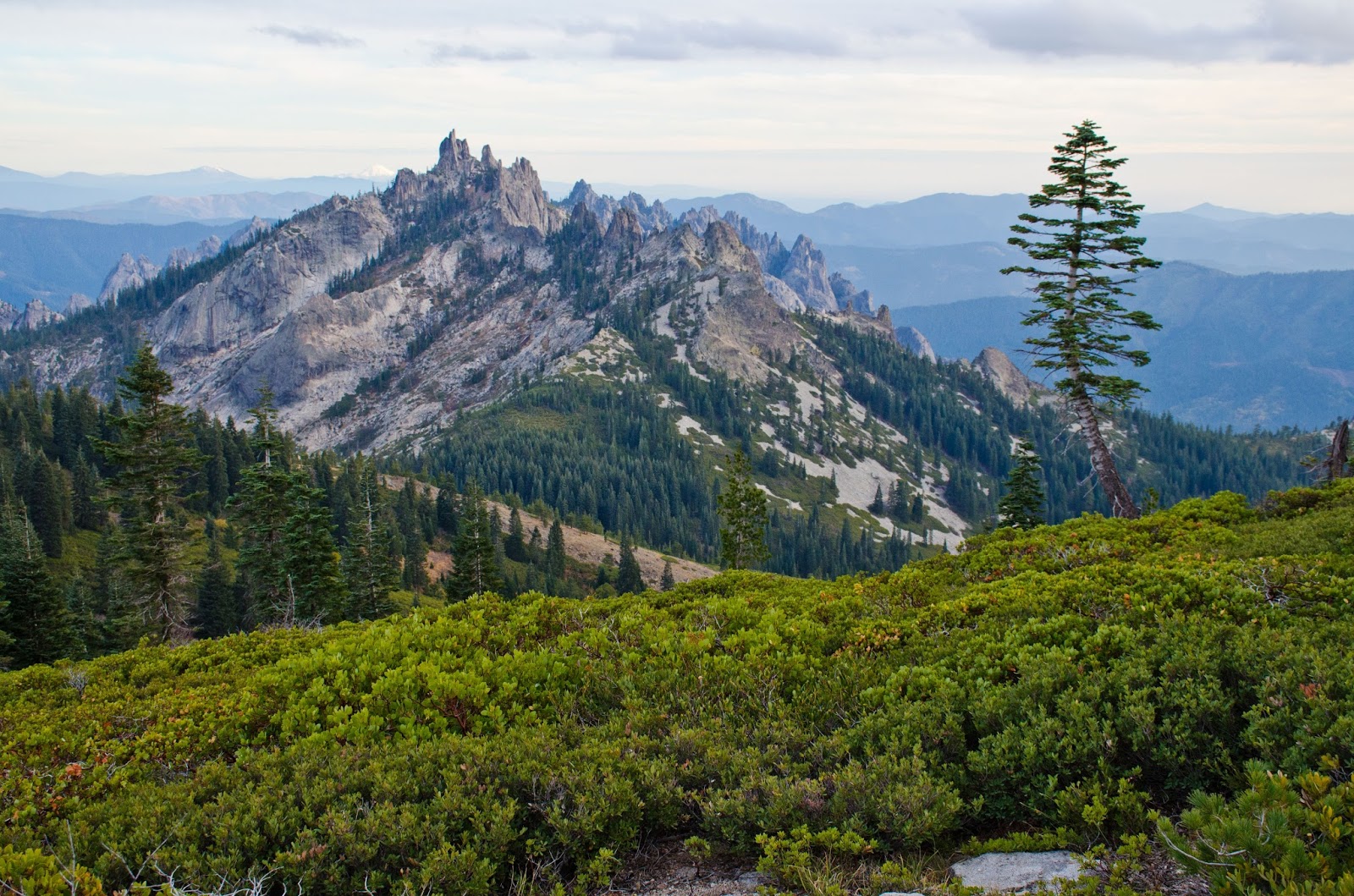
The trail occasionally emerged into small grassy clearings with views of Heavens Peak or other nearby mountains. The climb was constant but not terribly steep. At three and a half miles, the trail passed a junction to the left for the Granite Park Campground; I took the right fork to continue towards Granite Park Chalet. By this point, I often had views to the right of the trail of Logan Pass to the south, the rocky Garden Wall, Reynolds Mountain, Clements Mountain, and the many other glacial-carved fins and aretes.

Views of the Garden Wall from Granite Park Trail
After passing through a patch of blooming yellow glacier lilies alongside the trail, I came to an intersection about four miles away from the trailhead, where the Granite Park Trail met the Highline Trail. The trail to the right was the Highline Trail towards Logan Pass; the trail heading straight was the Highline Trail towards Swiftcurrent Pass. I took the trail to the left, which led to the stone structures of the Granite Park Chalet, a high country mountain lodge.

Granite Park Chalet and Heavens Peak
Granite Park Chalet was built by the Great Northern Railway during the heyday of close relationships between western national parks and transcontinental railroads. The railroad ran along the southern boundary of the national park, following the same route that now carries US Highway 2; the company built multiple lodges within the park and advertised the area as "America's Switzerland" to attract tourists from the East Coast. While lodges such as the hotel at Many Glacier could be reached by road, visitors hoping to stay at Granite Park Chalet could only gain access by foot or horse.

The front porch of the chalet had sweeping views of Heavens Peak and the valley of Logan Creek. As it was a cloudy and cold day, I decided to duck inside to eat my lunch and check out the inside of the chalet. A large common area with long tables was open to the public; snacks and drinks were for sale, but there was no hot water and thus no hot drinks. Visitors lucky enough to snag reservations at the chalet can hike in and stay overnight and spend more time exploring the network of alpine trails emanating from the chalet.

After leaving the chalet, I hiked back to the junction with the Highline Trail and followed it in the direction of Logan Pass. This stretch of trail is one of the most famous in all of Glacier National Park, but I experienced the beauty in nearly complete solitude: few hikers were on the Highline as an area near Logan Pass was still closed due to snow. Just past the trail junction, I entered a perfect meadow: tiny brooks flowed through a field of blooming glacier lilies, with evergreens dotting the edge of the meadow and snowy sandstone peaks rising behind that. I sat on a rock next to the trail and gazed contentedly out at the scene for nearly an hour.

Glacier lilies at Granite Park
After leaving the meadow, I continued along the Highline Trail, which descended briefly before flattening out as it followed the rocky southwest side of the Garden Wall. The reason for the trail's name became quite clear here: the Highline Trail cut through a stunning alpine environment just below the sharp ridgeline of the Continental Divide. Every step delivered jaw-dropping views.

Highline Trail leading south from Granite Park Chalet
Two-thirds of a mile from Granite Park Chalet, I came to the junction with the Grinnell Glacier Overlook Trail. While the Highline Trail continued its fairly level traverse towards the southeast, the Grinnell Glacier Overlook Trail headed up steeply to the left of the Highline Trail, aiming for a gap in the cliffs of the Garden Wall.

The trail was very steep, heading straight up the talus along the base of the Garden Wall and climbing nearly 1000 feet in just under a mile. The small rocks on the trail were very loose in places, making for sometimes unstable footing; at one point, the trail had more or less disintegrated into loose scree. Towards the top, the trail followed a series of rock ledges where hikers might want to use their hands. However, the path was generally not hard to follow and was made easier by the expanding views of the Continental Divide behind me and Granite Park below me.

The Highline Trail and the Continental Divide
I spotted three hoary marmots on the Grinnell Glacier Overlook Trail, including one at the overlook itself that pestered me continuously, presumably for a food handout. To discourage further begging behavior from the marmot, I kept my food to myself, but a few minutes later I turned around to see that marmot chewing on the handle of my hiking poles! I shooed it away and am still curious what nutritional value it found in hiking poles.

Marmot!
The most stunning view from the overlook was on the other side of the Continental Divide. The sheer cliffs of Mount Gould rose above a snow-covered cirque that contained the last remnants of the Grinnell Glacier. The snowbanks under the cliffs just below the overlook covered the Salamander, another rapidly shrinking glacier. In early July, snowmelt had not yet revealed the full forms of either glacier; the lake at Grinnell Glacier was still frozen over. Visiting in later summer would give a better idea of the extent of ice retreat at the glacier. Photographic comparisons of the Grinnell Glacier now to its state in the early 20th century are remarkable: it's immediately clear that over three-quarters of the glacier has been lost. The most striking realization of the extent of glacial retreat occurred when I realized that the Salamander and Grinnell Glaciers were still connected as a single glacier covering over a square mile at the time of the park's founding. The two ice masses are now separated by a distance of at least a third of a mile. The effect of climate change on the park's glaciers is unlikely to slow or reverse; nearly 90% of the glacial volume in the park has been lost since Glacier became a park. The park's permanent ice is not expected to last past 2030.

Grinnell Glacier Overlook, Mount Gould
To the southwest, I saw a unique view of Lake McDonald framed perfectly by Mount Cannon and Heavens Peak; the Grinnell Glacier Overlook is the only trail accessible spot in the park with this particular view angle.

Lake McDonald seen from the Grinnell Glacier Overlook
The overlook was quite cold due to the winds sweeping across the Continental Divide, so after enjoying the views and contemplating the accelerating effects of climate change on the park's glaciers, retraced my steps back to Granite Park Chalet, taking in the Rocky Mountain views en route. I spent much of the rest of the afternoon lounging about the meadows of glacier lilies near the chalet before hiking back down to the Loop.

Continental Divide peaks at Glacier National Park

Friday, November 4, 2016

Silver Peak

Snoqulamie, Thomson, Chikamin, Alta, and Hibox rise above fog at Snoqualmie Pass, seen from Silver Peak
6 miles round trip, 2100 feet elevation gain
Difficulty: Moderate-strenuous; rock scrambling necessary and routefinding skills are helpful
Access: Bumpy unpaved road to trailhead (no high clearance okay), Northwest Forest Pass required

Silver Peak is the tallest peak immediately south of Washington State's Snoqualmie Pass and is one of the more prominent peaks in the region. These attributes explain the peak's excellent views of Snoqualmie Pass and its attendant mountains. While the stats for this hike may suggest that Silver is a much easier climb than other I-90 peaks such as Bandera or McClellan Butte, the copious rock scrambling required at the end of this hike make this climb a bit of a challenge. Hikers who follow the Pacific Crest Trail and then an unmarked, unofficial climbers' trail to the summit of Silver Peak can experience an incredible panorama of peaks of the Central Cascades.

I hiked Silver Peak along with neighboring Mount Catherine on an extremely nice November day. I left Seattle on I-90 heading east and drove out to Hyak at exit 54; upon leaving the interstate, I turned right and followed Hyak Drive through the village of Hyak until the road turned into NF 9070. I continued on the road, now unpaved, for five miles to the trailhead, passing a set of switchbacks and some rocky patches in the road. The road came to a clearcut at Windy Pass after I passed by the trailhead for Mount Catherine; a wooden sign here marked the road's junction with the Pacific Crest Trail. I parked on the side of the road just past the Pacific Crest Trail access point; there's no parking lot so all hikers will need to park alongside the road here.

From the PCT junction, I followed the Pacific Crest Trail south. The first tenth of a mile of trail passed through a clearcut from a decade or so ago; new evergreens had begun filling the landscape but trees were sparse enough that I could still across from Windy Pass to the rocky peaks rising across the valley. I passed a small pond in the clearcut that reflected the snow-capped summits of Snoqualmie Mountain and Kaleetan Peak in its calm morning waters.

Pond in clearcut near trailhead
At the end of the clearcut, the trail entered a second-growth forest, immediately crossing a number of small streams before coming to and crossing Cold Creek, the main stream in the valley bound by Mount Catherine, Silver Peak, and Tinkham Peak. Looking through the trees to the northeast, I spotted the forested ridge of Mount Catherine rising on the opposite side of Windy Pass.

Cold Creek
Past Cold Creek, the well-maintained trail climbed gently through the forest. At rare spots, I could look down on the fog filling the Cold Creek Valley, hemmed in by the mountains to the east of Snoqualmie Pass.

Fog fills Cold Creek Valley
Although the bright colors of fall were gone and huckleberry bushes had shed both their leaves and their berries, I found that winter colors could be equally eye-popping. At one point along the PCT, moss covering a rock almost seemed to fluoresce.

Pacific Crest Trail south of Windy Pass
The trail crossed many small streams as it traversed the eastern slopes of Silver Peak. Few, if any, of these crossings were difficult; I found that most fords were easy either due to low flow of the creeks I crossed or due to a number of well-placed rocks that allowed me to cross easily. Many of these creeks formed pretty waterfalls as they plunged down the mountain towards their eventual confluence with Cold Creek and then the Cle Elum River.

Waterfall along the Pacific Crest Trail
Recent rains made the trail extremely muddy; after passing the mile mark, the trail was often rocky as well. After passing through a small clearing with limited views of Silver Peak's rocky ridge and neighboring Tinkham Peak, the PCT made a short descent through two sets of switchbacks. Just under two miles from the trailhead, I came to the unmarked turnoff for Silver Peak. The path towards the peak heads directly into the forest and was only marked by a small cairn. I didn't realize that I had reached the junction at first; instead, I only knew I had gone too far when I saw a small pond to the left of the trail. I retraced my steps from the pond until I found the unmarked trail off the PCT.

If you see this pond, you've hiked past the turnoff for Silver Peak
This narrow, unmarked path was much more of a challenge to follow and to hike than the PCT. Three major blowdowns blocked the trail between the turnoff and Abiel Pass, the saddle between Tinkham and Silver Peaks. I followed the path past two waterfalls along a constant uphill grade until reaching Abiel Pass. This unofficial footpath was both muddy and rocky, an unpleasant combination. Here, a path branched off to the left, heading for Tinkam Peak; I stayed to the right to continue on the main path, which led towards Silver Peak. The path quickly led to a steep scrambling section that required a 20-foot ascent up a 60-degree rock face. Once atop the short scramble, the trail grade became gradual as I followed it across a flat section of ridgeline. At one point, I noticed a "No Trespassing" sign to the left of the trail: although the Cedar River watershed to the southwest of Tinkham and Abiel Peaks belongs to the public, the valley is off limits to human travel due to its role as the Puget Sound metropolitan area's water supply.

The footpath was occasionally difficult to follow as it wound its way through the ridgetop forest.

Near the junction of ridges emanating from Silver, Abiel, and Tinkham Peaks, I caught a first view of my destination of the day: Silver Peak, reflected in a tiny rainwater pond.

Pools of water above Abiel Pass
As I approached the peak, the ascent route through the talus slope and up the summit block became apparent.

Silver Peak
The path ascended through a large talus field on the southern side of the peak. Loose rock slowed the ascent. Despite recent rains and snowstorms, the talus was neither wet nor icy, making my life a little easier.

Talus slope on the route up Silver Peak
My uphill effort was rewarded with a jaw-dropping view of Mount Rainier, which appeared particularly massive when viewed from Silver Peak. In morning light, I could tell many of the details on the Emmons and Winthrop Glacier, including the position of Steamboat Prow, Mount Ruth, and Burroughs Mountains.

Mount Rainier seen from Silver Peak
Past the talus slope, the path cut through a grassy knob along the ridge, offering views of Chikamin Peak and Mount Stuart. Fog still filled the valley to the east. Contuining onward, I soon came to the base of Silver Peak's summit block. A steep scramble up the many rocks that composed the peak brought me to the summit itself.

Silver Peak summit block
Silver Peak's prominence and its position grant the mountain a huge viewshed. The most striking part of the view was the collection of snow-covered rock spires to the northeast of Snoqualmie Pass: peaks such as Hibox, Alta, and Chikamin were showing off their new winter coats. Mount Stuart formed an impressive site to the east, while the line of peaks along I-90 were all visible to the west. In the far distance, I saw the Olympics, including the Brothers, Mount Constance, and Mount Anderson, rising above McClellan Butte in the foreground and the Bellevue skyline in the background. The blue waters of Annette Lake lay just below the peak, next to Abiel Peak. To the southwest of Rainier, I spotted the very top of Mount Adams.

Mount Catherine and Mount Stuart rise above the fog
Si, Mailbox, Defiance, Bandera, Granite, Kaleetan, and Chair- the I-90 peaks
Abiel Peak rises above Annette Lake
I stayed at the summit for an hour to enjoy the views before returning. During my five hour hike, I ran into just two other parties on the either trail, a stunning occurrence for such a nice Northwest day.

Mount Catherine

Granite, Kaleetan, Chair, Snoqualmie, Red- the Snoqualmie Pass peaks seen from Mount Catherine
3 miles round trip, 1300 feet elevation gain
Difficulty: Moderate, due to short scrambling section at end of trail
Access: Bumpy unpaved road to trailhead (no high clearance okay), Northwest Forest Pass required

Mount Catherine is likely the easiest hike to a summit in Washington State's Snoqualmie Pass corridor east of North Bend. This relatively short but fairly steep trail quickly elevates hikers to a rocky summit with nice views of the Snoqualmie Pass peaks, Lake Keechelus, and Mount Rainier. If you've got less than a half day and you want to summit one of the mountains off I-90, Mount Catherine is your hike. Although the summit view cannot compare to the views seen from higher nearby peaks such as Alta Mountain, Granite Mountain, or Silver Peak, it's still an impressive viewshed considering the relative ease of reaching the summit.

I hiked Mount Catherine along with neighboring Silver Peak on an extremely nice November day. I left Seattle on I-90 heading east and drove out to Hyak at exit 54; upon leaving the interstate, I turned right and followed Hyak Drive through the village of Hyak until the road turned into NF 9070. I continued on the road, now unpaved, for five miles, passing a set of switchbacks and some rocky patches in the road to the trailhead. The trail started off to the right (north) of the road; there was parking along the road on the downhill side. As the trailhead is extremely poorly marked, I've photographed the marker for the trail (which simply reads "1348" and does not mention Mount Catherine). If you come to a junction with the Pacific Crest Trail in a recent clearcut, then you've gone too far.

Mount Catherine Trailhead
The first three hundred yards of the trail followed an old roadbed, making a gentle ascent through the second-growth forests on the southern slopes of Mount Catherine. The trail deviated from the former road at a sharp left turn and began to climb aggressively. The next half mile was a constant ascent via switchbacks up the south side of Mount Catherine, entirely in the forest with only occasional views through the trees of Tinkham Peak and Silver Peak, which along with Mount Catherine bound the watershed of Cold Creek.

About three-quarters of a mile into the hike, I reached the top of the ridgeline and found a brief respite from the uphill. The switchback ascent had been cut into a fairly dry southern slope with little soil and no mud; atop the ridge, I found a much damper environment, with mud often covering the trail for the remainder of the hike.

Trail along ridgetop
At first, the ridgetop provided easy, flat hiking. Occasional breaks in the trees to the north revealed partial views of the rocky peaks surrounding Snoqualmie Pass, although the pass itself was not visible.

First views of Snoqualmie, Chikamin, and Alta
The lack of elevation gain didn't last; soon, the trail was once again climbing steeply as it followed the ridge towards Mount Catherine's summit. I passed by a well-situated campsite with a fire ring that offered nice partial views to the north. As I ascended further, I glimpsed more and more peaks through the trees; looking back, I could see McClellan Butte, Granite Mountain, Bandera Mountain, Mount Defiance, and other peaks that defined I-90's route through the South Fork Snoqualmie Valley.

Just before reaching the true summit, the trail emerged at a wide north-facing clearing. This was the best view of Snoqualmie Pass on the hike. All of the immediate peaks near the pass from Granite Mountain through Alta Mountain were visible; looking just east of the pass, I saw I-90 emerge from the the top of the pass and lead east towards Ellensburg. The cluster of buildings and ski lifts at Snoqualmie Pass were clearly visible. The real show stopper, though, was Chikamin Peak and Alta Mountain, two lofty, rocky peaks that were now coated in early-season snow.

Chikamin Peak and Alta Mountain from the clearing just below the summit
Past the clearing, the I followed the trail upward through two short switchbacks to the base of the rocky summit block. The final stretch of trail required a bit of scrambling: the path headed directly up a 60-degree slope to the rocky summit of Mount Catherine. Two cables offered additional support for hikers needing assistance for the ascent; the cables are probably unnecessary for most hikers.

At the top of the cables, I found a rocky ridge running east to west offering wide open views to the south. Silver, Tinkham, and Abiel Peaks were visible nearby, but the real star of the show here was Mount Rainier. The Emmons and Winthrop Glaciers were both visible and distinguishable on the eastern half of the mountain; the Willis Wall and Liberty Cap were the most impressive features of its western half. Other, lower peaks, many snowcapped, crowded the horizon.

Mount Rainier from Mount Catherine
Cascade ridges from Mount Catherine
Keechelus Lake was visible to the east. I watched from afar as larger tractor trailers threaded their way on I-90 along the lake towards Snoqualmie Pass. To the west, McClellan Butte, the skyscrapers of Bellevue, and the Olympics were visible through the sparse trees at the summit.

Keechelus Lake from Mount Catherine summit
The view to the north was a little underwhelming. Trees block much of the view, meaning that the partial views of the Snoqualmie Pass peaks and of the mountains lining I-90 to the west were no more clear than they had been along the ascent. As the forest on Mount Catherine continues to recover from former logging operations here, I expect that all northerly views from the summit will gradually disappear. For now, there are still a few interesting things to spot: the lookout atop Granite Mountain sticks out quite a bit from the pile of the rocks that appears to make up that mountain. To the northeast, I spotted Mount Stuart, the second tallest non-volcanic peak in the state, crowned with snow from recent storms.

Mount Stuart
After appreciating the views, I descended the way I came. On an extremely nice weekday, I shared the trail with just three other hiking parties. All in all, a decent though not remarkable hike near I-90 that is both relatively easy to get to and to hike.

Wednesday, November 2, 2016

Heart Lake and Castle Peak

Shasta, lone and white as a winter moon
3.5 miles loop, 1200 feet elevation gain
Difficulty: Moderate; some route-finding and rock scrambling necessary
Access: Paved road to trailhead, free parking
"As lone as God and white as a winter moon, Mount Shasta starts up sudden and solitary from heart of the great black forests of Northern California." 
So wrote Joaquin Miller, a frontier poet, of the snowy and lonely Shasta. The second tallest and second southernmost stratovolcano of the Cascade Range, Shasta's massive cone is one of the most impressive sights in a state packed with them. Castle Peak, a low but rocky summit in the nearby Trinity Divide of Northern California's Klamath Mountains, provides one of the best front-row seats to this singular, ice-clad mountain. The route to the peak via Heart Lake hits beautiful views of two different lakes and three different volcanoes in just over three miles; the catch is that it takes a bit of route-finding and rock scrambling to find your way to this still relatively unknown but increasingly popular peak.

I hiked up to Castle Peak on a reasonably nice late October day with three friends. We set out from the Bay Area early in the morning, stopping for lunch at Wilda's Grill in Redding and setting up our campsite at the Sims Flat Campground before driving to the trailhead in the early afternoon. The easiest way to reach the trailhead from I-5 is to leave the interstate at exit 738 at the city of Mount Shasta, head west on West Lake St, turn left to go south onto Old Stage Road, turn left at the next intersection to head south on W A Barr Road, continue on W A Barr until crossing the Box Canyon Dam and then immediately turn left at the next intersection onto Castle Lake Road, which dead ends at the lake after making its way uphill into the mountains of the Trinity Divide. Although Castle Peak, the destination of our hike, is over 6600 feet high, the car had already done most of the work, shuttling us over a mile above sea level to the trailhead. Castle Peak, Heart Lake, and Castle Lake are located in Shasta-Trinity National Forest; currently no fee is charged for trailhead parking.

The parking lot had enough room for at least 20 cars and was close to full on that comfortable fall day. The trailhead was unmarked, to the left of the parking area. We started by following one of the many beaten paths down to the lakeshore for a view of Castle Lake, a large lake that filled a glacier-carved bowl. The bare granite of Castle Peak rose to the south; two forested ridges bound the lake on either side. Placards here noted Castle Lake's significance in the field of limnology: scientists from UC Davis began monitoring this lake in the 1950s in a study that has continued through today in the longest-running mountain lake research program in existence, making this one of the most well-researched aquatic ecosystems in the world.

Castle Lake
We returned to the trail and followed it on a clockwise half-revolution of the lake. The trail crossed the lake's outlet stream and then delved into sparse woods on the eastern shore of the lake, beginning a gentle climb. The trail was rocky at times and we had to negotiate a large blowdown, but otherwise this stretch along the Castle Lake Trail was easy to follow. In half a mile, we had climbed above the southern end of the lake into an area of open rocks and low vegetation, just downhill of a saddle. Here, the Castle Lake Trail continued heading uphill towards the saddle, eventually leading to Little Castle Lake and Mount Bradley; we left the trail on one of the unmarked use paths that led to the right, heading uphill in the direction of Castle Peak. The trail to Heart Lake is unofficial, so there is not necessarily a "correct" path here; most of the trails lead uphill to Heart Lake. For the sake of the subalpine environment here, the Forest Service should construct an official trail to protect vegetation from the growing stampede of visiting hikers.

The path that we followed towards Heart Lake approached a picturesque pine perched over the Castle Lake basin, with Black Butte visible near the city of Mount Shasta and Mount Shasta itself just visible, poking out from behind the ridge east of Castle Lake. Black Butte, a steep cinder cone, was one of the more distinct geological features we noted on the hike.

Black Butte rises in the distance, Castle Lake in the foreground
Although not an official trail, the route was well-worn and easy to follow as it climbed to the base of the east-west ridge of Castle Peak. At the base of the ridge, the trail turned towards the right and climbed up to a small gap; after passing through the gap, we came upon tiny Heart Lake, about a mile from the trailhead. The lake was mostly in the open, with just a few pines and some bushes displaying nice fall foliage on its shores. The lake was divided into two lobes by a rocky peninsula to form a heart shape, which was not readily apparent from the lakeshore.

Heart Lake
We followed a path onto the rock that jutted into the lake and found a spectacular view of Mount Shasta reflected in the lake's calm waters.

Shasta and Shastina reflected in Heart Lake
Hikers who aren't prepared for route finding or rock scrambling should turn around at this point and return to the trailhead. The path to Castle Peak became much harder to negotiate and navigate past Heart Lake. We pressed onward from the lake, following the path across the lake's small outlet stream, briefly skirting the lake's northern shore, and then continuing on a well-trod path across the mountain bench holding Heart Lake. A couple hundred yards further, the trail began a steep ascent up the ridge leading north from Castle Peak. Here, the trail was sometimes easy to lose; at times we had to whack our way through scrubby manzanita bushes. At times, the trail devolved into a rock scramble, requiring us to use our hands with our feet to ascend. After a short but fairly intense push, we arrived at the top of the manzanita-covered ridge. Castle Peak rose to our left; we decided to first check out the northern cliff-edge of the ridge, which was to our right. We made our way down overgrown social trails through thick manzanita to the very edge of the cliff, which provided an unparalleled view of Castle Lake's blue waters.

Shasta towers over Castle Lake
Mount Eddy, blanketed in fresh snow, made a notable appearance to the north. At just over 9000 feet, Eddy is the tallest peak in the Klamath Mountains, and the tallest mountain west of I-5; indeed, its summit is over 1000 feet higher than any of the summits in Washington's Olympic Mountains, its only competition in height along the northwest coast. Despite all of these impressive descriptors, Mount Eddy gets no respect: Shasta, Lassen, Castle Crags, and Black Butte steal all the attention along this hike.

Mount Eddy
We followed the ridge south towards the summit of Castle Peak. There was sometimes a discernable trail and sometimes just a line of cairns marking the way through small boulder fields. Rock scrambling was necessary in multiple places and although the route was straightforward enough (we just followed the ridge), some judgment was necessary to pick reasonable routes up the mountain. The route was mostly out in the open, which meant that views of either Shasta or Eddy accompanied us throughout the uphill scramble.

As we continued upwards, views of the Castle Lake Basin opened up and we spotted both of the lakes that we had visited that day. Along with a handful of other lakes in the Trinity Mountains, these subalpine pools form the headwaters of the Sacramento River, one of the two major rivers that flows through California's Central Valley (the other is the San Joaquin, which flows from the alpine lakes of the High Sierra).

Shasta with Castle and Heart Lakes, from just below Castle Peak
After hiking a little over a half mile from Heart Lake and scrambling across quite a few rocks, we arrived at the summit of Castle Peak. The summit area was broad and flat, with two windshelters and an unobstructed 360-degree view of the Trinity Divide and the other ranges of the Klamath Mountains. The most impressive aspect of the view was to the south: for the first time, we spotted the granite spires of the Castle Crags. Below the Crags, we spotted the Pacific Crest Trail winding its way to the south; the snowy summit of Lassen Peak, a massive plug dome forming the southern anchor of the Cascade Range, rose beyond.

Lassen Peak and the Castle Crags
Castle Crags from Castle Peak
To the north, we spotted Mount McLoughlin, a Cascade stratovolcano in southern Oregon.

Mount McLoughlin
The many ridges of the Klamath Mountains rose to the north, south, and west. The mountains close in formed the subrange of the Trinity Divide. Mount Shasta lies at a junction between the Coast Ranges, of which the Klamath Mountains are a part, and the Cascade Range, which includes Mount Shasta itself.

Hazy blue ridges of the Klamath Mountains
From the summit, we decided to make a lasso-loop of the hike rather than return by the same way we came. We followed the ridge heading east from the summit: a faint path led along the through the manzanita shrubs at the top of the ridge, occasionally fading out at talus slopes. The ridge route was entirely open as it followed the top of the granite cliffs rising above Heart Lake, providing excellent views along the descent. Heart Lake's heart shape became more apparent from this angle while Mount Shasta and Castle Crags provided a constant wow factor.

Shasta and the lakes
Castle Crags from the descent along the Castle Peak east ridge
The Crags were the site of one of the many battles between the Native Americans of Northern California and the Europeans who arrived in the 19th century. The Klamath clashed with gold prospectors at Castle Crags in 1855; the most well-known of the Northern California conflicts, however, occurred in the lava beds of the Medicine Lake Volcano, in the northeastern shadow of Shasta during the Modoc War. The end result of these conflicts was the confinement of tribes that had populated the Klamath Mountains and the desert east of Mount Shasta to small reservations in Northern California and Southern Oregon.

Castle Crags
After taking in a final view of the Castle Crags from the ridgeline, we followed the social trail as it began to descend north from the ridge. At times the trail petered out, but we could now see the trail to Heart Lake below, so we made a beeline for the path up which we had come. During the descent, we saw the setting sun cast its final rays on Shasta, illuminating the snowcapped summit and the very top reaches of the Avalanche Gulch climbing route.

Last light on Shasta
Once we returned to the path to Heart Lake, we made our way downhill until we returned to the official Castle Lake Trail and made quick work of the final half mile down to the parking lot. Although this hike is quite short- just a three and a half mile loop- be sure to allocate plenty of time for the hike. The rock scrambling and route finding on the ascent from Heart Lake to the top of Castle Peak and the ridgeline descent are all time consuming; be sure you have enough time to return to the trailhead by dark. Additionally, the excellent views along the trail demand constant attention; plan on at least three to four hours to really enjoy this hike.