 |
View south along the Schell Creek Range
|
7 miles round trip, 3100 feet elevation gain
Difficulty: Moderate-strenuous; some route-finding required
Access: Rocky road to trailhead, no fee required
11880-foot North Schell Peak is the little-visited but scenic high point of the Schell Creek Range in the Great Basin of eastern Nevada, less than an hour's drive from Ely, the main town in this part of the state. There is no official trail leading to this high summit, but the peak can be reached via well-defined social paths and some relatively easy route-finding. The rewards from the summit are sweeping views of the High Schells and of the endless basins and ranges that define this area of Nevada and Utah. North Schell Peak has much of the spectacular scenery that can be seen on the nearby Wheeler Peak hike but has almost no crowds; in fact, you're very likely to have this peak to yourself if you hike here. North Schell is also one of 57 ultraprominent peaks- mountains with over 5000 feet of topographic prominence- in the contiguous United States. In the autumn, the slopes of the Schell Creek Range along this hike explode with fiery fall colors, making it a particularly nice time to visit.
I hiked North Schell Peak on the last day of September during a road trip through Nevada's Great Basin to see fall colors. North Schell Peak is very remote- it's a long drive from any major metropolitan area, about 3.5 hours from Salt Lake City and 4.5 hours from Las Vegas. However, it's not a terribly long drive from Ely, the main town in White Pine County and the only place you can find full services for over 120 miles in any direction. From Ely, I took US Highway 93 north from the town past McGill and then turned right onto Duck Creek Road; look out for signs for Humboldt National Forest and Duck Creek. Turning onto Duck Creek Road, I followed it east as it followed Duck Creek through a water gap in the lower range of the Schell Creek Range into Duck Creek Valley. After 8 miles along the Duck Creek Road, I turned left onto a gravel road leading up to Timber Creek Campground. This 4 mile long gravel road was quite rocky in places, making the drive a little slow; there were great views of the Schell Creek Range ahead of the road. As the road entered the mountains, aspens with bright fall color surrounded the road. I followed the road into Timber Creek Campground, passing the group sites and then parking near site 6, the last campsite. The road continues past this point to the true trailhead but is quite rough; as I did not have a high clearance vehicle, I chose to park at the campground and hiked the final half mile of road to the true trailhead. If you make it up to the actualtrailhead at the end of the road, you'll save a mile of hiking round trip and cut off 200 feet of elevation gain.
Leaving from the upper end of Timber Creek Campground, I followed the gravel road uphill for 0.6 miles to reach the true trailhead. The road ascended through an aspen grove and then leveled out a bit as it emerged onto open slopes with aspens lining the banks of Timber Creek to the right and the peaks of the High Schells rising ahead. An aspen forest covered the lower slopes of the High Schells and at the end of September the forest had burst into bright color.
 |
Fall aspens
|
Following the rocky gravel road for 0.6 miles past a former Scouts camp, I arrived at the true trailhead, where there was ample parking but not a single car. At the trailhead, there is only one signed trail, which heads off to the right and south; I ignored the signed trail and instead continued following the obvious road trace to the left, a continunation of the gravel road that led up from Timber Creek Campground. While large rocks blocked vehicles from following the road trace any further, it was straightforward to follow on foot. This road led through a beautiful forest of aspens. Aspens- found throughout the American West- are clonal trees, meaning that groves are often composed of genetically identical trunks that spring from a common root system. Aspen colonies often grow to massive sizes and can last for millenia; by some measures, aspens are the most massive and oldest organisms on the planet. Pando, an aspen colony in Utah, covers over 100 acres, weighs over 6 million kg, and may have lived as long as 80000 years, although no single trunk is particularly massive or old.
 |
Aspens
|
Aspen trunks typically last less than a century. During the early to mid-twentieth century, aspen trunks in Nevada and California were often used as message boards and canvasses for Basque sheepherders. Immigrants from the Basque regions of France and Spain often took to tending sheep in the mountain grasslands of the Great Basin and carved dated records of their presence along with political messages, poems, self-portraits, and images of women. These Basque arborglyphs can be found throughout the Great Basin and a number of them are found along this hike in the aspen groves of the Schell Creek Range. However, it can be difficult to distinguish sheepherder arborglyphs now as it has become quite popular for contemporary visitors to add their name to the bark record; it's a little difficult to tell whether these modern efforts are vandalism or simply the continuation of a tradition of historical and perhaps artistic significance.
 |
Basque arborglyphs
|
The trail paralleled Timber Creek, which still had some flow even during fall after a particularly dry year. Soon, the road trace died out into a single track trail, which followed the creek out of the aspen groves and onto open slopes. North Schell Peak rose directly above to the right, its slopes adorned with colorful aspens. Looking back from time to time back down the stream valley, there were ever-improving views encompassing a progressively wider swath of the Schell Creek Range and the fall aspen forests on its slopes.
 |
Aspens along the north branch of Timber Creek
|
The trail initially ascended at a moderate but steady grade. After following the road trace a half mile up from the trailhead, Timber Creek forked; the trail led up along the left fork of the creek. From here, the grade of the trail steepened as it continued to ascend along the creekbed, which at this elevation was dry. Views of the southern end of Timber Creek Valley and the High Schells continued to improve.
 |
Aspens in the Schell Creek Range
|
The trail passed in and out of a number of aspen groves in the stream valley and soon also entered a grove of bristlecone pines, which mainly covered the slopes on the left (west) bank of the stream valley. The bristlecone pines growing closer to the trail did not have the gnarled, windswept appearance for which the pines are known.
 |
Schell Creek Range
|
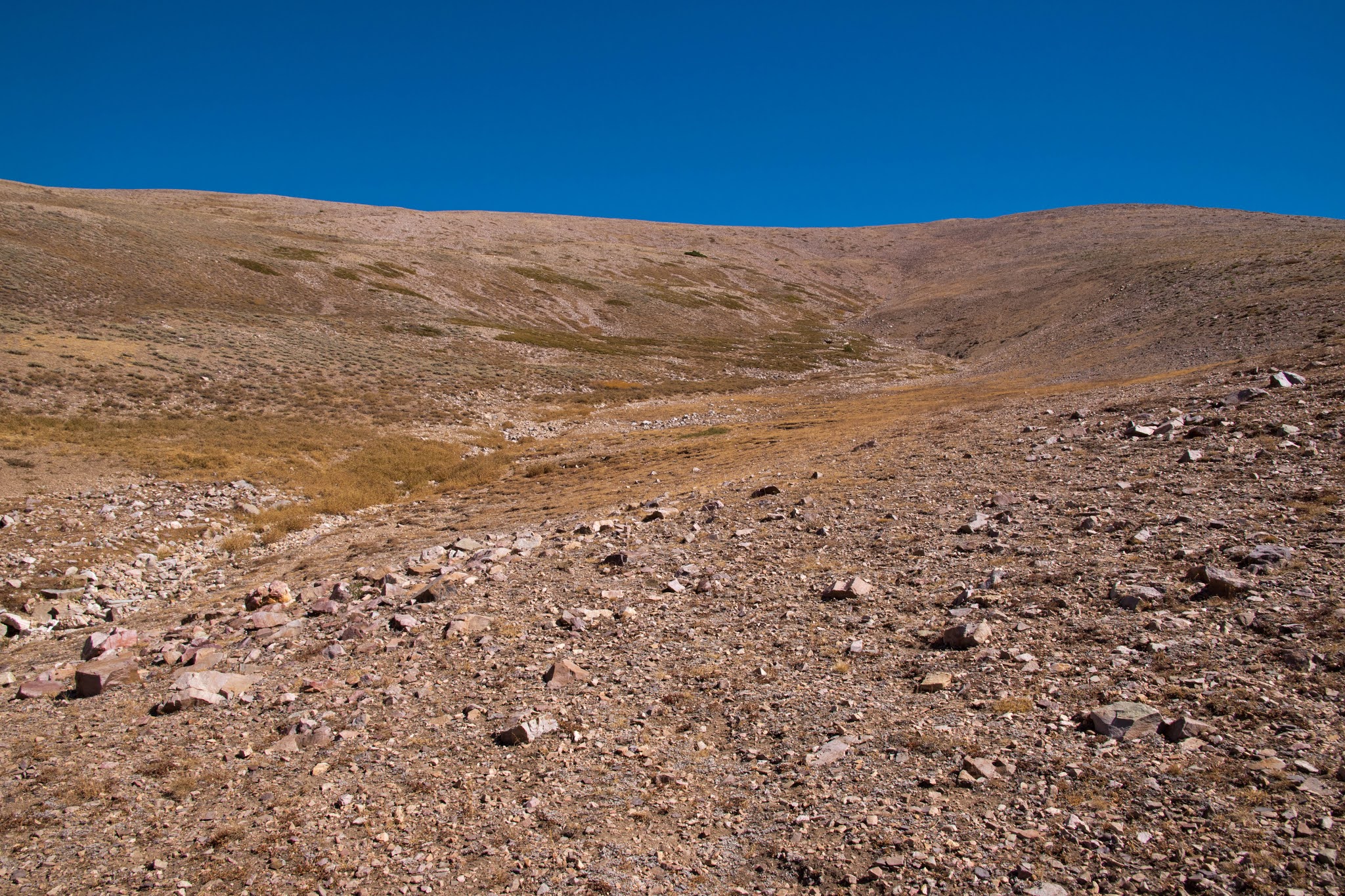
After following the trail a mile and a half up from the trailhead at the end of the road, the trail made a sharp turn left, crossing the creek and then heading up the opposite slope. Here, I left the existing trail to make my way cross-country to the summit. Looking to my right, I could see up to the crest of the High Schells. The ridge to the southeast- the West Ridge of North Schell Peak- provided a straightforward route to ascend to the crest; North Schell Peak was just off to the right of the stretch of the crest visible from here. I headed uphill largely by following this ridge; although unmarked, the route was fairly straightforward as the mountain slopes were so open here. The terrain was initially fairly friendly, with patchy grass and soil intermixed with small rocks, but the ridge soon devolved into talus slopes, which were more strenuous to navigate and made the going a little slower.
 |
Looking up to the crest of the Schell Creek Range
|
As I ascended along the ridge, views slowly began opening up to the west. First, I was able to gaze over the nearby ridge; then I could see past the Duck Creek Range to Steptoe Valley and the Egan Range. As I climbed further, range after range unfurled to the east: the Diamond Range near Eureka, Mount Jefferson and the high Toquimas, and then finally Toiyabe Dome and Arc Dome, the high summits of the Toiyabe Range 150 miles distant.
 |
View west across the Great Basin to Arc Dome and Mount Jefferson
|
The ascent up the West Ridge of North Schell Peak took a little while, with about a thousand feet of elevation gain over the uneven terrain of talus fields, but it was as far as route-finding went it ended up being fairly straightforward. Once the ridge started leveling out as I approached the crest, I could see a large cairn in the saddle between a local high point on the crest and North Schell Peak, which was to the south (right). I aimed towards the saddle on the crest. The views on the upper slopes of the High Schells were incredible: I could see back into aspen-filled the valley of Timber Creek below and the rocky spine of the Schell Creek Range stretched to the south. Wheeler Peak- the tallest peak in this part of the Great Basin- poked out above the saddle between North Schell Peak and the unnamed but impressive peak to its south.
 |
Wheeler Peak and the Schell Creek Range
|
Arriving at the saddle on the crest, a new set of views opened to the east. The Snake Range lay on the other side of Spring Valley. North Schell Peak rose directly to the south along the crest of the High Schells. Here, a social path reemerged, marking the final part of the hike to the summit. The trail initially ascended along the ridge but then stayed just below the ridgeline for a stretch as it passed a number of false summits before it finally made the brief, sharp climb to the mountain's high point.
 |
North Schell Peak, Mount Moriah in the distance
|
At 11880 feet, North Schell Peak is one of the tallest and most prominent peaks in all of the Nevada. The summit views, stretching in all directions, encompassed many of Nevada's other great peaks, missing just Charleston Peak near Vegas and Boundary Peak in the White Mountains. From this lofty viewpoint, layer upon layer of mountains stretched out in all directions, impressing upon me the immense scale of the Great Basin. The Schell Creek Range- the second longest of Nevada's many parallel mountains ranges, following the Toiyabe Range- stretched to the horizon to both the north and the south, with an impressive crest of more tall peaks to the south.
 |
Looking north along the Schell Creek Range, Ruby Mountains in the distance
|
To the west, the view of far-off mountain ranges extended as far as the Toiyabe and Toquima Ranges, with Mount Jefferson and Arc Dome- the two highest peaks in the central part of the state, both of which are also ultraprominent peaks- poking above their peers. The Egan Range and the Grant Range were among the layers of mountains visible closer by. To the north, the Ruby Mountains formed a major mountain wall. Far to the south, a distant wall of smoke was visible over southern Nevada, a result of major wildfires burning in California.
 |
View down the Timber Creek watershed
|
To the east was a great dry lakebed in the center of Spring Valley. Mount Moriah rose on the other side of this playa, the tallest peak of the northern Snake Range. Moriah is an impressive mountain over 12000 feet tall but just misses out on ultraprominence. Wheeler Peak, the 13063-foot giant at the heart of Great Basin National Park, rose dramatically from the South Snake Range, with the great cliffs that rise above its northeast cirque visible from this angle. To the northeast, Ibapah Peak, another ultraprominent summit, rose out of the Utah portion of the Great Basin.
 |
Ibapah Peak and the Utah Great Basin
|
If you've never been to Nevada or Utah, you might wonder: what is the Great Basin? What's up with all these mountain ranges in Nevada? The two answers are closely interconnected. The Great Basin is a contiguous set of endorheic watersheds in the desert between the Rocky Mountains and the Sierra Nevada- this means its an area where rainfall and snowmelt never reaches the ocean, instead flowing down into desert basins and then evaporating. The Great Basin covers almost all of Nevada and about half of Utah, as well as sizeable portions of California and Oregon and a bit of Idaho and Wyoming. It's not a single basin but a collection of many basins; some of these basins lie near the snowy peaks of the Sierra Nevada and the Wasatch Range and receive enough water and snowmelt to support permanent lakes in the desert like Pyramid Lake, Mono Lake, or the Great Salt Lake. Most of the basins are usually dry, with dusty dry lake beds like Spring Valley, although these dry lakes may flood seasonally.
The many basins characteristic of the Great Basin are part of the Basin and Range physiographic province, a region of parallel mountain ranges that covers all of Nevada but stretches far south into Arizona and northern Mexico. The Basin and Range is the result of extensional plate tectonics on the North American Plate. The Rocky Mountains formed during the Laramide Orogeny, a period tens of millions of years ago caused by the subduction of the Farallon Plate- part of the Pacific Ocean- beneath the North American Plate. After the Farallon Plate had been fully subducted beneath the North American Plate, the compression on the western edge of the North American Plate let up. As a result, the North American Plate began to extend between the Rockies and the Pacific; extension led to faulting, which caused faulted blocks to lift up relative to one another to compensate for the extending crust, creating many parallel mountain ranges. Erosion and sediment deposition filled the gaps between the ranges with the flat basins of today's Great Basin.
When I checked the summit register, it appeared that perhaps as few as ten people a month summit this remote but beautiful peak. The views from North Schell Peak are far-ranging and the aspens at its base make the peak an attractive fall destination. I highly recommend this hike for those with appropriate route-finding experience who want to experience more of Nevada's Great Basin than just Wheeler Peak and Great Basin National Park.


No comments:
Post a Comment