 |
Sierra Buttes Fire Lookout
|
5 miles round trip, 1600 feet elevation gain
Difficulty: Moderate
Access: Good paved but narrow road to trailhead, no fee required
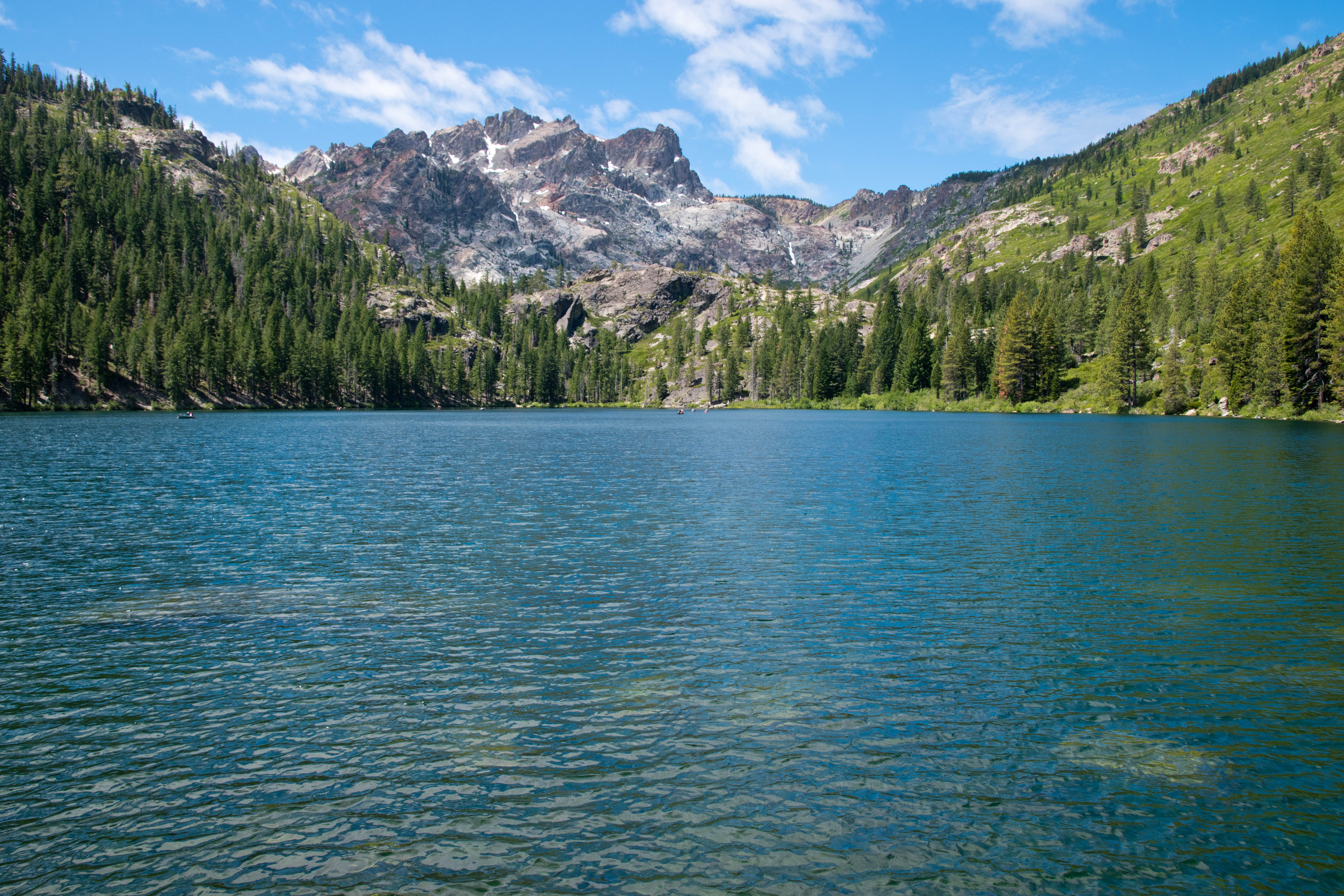
Sierra Buttes is one of the most prominent peaks in the northern section of California’s Sierra Nevada, with a massive eastern headwall that makes it one of the most scenically impressive mountains in the state north of Tahoe. The fire lookout perched atop its highest point is reached by a hair-raising walk up a steel staircase and delivers fabulous views of Northern California, from the Coast Range to the Cascades to the Great Basin Desert. The ridge hike to this summit packs in views of forested peaks and jewel-like lakes, with plenty of wildflowers in early summer; while this hike doesn’t quite live up to the scenery standard set by the High Sierra further south, it is one of the most enjoyable and worthwhile hikes in its part of the state.
There are many ways to get to ascend Sierra Buttes; by far the easiest route involves driving a 4WD high clearance vehicle to the base of the lookout and simply ascending three flights of steel stairs to the summit. Most visitors, however, will find a hike ascent along the mountain’s north ridge from Packer Saddle to be the most rewarding, as this route packs in plenty of views along its moderate climb to the mountaintop. My friends and I, who were visiting Sierra Buttes after a holiday weekend stay in North Lake Tahoe, took the hike up from Packer Saddle; we also paid a brief visit to Lower Sardine Lake, a highly worthwhile stop on the drive in that provided us a beautiful view of the great headwall on the eastern side of the mountain. Packer Saddle is just over an hour driving from Truckee and at least 2.5 hours of driving from Sacramento.
 |
Sierra Buttes and Lower Sardine Lake
|
We followed Gold Lakes Highway uphill for 1.3 miles from Highway 49, passing some jaw-dropping views of the precipitous east face of the Sierra Buttes. At the junction with the Sardine Lakes Road, we turned left; after crossing a bridge, we then turned right onto Packer Lake Road (although it’s also worth it to drive to the end of the road to see Sardine Lakes!). After turning onto Packer Lake Road, we drove uphill along a very well-maintained paved road with clear lane markings for 2.5 miles to Packer Lake Campground; past the campground, the road became very steep and narrower but remain paved, ascending through hairpin switchbacks until reaching the top of a ridge at 4.5 miles past the turnoff from Sardine Lakes Road. The paved road ended here; a final quarter mile of good gravel road descended along the ridge to the trailhead at Packer Saddle, where there was room to park about 20 cars. There is no fee and no restroom at the trailhead.
We headed south along an old service road from the trailhead at Packer Saddle. This road climbed steeply through the pine forest, quickly gaining the top of the ridge while making a stiff ascent. Blooming wildflowers around the trail provided interest and made the climb a little easier: paintbrush and lupine were particularly common here during our early July visit.
After a half mile of hiking from the trailhead, the trail narrowed to a single track and came to a flatter section of the ridge; at the fork between the wider road and the single track, I took the right fork for the single track trail (a rock barrier blocking the left fork clearly indicates not to head in that direction). Here, wildflowers bloomed profusely over an open ridgetop: the blooms of golden wyethia were particularly widespread and beautiful. The lower density of trees here also opened views off to both sides of the ridge as well as providing the hike’s first view of the lookout atop Sierra Buttes. When the flowers bloom here in spring and early summer, this is an absolutely beautiful stretch of trail that is certainly among the highlights of this hike.
 |
Flower-filled ridgeline
|
 |
Wyethia in bloom
|
At just under one mile from the trailhead, the flat trail ended at a junction with the Pacific Crest Trail, which crossed over the Sierra Buttes Trail here. Oddly enough, the PCT never follows any section of the north ridge of Sierra Buttes, missing out on many of the great views offered by this mountain. After passing the trail junction, we began to ascend at a steady grade along the ridge. The ridge was forested to the west but generally open to the east, providing views of the Sierra Buttes ahead and to the forested mountains in the east. Towards the top of this ascent, at 1.2 miles from the trailhead, we caught some nice views of the two Tamarack Lakes in the basin below.
 |
Overlooking Tamarack Lakes
|
The trail reentered the forest on the west slope of Sierra Buttes and continued climbing steadily upward. At 1.6 miles from the trailhead, a short spur leading left at a switchback brought us to a spectacular viewpoint above Young America Lake. This small lake was cradled in a rocky cirque directly below us and had a spectacular blue-green color when it was lit by the sunlight. From this spot, we also had a jaw-dropping view of the massive northeastern headwall of Sierra Buttes.
 |
Young America and Sardine Lakes
|
Shortly beyond that first viewpoint of Young America Lake, the trail reemerged along a clearing on a flatter stretch of the ridge. The views of Young America Lake were slightly blocked here, but the view of the great cliffs of Sierra Buttes and the small lookout perched atop the highest pinnacle were quite spectacular. The trail came to another junction at 1.8 miles; I continued following the single-track trail closest to the ridge, eschewing the wider 4WD road that came up from the right.
 |
Sierra Buttes and the summit lookout
|
The trail continued climbing steeply through the forest after the junction, making multiple switchbacks as it pushed towards the summit. At 2.1 miles, the single-track trail merged with the 4WD road that leads to the summit. It’s important to make note of this junction: it is easy for hikers to miss this turn on the way down. Joining the 4WD road, we continued to head uphill through a series of switchbacks. This wide, rutted gravel road soon broke out of the forest onto the windswept alpine slopes of the upper mountain, opening up incredible views to the north and west. At the northern end of various switchbacks here, we caught incredible views of the vertical eastern headwalls of the Sierra Buttes and saw the lookout perched precariously atop the mountain’s highest pinnacle.
 |
Jackson Meadows Reservoir and Sierra Crest
|
Views to the south opened up as the 4WD road ended at the base of the Sierra Buttes’ summit block. From here, a three-part steel staircase climbed a final 150 feet to the very highest point of the mountain. It’s extraordinary that this ladder was installed in such a precarious place. Some hikers will find the staircase to be too much; rest assured that reaching this point still guarantees sweeping views of the Central Valley, the Coast Range, Lassen Peak to the north, and the crest of the Sierra Nevada to the south.
 |
Looking up to the Sierra Buttes Lookout
|
The final ascent up the three steel staircases to reach the summit were the most thrilling stretch of this hike. While the staircases may look terrifying to some, I found them fairly straightforward to go up and down in person; the last of these staircases, which is airier underneath than the first two, is a bit more likely to trigger acrophobia. At the end of the ladders, a final ten meters of uphill through a stone pile brought me to the foot of Sierra Buttes lookout. A short steel staircase brought me to the fire lookout’s upper deck, the highest point of the hike on top of this 8591-foot high summit. Not everyone will be okay with the ladders: three of the five in our group went up the ladders, while two decided to stick to the base and enjoy the views from there.
 |
Starting up the staircase
|
 |
Looking down from the top of the staircase
|
I made my way gingerly around the upper deck of Sierra Buttes lookout, with a steel lattice floor being all that separated me from a thousand-foot vertical drop down the east face of the mountain. The airiness of this drop was thrilling.
 |
Eastern headwall of Sierra Buttes
|
The 360-degree view achieved by going around the deck of the lookout was too packed with peaks and landmarks for me to note them all, but I’ll give it a go. To the south, we could see along the crest of the Sierra Nevada towards snow-covered mountains near Donner Pass and Lake Tahoe, while the drier but still noteworthy peaks of the Carson Range were visible further east. Jackson Meadows Reservoir was visible amidst the forested slopes of the Sierra. Sierra Valley, a flat basin to the east over Yuba Pass, was somewhat visible, with layered mountains of the Basin and Range visible beyond it. The Sardine Lakes were visible directly below the lookout to the east.
To the west lay the vast Central Valley. Sutter Buttes- a tiny, isolated range of hills in the middle of the valley- stood out from the flat farmland. Across the valley rose the Coast Ranges, which rose from more hill-like forms in the south to more impressive heights in the north, with Snow Mountain, a 7000-foot peak directly across the valley, especially notable. Mount Diablo was visible far to the south- it was crazy to think that I could see this Bay Area icon from both Sierra Buttes and from where I lived, nearly a five-hour drive away. The Yuba River's deep canyon was cut into the forested slopes of the Sierra Nevada below me to the west, while the Sierra Nevada became progressively more tame as it headed north, the rocky peaks fading into forested and rounded ridges. Lassen Peak, a great plug dome volcano and the southernmost peak of the Cascades, broke that monotony to the north; on a clear day, I imagine that Mount Shasta, the greatest of the California Cascade volcanoes, would be visible from here, but it was a bit too cloudy on the day of my visit.
 |
Looking west into the Yuba River watershed
|
 |
Sardine Lakes below, Sierra Valley in the distance
|
 |
Lassen Peak
|
 |
Mount Diablo across Central Valley
|
 |
Sutter Buttes, Coast Ranges, Central Valley
|
The inside of the fire lookout is still furnished with a refrigerator and a stovetop, from the days when Sierra Buttes Fire Lookout was an active fire lookout. At the time of writing (but likely for not too much longer), the Sierra Buttes and the Yuba River watershed remain one of the few mountainous areas of Northern California that have not been hit by the megafires devastating California: the 2021 Caldor Fire, the 2020 North Complex, and the 2021 Dixie Fire devastated the Feather and American River watersheds to the north and south of the Sierra Buttes, respectively. For the moment, the view from the lookout still covers a landscape that is largely green and remains covered with conifers.
The hike to the fire lookout atop Sierra Buttes is one of the premier hikes of the northern Sierra Nevada. The trail combines a good workout with stellar views, a fun staircase ascent, and lots of wildflowers. While this is a relatively popular hike for the region- we saw upwards of twenty hiking groups over the course of the day- it is still reasonably peaceful and far quieter than the busy trails of the Tahoe region. Highly recommended.


No comments:
Post a Comment