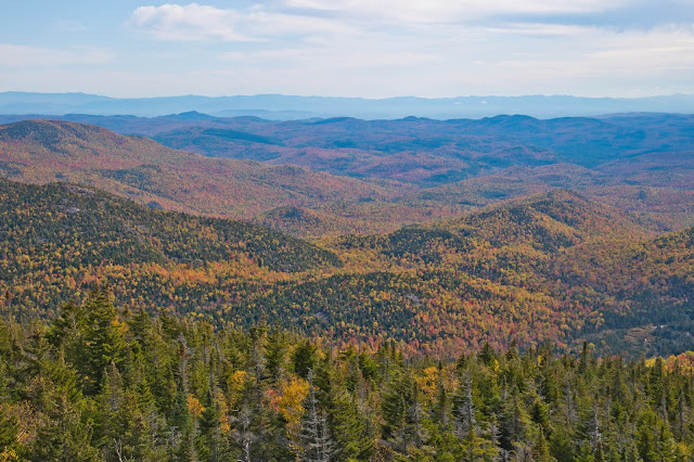
Friday, October 23, 2020

Mount Dana

Mount Lyell rising above the High Sierra
6 miles round trip, 3150 feet elevation gain
Difficulty: Strenuous
Access: Paved road to trailhead, Yosemite National Park entrance fee required

The second highest peak in California's Yosemite National Park delivers unparalleled views of the High Sierra and the deserts of the Great Basin. This is a hike with extraordinary views but it is also a demanding one, tackling this summit near Tioga Pass with incredibly steep grades and stretches of trail that may require rock scrambling. The reward is a panorama of Mono Lake and Tuolumne Meadows, the Great Basin Desert and the High Sierra. Views are excellent throughout the steep and challenging ascent; although a daunting peak, Mount Dana is also a rare chance to reach such a lofty viewpoint from an easily accessible high elevation pass. Serious hikers will find this to be one of the best hikes in what is perhaps America's most famous national park.

As this hike visits the second highest point in Yosemite National Park, it can be challenging for visitors coming from lower elevations. The trailhead is already at nearly 10000 feet and the summit of Mount Dana is at a lofty 13061 feet: be sure to watch for signs of altitude sickness and descend to lower elevations if you feel headache or nausea. Additionally, check the weather before coming: this hike is entirely through open, exposed alpine terrain and is extremely dangerous during thunderstorms. The extent of the exposure and the challenging terrain makes it nearly impossible to beat a quick retreat in case of a storm, so do not stay on the mountain's upper slopes if a storm even seems to threaten. The trail itself is a brutally steep ascent, with only one brief respite a little over halfway through the climb.

I hiked Mount Dana during an August visit to Yosemite National Park. The trailhead is at Tioga Pass, on the eastern boundary of Yosemite National Park; from Yosemite Valley, one can reach the trailhead by following CA Highway 140 west and then turning onto Big Oak Flat Road to head towards Highway 120. At the junction with Tioga Road at Crane Flat, turn right and follow Tioga Road 48 miles to a parking lot on the left side of the road just before the entrance station at Tioga Pass. Park here, cross the road at the entrance station and find an unmarked path leading off from the "Authorized Vehicles Only" parking area on the east side of the entrance station: this marks the start of the hike to Mount Dana.

This unmarked and largely unmaintained path started out by crossing the flat saddle of Tioga Pass, cutting through a mix of forest and meadows, with partial views of Mammoth Peak and the Kuna Crest. The trail passed by two small ponds in the broad and flat area of Tioga Pass; Tioga Peak rose above the pond to the north, while a steep cliff on the western slopes of Mount Dana rose straight ahead.

Tioga Pass pond
After passing the two ponds, the trail began a short initial ascent out of the low point of Tioga Pass, climbing through small meadows ringed by trees and dotted with boulders and wildflowers. After a short stretch of ascent, the trail leveled out as it approached the base of the cliffs and talus slopes of Mount Dana and began heading to the southeast as it contoured along the lower slopes of the mountain.

Meadows at Tioga Pass
After a brief interlude with a gentler grade, the trail made a sharp left turn, ascending steeply into a cavity behind the large cliff defining Dana's western flank. The trail was quite rocky as it made its way rapidly uphill through meadows of late-blooming lupine. Views of Dana Meadows below quickly opened up, with sweeping views of Mammoth Peak and the Kuna Crest rising nearby and the peaks of the Cathedral Range farther in the distance. Gaylor Peak rose on the other side of Tioga Pass.

Kuna Crest and Cathedral Range rising over Tioga Pass
The ascent was very steep. I passed the treeline; soon afterwards, the meadows thinned out and the landscape became dominated by rock. The trail became progressively rockier and progressively steeper, soon turning slightly to the right as it climbed out of what had been a more vegetated chute into barren slopes of broken metamorphic rock. The high slopes above looked far away and the thin air literally took my breath away. I saw high ridges to both my left and right during the ascent; the ridge of the left is the top of the cliff that I saw from the trailhead and is much lower than the level of the midway plateau that I was aiming for, while the ridge to the right- which looked higher- was actually that plateau.

After substantial exertion, I arrived at a plateau just over halfway through the ascent. Marked by a massive cairn, the trail leveled out here for a stretch as it crossed a broad, grassy bench on the high slopes of Mount Dana. Mount Dana's true summit now rose ahead, a massive pyramid of metamorphic rock that was still 1400 feet above where I stood.

Mount Dana's summit from the plateau
With this brief break from climbing came expansive new views. Mammoth Peak and the Kuna Crest were again visible to the south, but now they were joined by the glacier-coated dark rock spires of Mounts Maclure, Lyell, and Rodgers. 

Mount Lyell rises from behind the Kuna Crest
The next 0.3 miles ascended at a more moderate grade, making for pleasant hiking as I crossed this alpine tundra landscape with remarkable views. Wildflowers were still blooming here, but plants that had adapted to this harsh environment grew smaller and stayed close to the ground to avoid the high winds that buffet the mountain's upper slopes. I found pockets of blooming lupine and stonecrop and I also saw marmots, the hardy alpine groundhogs that manage to survive in this seemingly barren alpine landscape.

Alpine lupine
Stonecrop
Marmot amidst scree
Arriving at the base of the massive summit pyramid, the trail began to ascend again. The grade was steep but initially manageable, but became progressively more brutal as I went along. Here, the mountain had devolved into a massive scree pile, a tower built of luggage-sized boulders. The trail became more faint and difficult to follow, although massive cairns helped keep me on track. The grade here became extremely steep: the angle of the slope approached 35 degrees and the trail simply ploughed straight up the mountain, no holds barred. Footing was frequently unstable and at many points it was necessary to use my hands as I scrambled up this most difficult stretch of Mount Dana.

Final ascent up scree
The intense climb began to level out a little as I finally approached the summit. Looking back, an extraordinary view was unfolding to the north: the grey granite of Mount Conness contrasted with the nearby dark metamorphic rock around Lundy Canyon. 

View of Saddlebag Lake, Mount Conness, and Lundy Canyon from final ascent
After about two and a half hours of strenuous ascent, I arrived at the summit of Mount Dana, the second highest point of Yosemite National Park. The summit area was not particularly large but this was not an issue as I had the top to myself. The views were stupendous.

Directly below my feet to the east was the gaping maw of Glacier Canyon. As the name suggests, this chasm is a cirque carved out by the Dana Glacier. The Dana Glacier was still identifiably a glacier when European Americans first began exploring this area in the late 19th century but has retreated significantly since then and is now just a permanent snowfield. Dana Lake fills the deep canyon below; neither the glacier nor the lake were visible without going to the very edge of the mountain's sheer east face, which I was uninterested in doing.

Beyond Glacier Canyon were the broad slopes of the Dana Plateau, which drop off at the eastern flank of the Sierra Nevada. The shimmering waters of Mono Lake lay beyond, its figure 8 form dotted with the islands Paoha and Negit. To the south of Mono Lake were the Mono Craters and beyond that were the White Mountains, which crested at White Mountain Peak, the third-tallest mountain in California and the highest peak within the Great Basin. Beyond the White Mountains were range after range of mountains- the Basin and Range of Nevada. The White Mountains bounded one side of Owens Valley, which from here appeared just as a dusty depression- on the other side of the valley rose the mighty eastern front of the Sierra Nevada. This vantage point- more than any other I've been to- allowed me to appreciate the fault block geology of the Sierra Nevada, its eastern edge defined by stunning topographical relief while its western edge sloped gently, the high peaks of Dana, Gibbs, and Lyell diminishing to Cathedral Peak and Mount Hoffman, then to Clouds Rest, and then to the faraway foothills.

Mono Lake from Dana's summit
White Mountains, Mount Gibbs, Owens Valley, and the southern High Sierra
The view of the Sierra Nevada encompassed all of the park's mighty peaks. Gibbs was nextdoor and just a little lower than Dana. The Kuna Crest lay across the valley, its granite peaks towering over numerous lakes- among which were Helen, Spillway, and Kuna Lakes. Behind the Kuna Crest rose the very tallest peak in the park, Mount Lyell, which was draped with regal glaciers and flanked on either side by the impressive peaks of Rodgers and Maclure. The top of Banner Peak and Mount Ritter's summit fins poked out behind Kuna Peak and Koip Peak. Farther to the southwest were the peaks of the remote Clark Range: Red Peak, Gray Peak, and Mount Clark. The Cathedral Range continued stretching north: Unicorn Peak and Cathedral Peak rose above Tuolumne Meadows. Lembert Dome was on this side of the meadow, with Dog Lake to the north of it, and Mount Hoffman and Tuolumne Peak rose behind the meadow. Clouds Rest poked its head out as well, although the other Yosemite Valley features were not visible. The Tuolumne River disappeared into the jumble of domes that makes up the Grand Canyon of the Tuolumne; to the north were impressive granite peaks like Conness, Matterhorn, and Excelsior. The Central Valley was smoggy, but above the haze I made out the faint outline of the Coast Ranges in the distance- a rarity as smog usually swallows the view in that direction.

Mount Lyell, the Ritter Range, Cathedral Range, and Clark Range
Cathedral Peak and Mount Hoffman rise above Tuolumne Meadows
Having started the hike at 7:30 AM on a Friday, I had the summit entirely to myself for over an hour after I arrived. I saw only six other hikers on Mount Dana that day, and only three of them were on the upper slopes of the mountain- in any case, you're likely to have this summit to yourself on a weekday. If you are in appropriate physical condition to tackle this challenging hike, you'll find some of Yosemite's most breathtaking views at the summit of Mount Dana. If your idea of hiking in Yosemite is chasing after Half Dome permits or packing onto other crowded trails in the Valley, consider hiking Mount Dana to find the wild majesty that made John Muir fall in love with this Range of Light in the first place.

Tuesday, October 20, 2020

North Dome

Mighty Half Dome rising across Tenaya Canyon
9 miles round trip, 2000 feet elevation gain
Difficulty: Moderate
Access: Paved road to trailhead, Yosemite National Park entrance fee required

The open granite summit of North Dome provides a front row view of massive Half Dome, the most iconic rock in California's Yosemite National Park. This hike reaches the top of one of the major granite domes rising above Yosemite Valley but with far less effort, far smaller crowds, and far less red tape than the highly sought-after hike up Half Dome itself. The views from North Dome are stunning, encompassing a close-up of Half Dome's vertical cliffs and excellent views over much of the rest of Yosemite Valley. This hike traverses rolling terrain to reach North Dome but saves the primary ascent for the return, so be sure to save energy and water for the hike back. This hike also visits the a rare natural arch in Yosemite National Park, perched along the granite ridge of Indian Rock; that side trip can be skipped to shorten the hike by a half mile.

I hiked North Dome during an August visit to Yosemite National Park. Although North Dome overlooks Yosemite Valley, the trailhead is along Tioga Road, over an hours drive from Yosemite Valley. From Yosemite Valley, one can reach the trailhead by following CA Highway 140 west and then turning onto Big Oak Flat Road to head towards Highway 120. At the junction with Tioga Road at Crane Flat, turn right and follow Tioga Road 25 miles to the Porcupine Creek Trailhead, which is on the right (south) side of the road.

From the parking lot, a trail departs from next to the bathroom and quickly descends to join up with an decommissioned paved road. This road once led down to a campground but today serves as the beginning of the North Dome hike. The road descended gradually through the forest, dropping about 300 feet in 0.7 miles. The paved road ended and the trail entered the Yosemite Wilderness just before reaching Porcupine Creek. The trail crossed Porcupine Creek, which was nearly dry at the time of my visit during a particularly dry summer.

After crossing Porcupine Creek, the trail was fairly level over the next mile as it cut through the forest, passing another (dry) creek crossing before coming to two consecutive trail junctions, 1.7 miles from the trailhead. The first trail junction was with the Snow Creek Trail, which branched off to the left and descended into Yosemite Valley; I stayed straight here and arrived at the second junction just a hundred feet later, where a trail headed to the top of Yosemite Falls (with later access to Yosemite Valley, as well) branched off to the right. Here, I took the left fork to continue towards North Dome.

The trail initially stayed relatively flat, passing a spur path on the right that led to a viewpoint of the forested terrain north of Yosemite Valley as well as partial views of the Sentinel and Cathedral Rocks. There were some stretches of ascent as the trail continued south along the slopes of Indian Rock. The trail eventually started a slightly more vigorous ascent and then came to a saddle on Indian Rock a mile past the previous trail junction. Here, the spur trail up to the natural arch on Indian Rock split off to the left. I took this spur now, knowing that I'd probably be tired on the way back from North Dome.

The climb up to the natural arch is short but steep. The trail climbed about 200 feet in a quarter of a mile as it followed the ridge directly up. The natural arch soon came into view: a thin span of granite rose above a small opening at the top of a large rock outcrop along the ridge.

Natural arch at Indian Rock
Looking off to the east, the first good views of the hike also opened up as I hiked up to the arch. The massive northwest face of Half Dome came into view, with the granite cone of Mount Starr King rising behind it and the multicolored peaks of the Clark Range further in the distance.

Half Dome and Clark Range views from Indian Rock
The trail ascended along the east side of the outcrop holding the arch and then circled around it from the north. A short rock scramble brought me to the opening of the arch itself. The granite span was quite thin and looked precarious: it seemed as though the underlying rock beneath the arch had collapsed in one go at some point and this particular exfoliated granite layer simply hadn't collapsed yet. There were nice views of Half Dome and parts of Yosemite Valley from this perch on Indian Rock.

The natural arch at Indian Rock
Returning to the main trail to North Dome after my half-mile round trip detour, I continued heading south. The trail descended a bit and soon started following the spine of a granite dome; internally, I wondered "Is this North Dome?" The answer was no. Before yielding much in terms of views, cairns and guiding rocks directed me off of the dome and down into the forest on the left. The trail ran parallel of the granite ridge above but stayed in the forest for a while before rejoining the ridge on another open stretch of granite. Interally, I wondered "Is this North Dome?" but again the answer was no.

As the trail rejoined the granite ridge, impressive views opened up to the east. Half Dome's mighty northwest face appeared even more imposing as I approached it and Clouds Rest's expansive granite slopes were now visible as well. Basket Dome was just below this ridge to the east, while North Dome itself was finally visible ahead to the south. Mount Clark rose in the distance, along with High Sierra peaks near the headwaters of the Merced River.

Clouds Rest and Half Dome on the approach to North Dome
For a brief stretch, the trail followed the spine of the granite ridge, with wide, airy views. Then, a guiding line of rocks redirected me downhill to the left side of the ridge again; this time, I arrived at a junction with the trail to North Dome, a mile past the junction with Indian Rock and 3.7 miles from the trailhead. The main trail here continued towards Yosemite Falls, while a sign indicated that the North Dome Trail branched off to the left.

The North Dome Trail descended down the east side of the granite ridge. North Dome itself was visible ahead to the south from here, with Glacier Point, Sentinel Dome, and the Sentinel rising across the valley.

North Dome
The trail down this granite ridge was very rocky and at one point required a little bit of scrambling: one sharp switchback required a 6-foot descent down a steeply angled (>30 degree) granite slope, with two iron bolts holding a granite step halfway down the drop. Descending (and later ascending) this stretch is probably the most challenging move of the hike; most hikers should be fine, but just be prepared that stretches of the hike here are a little less than straightforward.

Tricky stretch along the descent to North Dome
The trail then descended another narrow, rocky switchback to reach the forest below. Continuing the descent through the forest, I finally arrived at the northern base of North Dome itself. The final stretch of hike was a gentle ascent along the spine of North Dome to its broad granite summit, which overlooked Yosemite Valley.

Trail to North Dome
Ending the hike here, four and a quarter miles from the trailhead, I reveled in the astonishing views of the valley. The most compelling part of the view was the vertical Northwest Face of Half Dome, which rose directly across the valley from where I stood. Vertical lines streaked the multi-colored granite cliff face, which towered 5000 feet over the valley below. No other viewpoint in the park provides as excellent a perspective for studying this massive cliff, a sheer 2000-foot stretch of granite. It is one of the classic challenges in rock climbing, one that would surely have topped the lists of extraordinary rock faces in the park and the world were the 3000-foot face of El Capitan not just a few miles away. Although Half Dome appears like a rounded dome shorn in half, it is not in fact half a dome: in fact, the northwest face was likely quite steep even before Ice Age glaciation eroded it into the vertical wall that it is today.

Half Dome
To the west, the rest of Yosemite Valley was spread out at my feet. At the far end of the valley rose the Cathedral Rocks. While the majestic face of El Capitan was not visible, I could spot the top of the Nose on that great rock from this angle. More prominent was the sharp spire of the Sentinel, which rose above Sentinel Meadow below. Above the Sentinel rose the rounded top of Sentinel Dome, which also rose above the towering cliff face of Glacier Point. Eagle Peak and Yosemite Point were also visible along the north rim, although neither looked particularly impressive from this angle. Seeing the great rock walls, spires, and domes of Yosemite never ceases to amaze me: it is the grand cathedral that inspired the writings of John Muir, the paintings of Albert Bierstadt, and the photography of Ansel Adams.

Yosemite Valley: the Sentinel, Cathedral Rocks, and El Capitan
Turning my attention back to the northeast, I looked up the length of Tenaya Canyon, one of the two main tributary canyons to Yosemite Valley. The lower cliffs of Half Dome connected to the granite expanse of Clouds Rest, with Basket Dome and Mount Watkins forming the other side of this wild granite gorge. While the Clark Range had largely disappeared behind Half Dome itself, I could see through the saddle between Half Dome and Clouds Rest to the distant granite peaks of the High Sierra.

Basket Dome, Mount Watkins, and Clouds Rest rise over Tenaya Canyon
After enjoying the views in the late afternoon, I made my way back to the trailhead, covering most of the uphill on this hike along my way back.

I saw a good number of other hikers on this trail, although there are still far fewer visitors here than you would find on any day hike starting from Yosemite Valley itself. North Dome delivered the most impressive view of Half Dome that I've seen after many visits to Yosemite Valley and was generally an excellent and enjoyable hike. It's not necessarily outstanding from the other hikes to viewpoints above the valley if you're visiting Yosemite and have limited time, but if you love Yosemite then you should certainly see the incomparable valley from this lofty viewpoint.

Friday, October 16, 2020

Gaylor Lakes

Gaylor Lakes and the High Sierra
4 miles round trip, 1200 feet elevation gain
Difficulty: Moderate
Access: Paved road to trailhead, Yosemite National Park entrance fee required

The relatively easy hike to the alpine setting of Gaylor Lakes is an overlooked gem in California's Yosemite National Parks and a relaxing and enjoyable way to visit some of the park's most spectacular High Sierra scenery with no crowds and just a mild workout. In two miles, this alpine trail visits two beautiful lakes set beneath grey granite and red metamorphic rock peaks, wandering through meadows with views of the Cathedral Range and Dana Meadows. Most visitors to the park ignore the hike to Gaylor Lakes; even those that venture out on Tioga Road often stick by the better-known destinations around Tuolumne Meadows and Tenaya Lake. Don't make the mistake they do and you'll discover a breathtaking scenery on a short trail that epitomizes the allure of the High Sierra.

While this hike is probably the easiest way to see the lakes and meadows characteristic of the High Sierra in Yosemite National Park, it is still quite steep in parts (hence the moderate difficulty rating) and can be challenging for visitors coming from lower elevations as the trailhead is already at nearly 10000 feet. Be sure to watch for signs of altitude sickness and descend to lower elevations if you feel headache or nausea. Additionally, check the weather before coming: with the exception of the early ascent through the forest, this hike is largely through open, exposed alpine terrain, making it quite dangerous in a thunderstorm.

I hiked Gaylor Lakes with Anna during an August visit to Yosemite National Park. The trailhead is at Tioga Pass, on the eastern boundary of Yosemite National Park; from Yosemite Valley, one can reach the trailhead by following CA Highway 140 west and then turning onto Big Oak Flat Road to head towards Highway 120. At the junction with Tioga Road at Crane Flat, turn right and follow Tioga Road 48 miles to a parking lot on the left side of the road just before the entrance station at Tioga Pass. The parking lot is small, but there were still parking spots left on a summer weekend afternoon: this spot is far less popular than the more crowded trails of Yosemite Valley or even Tuolumne Meadows.

From the trailhead, we took the single-track trail heading into the forest to the west. The ascent started immediately, the trail tackling the hill directly with a moderately steep grade. The forest was fairly thin, with small trees and frequent small clearings dotted with wildflowers and providing peeks of Mount Dana, the massive reddish-brown pyramid of metamorphic rock across Tioga Pass.

Meadows and Mount Dana on the Gaylor Lakes Trail
After 0.3 miles, the trail steepened as it entered a larger meadow that provided the hike's first views of Mount Dana, Mount Gibbs, and the Kuna Crest rising above Dana Meadows. As the trail ascended steeply through the meadow, it veered off to the right (north) to begin the most difficult part of the hike. 

Meadows and views of Mount Gibbs along the Gaylor Lakes Trail
As the trail reentered the forest, it cut a series of short and fairly steep switchbacks in rocky terrain and quickly ascended 200 feet, sometimes using granite stairs. Soon, the trail emerged into the alpine tundra, coming out into a landscape of barren rock and grasses. Here, the trail leveled out a bit as it completed a 600-foot ascent in the first 0.6 miles to reach a saddle. Wide views opened up here: the ponds and meadows of Tioga Pass were spread out below us and the high summits of Mount Dana and Mount Gibbs towered across the pass. This was a particularly nice spot for me to appreciate the route up Mount Dana, which I had just hiked the day before. Mammoth Peak and the Kuna Crest provided a granite counterpoint to the south while to the north Tioga Peak joined in with the incongruous brown-red metamorphic rock that is characteristic of this part of the otherwise granite-dominated Sierra Nevada. While hiking across the saddle, we also experienced this granite-metamorphic rock transition beneath our feet as we hiked onto the red metamorphic rock; Gaylor Peak, to our north, was composed of this red rock while the ridge to our south was still grey granite.

Mount Dana and Mount Gibbs rise above Tioga Pass
On the other side of the saddle, we had our first views of the windswept alpine landscape of the Gaylor Lakes Basin. Middle Gaylor Lake filled the basin at the foot of the ridge we were descending, while False White Mountain's granite cliffs rose behind the lake to the north. The trail dropped steeply down to the lakeshore, descending 200 feet in a fifth of a mile. At the lake, unmarked trails branched to the south (left) and north (right) along the lakeshore. We followed the trail to the right, which took us along the north shore of Middle Gaylor Lake.

The lake was set amidst a rocky, almost barren alpine landscape. Grasses and flowers lining the lakeshore and scattered pines provided some color; otherwise, looking out into the lake, we saw just granite, sky, clouds, and their clear reflections. The distant peaks of the Cathedral Range just barely rose above the surface of this lake, which- at nearly 10,400 feet above sea level- is nearly as high in elevation as the summits of Cathedral Peak and Mount Hoffman, which we spotted in the distance.

Cathedral Range and Mount Hoffman rising above Middle Gaylor Lake
Middle Gaylor Lake
We had beautiful views every step of the way along the north shore of Middle Gaylor Lake until we reached the inlet, a mile from the trailhead. The creek that drains Upper Gaylor Lake and feeds Middle Gaylor Lake had dried up at this point in the season during this dry summer, so we were able to easily cross the inlet. Here, the trail turned north, following the creek gradually uphill through alpine meadows towards Upper Gaylor Lake.

Cathedral Range over Middle Gaylor Lake
The next half mile was one of the most enjoyable and scenic parts of the hike, as we ascended along this dry creek through the meadows. Although the creek had dried, some final alpine wildflowers were still blooming, with many pockets of purple gentian lighting up the meadows near the streambed. Although we saw few other visitors on the trail, whistling marmots kept us company.

Gentian in the meadows
Marmot in the meadows
Looking back, the views from the trail became increasingly more beautiful. The boulder-strewn meadows of the Gaylor Lake Basin served as the foreground to a growing panorama of Sierra peaks: Cathedral Peak, Unicorn Peak, and Mount Hoffman were joined by Fletcher and Vogelsang Peaks and the darker rock of Parsons and Simmons Peak. The granite summit of Mammoth Peak also rose above the ridgeline of nearby Gaylor Peak.

Middle Gaylor Lake
As we walked through the meadows, our hike was briefly interrupted by a spell of rain and thunder. The weather forecast had been less than perfect that day, but we had hoped to squeeze in the hike in late day after inclement weather had seemingly dissipated after an earlier thunderstorm. But in the early evening hours, a second thunderstorm rolled in, delivering 20 minutes of rain, hail, and a few peals of faraway thunder as we took a brief break under an umbrella. 

As the weather let up and the sun returned, we arrived at Upper Gaylor Lake, 1.5 miles from the trailhead. The lake was set in a desolate alpine basin at the foot of Gaylor Peak. The trail- fading out more and more as we went along- followed the western shore of the lake, crossing a few short sections of talus with some less even footing. On the north side of the lake, the trail appeared to head uphill on the left side of the inlet and then fade into the bushes: instead, look to cross the inlet just above the lakeshore and then pick up a trail leading uphill along the right (east) side of the inlet stream. There was still a little bit of water flowing here during our mid-August visit.

Upper Gaylor Lake
The final stretch of the hike ascended 200 feet over 0.3 miles from the lakeshore to reach the ruins of the High Sierra Mine. As I ascended, the best views of the hike unfolded behind me. Finally, arriving at the mine, I saw a magnificent panorama unfurled to the south: Gaylor Peak rising over Upper and Middle Gaylor Lakes with the granite peaks of the Kuna Crest in the distance and the glacier-covered slopes of Mount Maclure rising beyond that. The Cathedral Range stretched along the horizon to the west. Mount Dana rose to the east, its rounded visage from westerly views now giving way to its sharp profile when viewed from the north. 

The High Sierra Mine (or Great Sierra Mine) is an abandoned mining site at the end of the hike. The trail first comes to an old miner's cabin before continuing farther to a few more structures associated with the mine, at which point the trail dies out. This was the site of the Sheepherder Lode, a vein of silver that attracted a mining company in the late 19th century to build a town above Upper Gaylor Lake and drive mining shafts into the mountain here. The promise of silver never panned out and most traces of a town once built at 10,800 feet are now gone.

Gaylor Lakes and the High Sierra Mine
Mount Dana
After enjoying the views here, we returned to the trailhead, reveling in the beautiful high country that we reached so easily on this short and relatively uncrowded hike. As we climbed over the saddle between Middle Gaylor Lake and Tioga Pass at sunset, we saw spectacular alpenglow painting the high slopes of Mount Dana and Mount Gibbs. After completing our hike, we descended to Lee Vining and dined at Whoa Nellie Deli at the Mobil gas station- an eastern Sierra favorite of mine for 14 years now.

Sunset on Mounts Dana and Gibbs
The High Sierra is known for its spectacular alpine scenery, but its also known for being relatively difficult to access. This hike delivers all the goods of a High Sierra lake basin but with minimal effort from an easily accessible trailhead- and best of all, we only had to share these beautiful views with a handful of other hikers. I highly recommend this hike.

Friday, October 9, 2020

Split Rock Mountain

Lake Champlain from the Ore Bed Overlook on Split Rock Mountain
4 miles round trip, 800 feet elevation gain
Difficulty: Easy-moderate
Access: Paved road to trailhead, no entrance fee

Split Rock Mountain is a quiet hike near the shore of Lake Champlain at the edge of New York State's Adirondack Mountains. This is not a standout hike, delivering just one limited view of Lake Champlain and the surrounding countryside, but it is still an enjoyable jaunt through the forest and you're very likely to have most of this hike to yourself. While multiple hikes are possible in the Split Rock Mountain Wild Forest, a state-managed property that is part of Adirondack Park, and a loop trail in the park heads north over the summit of Split Rock Mountain, most of the trails in the park don't have views; the best hike is perhaps the round-trip journey from the trailhead to the Ore Bed Overlook, which is just south of the mountain's true summit and overlooks the lake.

I hiked Split Rock Mountain during an early October visit to the Adirondacks. Split Rock Mountain abuts Lake Champlain just south of the town of Essex, where a ferry crosses the lake to Vermont; the mountain is the tallest to rise directly above Lake Champlain. The trailhead is about two hours from either Montreal or Albany. To reach the hike from I-87, take exit 31 and follow Highway 9N east to the town of Westport. In town, turn left onto Champlain Ave- New York Route 22- and follow 22 north for a third of a mile. Turn right onto Lakeshore Road and follow it north for 4 miles to the trailhead, which is on the right (east) side of the road and is marked by a hanging wooden sign for the Split Rock Mountain Wild Forest. There is a small gravel parking lot here; the property is administered by the State of New York, which provides online maps of the area.

The first 0.3 miles of the trail follows the Lewis Clearing Bay Trail, ascending gently on a former roadbed through the forest. At 0.3 miles, I came to a junction with the North Rim Trail and I took the left fork, heading off on the North Rim Trail, a logging road which started a slightly steeper ascent as it climbed up the slopes of Split Rock Mountain. In early October, most of the trees here still had their green summer foliage, although a few trees were showing hints of yellow as they started their autumnal transition. Peak fall color along the Adirondack Coast usually comes in mid-October.

North Rim Trail through the forest
After a steady 400 foot ascent from the trailhead, the North Rim Trail dropped downhill slightly to reach a junction with the Robin Run Trail one mile from the start. At the junction, I took the right fork to stay on the North Rim Trail. Continuing along the old roadbed, the trail alternated between gentle ascent and flat hiking through the forest along the ridge for the next 0.6 miles until it reached the base of Split Rock Mountain's summit bump. Here, I started the steepest ascent of the hike, a thankfully short 200-meter stretch that packed in nearly 200 feet of uphill. At the top of the ascent, about 1.8 miles from the trailhead, I came to a junction where the trail to the Ore Bed Overlook split off to the right. The high point of Split Rock Mountain was just about 40 feet higher, another fifth of a mile north along the North Rim Trail and covered with trees, but I skipped tagging the high point to instead visit the Ore Bed Overlook, which has the best view on Split Rock Mountain.

The Ore Bed Overlook Trail was a narrow single-track that circled around a rounded bump on the mountain to reach the top of a small rock outcrop. Trees are growing up and beginning to obscure this view, but there were still pretty views down the length of Lake Champlain, the largest lake in the Northeast outside the Great Lakes. Lake Champlain fills the Champlain Valley, which itself is the northermost extension of the Great Appalachian Valley; the lake is fed by Green Mountains and the Adirondacks and drains north to the St. Lawrence River. Across the lake, I could see some farmland on the Vermont side. A narrow and long lake, Lake Champlain almost looks like a fjord from this angle- it's quite scenic. The lake had great strategic importance to both the Continental and British Armies during the American Revolution and was best known for military engagements at Fort Ticonderorga at the lake's southern end.

View of Lake Champlain from Ore Bed Overlook
The view at Ore Bed Overlook also stretched to the west to encompass some nearby farms and the Adirondacks in the distance. Cloud cover was unfortunately quite low on the day of my visit, preventing me from seeing the High Peaks of the Adirondacks, but the lower foothills near Lake Champlain were still quite pretty. There was a smattering of fall color that appeared to be more intense in the deeper areas of the range.

View of the Adirondacks from Ore Bed Overlook
Adirondacks from Split Rock Mountain
I saw a single other hiker on this trail during about two hours of hiking and didn't see anyone else at the overlook; this did not seem to be a heavily used trail. This is somewhat understandable as the scenery is nice but not amazing, but the lack of crowds did make my experience here more enjoyable. Rattlesnake Mountain, another short hike to the north near Willsboro, is a better option for views of Lake Champlain, but if Rattlesnake is crowded then the hike up Split Rock Mountain to Ore Bed Overlook is a good alternative.

Tuesday, October 6, 2020

Rattlesnake Mountain (Lake Champlain)

View of Long Pond from the summit of Rattlesnake Mountain
3 miles round trip, 700 feet elevation gain
Difficulty: Easy-moderate with a steep stretch
Access: Paved road to trailhead, no parking fee

Rattlesnake Mountain is a low peak near Lake Champlain in New York State's Adirondack Mountains. The peak lies on private land that has been opened to the public for hiking and provides nice views of Lake Champlain as well as the ponds and mountains that make up the northeastern Adirondacks. The hike up to this peak is fairly gentle save a very steep climb at its conclusion, but rewards with views of the Lake Champlain that extend into Vermont on a clear day.

I hiked Rattlesnake Mountain during an early October visit to the Adirondacks. The hike starts near the town of Willsboro on the shores of Lake Champlain, not far from the town of Essex, where a ferry runs across the lake to Vermont. The trailhead is 1.5 hours from Montreal and a little less than 2.5 hours from Albany. To reach the hike from I-87, take exit 33 and follow New York Route 22 southeast five miles to Long Pond. When you see Long Pond Cabins on the right side of the road, you will spot the trailhead- a dirt turnoff with limited parking- to the left (east) side of the road. This hike is on private land; you should always treat the outdoors respectfully but understand when you visit that public access to wonderful hikes like this one is easier to maintain when the landowners don't have to deal with litter, spillover parking, and other problems. Thanks to the current landowner for allowing access to the peak and its views!

The trail- an old roadbed- delved straight into the forest on a gentle ascent on the lower slopes of Rattlesnake Mountain. The former road crossed a low saddle and then worked its way into a narrow stream valley, steepening as it ascended here. At about a mile in, the trail broke off to the left and began a very steep and direct ascent up Rattlesnake Mountain, climbing up an eroded slope with much exposed rock. Just as the beginning of this trail was very gentle, this stretch of the trail was really very steep, ascending 350 feet in just a fifth of a mile. The trail is not steep enough to require scrambling but hiking poles can be quite helpful for ascending and descending this stretch. The trail leveled out atop the pleasant, forested ridge.

Forest at the top of the ridge on Rattlesnake Mountain
At the top of the ridge, I followed the trail to the right. Almost immediately, a spur trail broke off to the right. I followed this spur trail out to a beautiful southeast-facing overlook. Long Pond lay below while the higher peaks of the Adirondacks rose in the distance. The forest below was showing just a few hints of fall color: I had timed my trip for peak color in the Adirondack High Peaks, which meant that I was too early for peak color by Lake Champlain. In a typical year, one can expect to see peak fall color around Lake Champlain in mid-October.

View of Long Pond and the Adirondacks
Returning to the trail, I soon arrived at a larger rocky outcrop that most visitors will probably take to be the end of the hike. From here, there was a wide view over Willsboro Bay and Lake Champlain, with a view to the south down the length of the lake. The northern end of Willsboro Point was not visible from here, but on a clear day the Green Mountains of Vermont, including Mount Mansfield and Camels Hump, would be in the field of view. The weather was unfortunately overcast during my visit, so even though I could see across the lake and make out the city of Burlington I could only see the bases of the Green Mountains.

View of Willsboro Bay, Lake Champlain, and Vermont
Lake Champlain is the largest lake in the Northeast outside the Great Lakes and one of the larger lakes in the US, defining much of the New York-Vermont border and draining Champlain Valley, which is hemmed in by the Adirondacks and the Green Mountains, north into the St. Lawrence River.

Although it's not obvious, the trail continued from this main viewpoint outcrop, heading north for a fifth of a mile along the flat ridge of Rattlesnake Mountain. There was one more good viewpoint, this one expanding the view shed a bit more to the north to take in the northern edge of Willsboro Point and Lake Champlain; past this viewpoint, a sign indicated that the trail had ended and that the land beyond was private and not open to the public.

View past Willsboro Point and Lake Champlain to the Green Mountains from the last lookout
I saw a handful of other people on this hike on a weekday afternoon with a storm threatening, so it's likely that this hike is fairly popular. The views are indeed quite enjoyable and although the steep stretch of this hike makes this decidedly not an easy hike, it is still a nice summit that is within reach for most hikers.

Friday, October 2, 2020

Noonmark Mountain

Dix Mountain rises above the colorful fall forests of the Adirondacks
6 miles loop, 2350 feet elevation gain
Difficulty: Moderate-strenuous
Access: Paved road to trailhead, no parking fee

Although only 3556 feet tall, the summit of Noonmark Mountain delivers a stunning view of the High Peaks of New York State's Adirondack Park, accessible via a steep trail that requires scrambling up rocks and ladders. Noonmark is not one of the Adirondack High Peaks but is surrounded by those peaks on all sides; it is an excellent fall foliage hike as it overlooks deciduous forests in Keene Valley. The peak is so named because the sun appears behind the mountain at noon when viewed from Keene Valley. This was my favorite hike during my Adirondack visit, reaching a beautiful summit on a trail that was slightly less crowded than many neighboring hikes. I highly recommend this hike, especially in early October.

There are two routes up Noonmark Mountain, both extremely steep: the Henry Stimson Trail up the north ridge of the mountain and the Felix Adler Trail down the southeast ridge. Most hikers approach and return via the Stimson Trail, but I found it enjoyable to make a loop by ascending via the rockier Stimson Trail, descending via the Adler Trail, and then returning via the Old Dix Trail. The loop does not add any particularly scenic destinations to the hike but it does give a bit of variety and avoids descending the ladders on the Stimson Trail. If you choose to skip the loop, you can hike to the summit round trip via the Stimson Trail in 5 miles round trip with slightly less elevation gain.

I hiked Noonmark Mountain during an October visit to the Adirondacks to see the fall foliage. Peak color at Noonmark Mountain is around late September to the first two weeks of October in most years. The hike is near the village of Keene Valley, slightly east of Lake Placid. The trailhead is not far off of I-87, which surely contributes to its popularity; it is a 2 hour drive from either Montreal or Albany. From I-87, you can reach the trailhead by taking exit 30 and then turning left and following US Highway 9 north for 2 miles and then turning left onto New York Route 73. Follow New York Route 73 north for 5.5 miles and then turn left onto Ausable Road at the bottom of a long downhill; the turnoff for Ausable Road is directly across from a turnoff on the right for the Giant/Roaring Brook Trailhead. After turning onto Ausable Road, immediately make another left to enter the trailhead parking lot. There is plenty of parking here, but during the summer and on fall weekends the lot will fill up fairly early in the morning. This is an immensely popular trailhead (it's also used to access Ausable Lake) so it's important to arrive early if you want a spot here. Parking along Highway 73 or Ausable Road is illegal and the town of Keene aggressively tickets anyone who parks along roadways. The town of Keene does operate shuttles to the trailhead from Marcy Field during busy hiking times; otherwise, if the lot is full, you can choose to approach Noonmark Mountain from the Round Pond trailhead or do another hike.

The actual trail does not begin at the parking area, but the last stretch of road to the start of the trail is reserved for members of the Ausable Club, a private country club. From the parking lot, I turned left and followed Ausable Road to the west, crossing Icy Brook. After following the paved road for 0.3 miles from the parking area, I came to the edge of Ausable Club's golf course on the right side of the road; on the left side of the road, a sign directed me to follow a gravel road that split off here to access the Noonmark Mountain Trail. I followed this gravel road uphill through the forest, passing a few driveways to residences before I arrived at the start of the actual trail, which split off to the right of the road.

The trail began with a gentle ascent above Icy Brook through the forest, entering the High Peaks Wilderness and then reaching a junction with the Stimson Trail at 0.6 miles (1 mile from the trailhead). Taking the right fork here, I began a long and direct ascent up the slopes of Noonmark Mountain. The ascent here was very aggressive and steep, packing in 2000 feet of elevation gain over the next 1.5 miles en route to the summit. There's not much to say here: the eschews switchbacks for going straight up the mountain, gaining the north ridge of the mountain and following it up about a third of the way through the ascent. Soon after gaining the ridge, the first views of the hike opened up, an eastward glimpse of the forested slopes of Giant Mountain across Keene Valley. The fall colors were already beautiful here, but it was just a teaser for the incredible foliage show that was to come.

Fall color on the slopes of Giant Mountain
The trail along the ridge was both steep and rocky, with the ascent frequently utilizing climbs up angled rock slabs. At two points on the trail, the obstacles on the rocky terrain were a bit too much and so ladders helped me tackle the uphill. The colorful deciduous forest that I hiked in earlier on transitioned to a dark green conifer forest.

Ladders on the ascent up the Henry Stimson Trail
The sustained ascent helped me gain elevation quickly and finally paid off as I reached the first impressive view outcrops around 3200 feet. Walking out onto massive west-facing cliffs on the ridge, I found extraordinary views of the Great Range and Keene Valley. The mountain slopes above Keene Valley sported some spectacular autumn color, with streaks of dark green conifers mixed into the arboreal cloak of red and orange. I really enjoyed the prevalence of reds and oranges in Adirondack fall colors, which I found more visually stunning than the yellows and browns that dominate fall foliage in the Blue Ridge. 

View north along Keene Valley
To the west lay the Great Range, a rugged ridge connecting a string of Adirondack High Peaks. The lower slopes of these peaks were showing off spectacular fall color as well, though their rocky peaks were above the transition zone to coniferous forest. More or less the entire Great Range is visible here: Lower and Upper Wolfjaw Mountains, Armstrong Mountain, and Gothics Mountain. Behind the Great Range lay Mount Haystack and Mount Marcy, the third and first tallest peaks in New York State.

The Great Range rising above forests exploding with fall color
Although I had already ascended quite a bit, looking above me to the south at the great cliffs of the west face of Noonmark Mountain I realized that I still had a little ways to go.

View toward the summit of Noonmark Mountain
A final push through the still-rocky terrain brought me to the very top of Noonmark Mountain. The good workout of the climb and the spectacular views were extremely invigorating: it felt great to be atop this peak. The summit area was quite spacious, with a broad rock platform providing plenty of good lunch spots on the western and southern sides of the summit. A few trees at the summit prevented me from seeing a full 360-degree from any one spot but I was able to see the whole view with a little bit of walking. Having arrived early in the morning, the summit was fairly quiet while I was there but I appreciated how even with more crowds there would have been plenty of room to space out.

The earlier views of Keene Valley and the Great Range remained in my viewshed at the summit, not particularly changed from when I had gazed out at them at the lower outcrop. The summit brought in views of many more peaks, though: Giant Mountain dominated the horizon to the east, while Dix Mountain rose majestically above a forest blazing with fall color to the south. Layer upon layer of brilliantly colored hills stretched to the southeast, with the Green Mountains of Vermont forming a distant wall along the horizon across Champlain Valley. Even though the view here may not encompass as many peaks as the view on Marcy or other High Peaks, I appreciated being able to study many of the High Peaks from fairly close up. Being at a lower elevation than these peaks also made them seem more majestic than they looked when I saw them on Mount Marcy.

Giant Mountain across the valley from Noonmark Mountain
The Great Range and Mount Marcy
Dix Mountain
Fall colors on the Adirondacks with the Green Mountains in the distance
After sufficiently enjoying the marvelous views, I started the descent on the Felix Adler Trail, which left from the east side of the summit block. This trail required rock scrambling just as the ascent on the Stimson Trail had, although there were no ladders on my descent this direction. The Felix Adler Trail has a grade just as steep as the Henry Stimson Trail: it dropped nearly 1300 feet in a mile. The descent started by following the southeast ridge of Noonmark Mountain, pushing through rocky terrain in coniferous forest, but later returned to some pretty deciduous color during the latter parts of the descent. The trail was continuously brutally steep in its descent, taking a toll on my knees, until it all of a sudden ended as the Adler Trail intersected with the Old Dix Trail.

Fall colors on the descent down the Felix Adler Trail
I turned left to follow the Old Dix Trail north. The trail passed a small clearing with views of colorful forests on nearby Round Mountain. In the spring, this clearing sometimes floods into a pond but during my autumn visit, it was a dry meadow. Continuing past the meadow, the trail gently ascended to a saddle between Noonmark Mountain and Round Mountain. An unmarked trail broke off to the right from the pass to ascend Round Mountain; I ignored that trail and stayed on the Old Dix Trail, which began descending into the Icy Brook drainage on the north side of Noonmark Mountain.

Round Mountain rises above a clear on the Old Dix Trail
Over the next mile, the Old Dix Trail descended moderately and steadily down a pretty, forested ravine, crossing Icy Brook on its way back to meeting up with the Stimson Trail. Finally, 5 miles from the trailhead, I arrived back at the junction for the Stimson Trail; from here, I followed the trail out for the final mile back to Ausable Road and the parking lot.

Noonmark Mountain is an extraordinarily beautiful hike, easily accessible from I-87 with a good workout, some fun rock scrambling and ladders, and absolutely magnificent views. I know it's a popular hike, but that's because it's a good hike! Come early to make sure you nab a parking spot, but do come as this is surely one of the most enjoyable hikes of the Adirondacks.