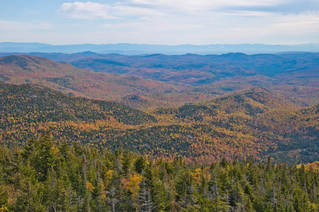
Friday, October 9, 2020

Split Rock Mountain

Lake Champlain from the Ore Bed Overlook on Split Rock Mountain
4 miles round trip, 800 feet elevation gain
Difficulty: Easy-moderate
Access: Paved road to trailhead, no entrance fee

Split Rock Mountain is a quiet hike near the shore of Lake Champlain at the edge of New York State's Adirondack Mountains. This is not a standout hike, delivering just one limited view of Lake Champlain and the surrounding countryside, but it is still an enjoyable jaunt through the forest and you're very likely to have most of this hike to yourself. While multiple hikes are possible in the Split Rock Mountain Wild Forest, a state-managed property that is part of Adirondack Park, and a loop trail in the park heads north over the summit of Split Rock Mountain, most of the trails in the park don't have views; the best hike is perhaps the round-trip journey from the trailhead to the Ore Bed Overlook, which is just south of the mountain's true summit and overlooks the lake.

I hiked Split Rock Mountain during an early October visit to the Adirondacks. Split Rock Mountain abuts Lake Champlain just south of the town of Essex, where a ferry crosses the lake to Vermont; the mountain is the tallest to rise directly above Lake Champlain. The trailhead is about two hours from either Montreal or Albany. To reach the hike from I-87, take exit 31 and follow Highway 9N east to the town of Westport. In town, turn left onto Champlain Ave- New York Route 22- and follow 22 north for a third of a mile. Turn right onto Lakeshore Road and follow it north for 4 miles to the trailhead, which is on the right (east) side of the road and is marked by a hanging wooden sign for the Split Rock Mountain Wild Forest. There is a small gravel parking lot here; the property is administered by the State of New York, which provides online maps of the area.

The first 0.3 miles of the trail follows the Lewis Clearing Bay Trail, ascending gently on a former roadbed through the forest. At 0.3 miles, I came to a junction with the North Rim Trail and I took the left fork, heading off on the North Rim Trail, a logging road which started a slightly steeper ascent as it climbed up the slopes of Split Rock Mountain. In early October, most of the trees here still had their green summer foliage, although a few trees were showing hints of yellow as they started their autumnal transition. Peak fall color along the Adirondack Coast usually comes in mid-October.

North Rim Trail through the forest
After a steady 400 foot ascent from the trailhead, the North Rim Trail dropped downhill slightly to reach a junction with the Robin Run Trail one mile from the start. At the junction, I took the right fork to stay on the North Rim Trail. Continuing along the old roadbed, the trail alternated between gentle ascent and flat hiking through the forest along the ridge for the next 0.6 miles until it reached the base of Split Rock Mountain's summit bump. Here, I started the steepest ascent of the hike, a thankfully short 200-meter stretch that packed in nearly 200 feet of uphill. At the top of the ascent, about 1.8 miles from the trailhead, I came to a junction where the trail to the Ore Bed Overlook split off to the right. The high point of Split Rock Mountain was just about 40 feet higher, another fifth of a mile north along the North Rim Trail and covered with trees, but I skipped tagging the high point to instead visit the Ore Bed Overlook, which has the best view on Split Rock Mountain.

The Ore Bed Overlook Trail was a narrow single-track that circled around a rounded bump on the mountain to reach the top of a small rock outcrop. Trees are growing up and beginning to obscure this view, but there were still pretty views down the length of Lake Champlain, the largest lake in the Northeast outside the Great Lakes. Lake Champlain fills the Champlain Valley, which itself is the northermost extension of the Great Appalachian Valley; the lake is fed by Green Mountains and the Adirondacks and drains north to the St. Lawrence River. Across the lake, I could see some farmland on the Vermont side. A narrow and long lake, Lake Champlain almost looks like a fjord from this angle- it's quite scenic. The lake had great strategic importance to both the Continental and British Armies during the American Revolution and was best known for military engagements at Fort Ticonderorga at the lake's southern end.

View of Lake Champlain from Ore Bed Overlook
The view at Ore Bed Overlook also stretched to the west to encompass some nearby farms and the Adirondacks in the distance. Cloud cover was unfortunately quite low on the day of my visit, preventing me from seeing the High Peaks of the Adirondacks, but the lower foothills near Lake Champlain were still quite pretty. There was a smattering of fall color that appeared to be more intense in the deeper areas of the range.

View of the Adirondacks from Ore Bed Overlook
Adirondacks from Split Rock Mountain
I saw a single other hiker on this trail during about two hours of hiking and didn't see anyone else at the overlook; this did not seem to be a heavily used trail. This is somewhat understandable as the scenery is nice but not amazing, but the lack of crowds did make my experience here more enjoyable. Rattlesnake Mountain, another short hike to the north near Willsboro, is a better option for views of Lake Champlain, but if Rattlesnake is crowded then the hike up Split Rock Mountain to Ore Bed Overlook is a good alternative.

Tuesday, October 6, 2020

Rattlesnake Mountain (Lake Champlain)

View of Long Pond from the summit of Rattlesnake Mountain
3 miles round trip, 700 feet elevation gain
Difficulty: Easy-moderate with a steep stretch
Access: Paved road to trailhead, no parking fee

Rattlesnake Mountain is a low peak near Lake Champlain in New York State's Adirondack Mountains. The peak lies on private land that has been opened to the public for hiking and provides nice views of Lake Champlain as well as the ponds and mountains that make up the northeastern Adirondacks. The hike up to this peak is fairly gentle save a very steep climb at its conclusion, but rewards with views of the Lake Champlain that extend into Vermont on a clear day.

I hiked Rattlesnake Mountain during an early October visit to the Adirondacks. The hike starts near the town of Willsboro on the shores of Lake Champlain, not far from the town of Essex, where a ferry runs across the lake to Vermont. The trailhead is 1.5 hours from Montreal and a little less than 2.5 hours from Albany. To reach the hike from I-87, take exit 33 and follow New York Route 22 southeast five miles to Long Pond. When you see Long Pond Cabins on the right side of the road, you will spot the trailhead- a dirt turnoff with limited parking- to the left (east) side of the road. This hike is on private land; you should always treat the outdoors respectfully but understand when you visit that public access to wonderful hikes like this one is easier to maintain when the landowners don't have to deal with litter, spillover parking, and other problems. Thanks to the current landowner for allowing access to the peak and its views!

The trail- an old roadbed- delved straight into the forest on a gentle ascent on the lower slopes of Rattlesnake Mountain. The former road crossed a low saddle and then worked its way into a narrow stream valley, steepening as it ascended here. At about a mile in, the trail broke off to the left and began a very steep and direct ascent up Rattlesnake Mountain, climbing up an eroded slope with much exposed rock. Just as the beginning of this trail was very gentle, this stretch of the trail was really very steep, ascending 350 feet in just a fifth of a mile. The trail is not steep enough to require scrambling but hiking poles can be quite helpful for ascending and descending this stretch. The trail leveled out atop the pleasant, forested ridge.

Forest at the top of the ridge on Rattlesnake Mountain
At the top of the ridge, I followed the trail to the right. Almost immediately, a spur trail broke off to the right. I followed this spur trail out to a beautiful southeast-facing overlook. Long Pond lay below while the higher peaks of the Adirondacks rose in the distance. The forest below was showing just a few hints of fall color: I had timed my trip for peak color in the Adirondack High Peaks, which meant that I was too early for peak color by Lake Champlain. In a typical year, one can expect to see peak fall color around Lake Champlain in mid-October.

View of Long Pond and the Adirondacks
Returning to the trail, I soon arrived at a larger rocky outcrop that most visitors will probably take to be the end of the hike. From here, there was a wide view over Willsboro Bay and Lake Champlain, with a view to the south down the length of the lake. The northern end of Willsboro Point was not visible from here, but on a clear day the Green Mountains of Vermont, including Mount Mansfield and Camels Hump, would be in the field of view. The weather was unfortunately overcast during my visit, so even though I could see across the lake and make out the city of Burlington I could only see the bases of the Green Mountains.

View of Willsboro Bay, Lake Champlain, and Vermont
Lake Champlain is the largest lake in the Northeast outside the Great Lakes and one of the larger lakes in the US, defining much of the New York-Vermont border and draining Champlain Valley, which is hemmed in by the Adirondacks and the Green Mountains, north into the St. Lawrence River.

Although it's not obvious, the trail continued from this main viewpoint outcrop, heading north for a fifth of a mile along the flat ridge of Rattlesnake Mountain. There was one more good viewpoint, this one expanding the view shed a bit more to the north to take in the northern edge of Willsboro Point and Lake Champlain; past this viewpoint, a sign indicated that the trail had ended and that the land beyond was private and not open to the public.

View past Willsboro Point and Lake Champlain to the Green Mountains from the last lookout
I saw a handful of other people on this hike on a weekday afternoon with a storm threatening, so it's likely that this hike is fairly popular. The views are indeed quite enjoyable and although the steep stretch of this hike makes this decidedly not an easy hike, it is still a nice summit that is within reach for most hikers.

Friday, October 2, 2020

Noonmark Mountain

Dix Mountain rises above the colorful fall forests of the Adirondacks
6 miles loop, 2350 feet elevation gain
Difficulty: Moderate-strenuous
Access: Paved road to trailhead, no parking fee

Although only 3556 feet tall, the summit of Noonmark Mountain delivers a stunning view of the High Peaks of New York State's Adirondack Park, accessible via a steep trail that requires scrambling up rocks and ladders. Noonmark is not one of the Adirondack High Peaks but is surrounded by those peaks on all sides; it is an excellent fall foliage hike as it overlooks deciduous forests in Keene Valley. The peak is so named because the sun appears behind the mountain at noon when viewed from Keene Valley. This was my favorite hike during my Adirondack visit, reaching a beautiful summit on a trail that was slightly less crowded than many neighboring hikes. I highly recommend this hike, especially in early October.

There are two routes up Noonmark Mountain, both extremely steep: the Henry Stimson Trail up the north ridge of the mountain and the Felix Adler Trail down the southeast ridge. Most hikers approach and return via the Stimson Trail, but I found it enjoyable to make a loop by ascending via the rockier Stimson Trail, descending via the Adler Trail, and then returning via the Old Dix Trail. The loop does not add any particularly scenic destinations to the hike but it does give a bit of variety and avoids descending the ladders on the Stimson Trail. If you choose to skip the loop, you can hike to the summit round trip via the Stimson Trail in 5 miles round trip with slightly less elevation gain.

I hiked Noonmark Mountain during an October visit to the Adirondacks to see the fall foliage. Peak color at Noonmark Mountain is around late September to the first two weeks of October in most years. The hike is near the village of Keene Valley, slightly east of Lake Placid. The trailhead is not far off of I-87, which surely contributes to its popularity; it is a 2 hour drive from either Montreal or Albany. From I-87, you can reach the trailhead by taking exit 30 and then turning left and following US Highway 9 north for 2 miles and then turning left onto New York Route 73. Follow New York Route 73 north for 5.5 miles and then turn left onto Ausable Road at the bottom of a long downhill; the turnoff for Ausable Road is directly across from a turnoff on the right for the Giant/Roaring Brook Trailhead. After turning onto Ausable Road, immediately make another left to enter the trailhead parking lot. There is plenty of parking here, but during the summer and on fall weekends the lot will fill up fairly early in the morning. This is an immensely popular trailhead (it's also used to access Ausable Lake) so it's important to arrive early if you want a spot here. Parking along Highway 73 or Ausable Road is illegal and the town of Keene aggressively tickets anyone who parks along roadways. The town of Keene does operate shuttles to the trailhead from Marcy Field during busy hiking times; otherwise, if the lot is full, you can choose to approach Noonmark Mountain from the Round Pond trailhead or do another hike.

The actual trail does not begin at the parking area, but the last stretch of road to the start of the trail is reserved for members of the Ausable Club, a private country club. From the parking lot, I turned left and followed Ausable Road to the west, crossing Icy Brook. After following the paved road for 0.3 miles from the parking area, I came to the edge of Ausable Club's golf course on the right side of the road; on the left side of the road, a sign directed me to follow a gravel road that split off here to access the Noonmark Mountain Trail. I followed this gravel road uphill through the forest, passing a few driveways to residences before I arrived at the start of the actual trail, which split off to the right of the road.

The trail began with a gentle ascent above Icy Brook through the forest, entering the High Peaks Wilderness and then reaching a junction with the Stimson Trail at 0.6 miles (1 mile from the trailhead). Taking the right fork here, I began a long and direct ascent up the slopes of Noonmark Mountain. The ascent here was very aggressive and steep, packing in 2000 feet of elevation gain over the next 1.5 miles en route to the summit. There's not much to say here: the eschews switchbacks for going straight up the mountain, gaining the north ridge of the mountain and following it up about a third of the way through the ascent. Soon after gaining the ridge, the first views of the hike opened up, an eastward glimpse of the forested slopes of Giant Mountain across Keene Valley. The fall colors were already beautiful here, but it was just a teaser for the incredible foliage show that was to come.

Fall color on the slopes of Giant Mountain
The trail along the ridge was both steep and rocky, with the ascent frequently utilizing climbs up angled rock slabs. At two points on the trail, the obstacles on the rocky terrain were a bit too much and so ladders helped me tackle the uphill. The colorful deciduous forest that I hiked in earlier on transitioned to a dark green conifer forest.

Ladders on the ascent up the Henry Stimson Trail
The sustained ascent helped me gain elevation quickly and finally paid off as I reached the first impressive view outcrops around 3200 feet. Walking out onto massive west-facing cliffs on the ridge, I found extraordinary views of the Great Range and Keene Valley. The mountain slopes above Keene Valley sported some spectacular autumn color, with streaks of dark green conifers mixed into the arboreal cloak of red and orange. I really enjoyed the prevalence of reds and oranges in Adirondack fall colors, which I found more visually stunning than the yellows and browns that dominate fall foliage in the Blue Ridge. 

View north along Keene Valley
To the west lay the Great Range, a rugged ridge connecting a string of Adirondack High Peaks. The lower slopes of these peaks were showing off spectacular fall color as well, though their rocky peaks were above the transition zone to coniferous forest. More or less the entire Great Range is visible here: Lower and Upper Wolfjaw Mountains, Armstrong Mountain, and Gothics Mountain. Behind the Great Range lay Mount Haystack and Mount Marcy, the third and first tallest peaks in New York State.

The Great Range rising above forests exploding with fall color
Although I had already ascended quite a bit, looking above me to the south at the great cliffs of the west face of Noonmark Mountain I realized that I still had a little ways to go.

View toward the summit of Noonmark Mountain
A final push through the still-rocky terrain brought me to the very top of Noonmark Mountain. The good workout of the climb and the spectacular views were extremely invigorating: it felt great to be atop this peak. The summit area was quite spacious, with a broad rock platform providing plenty of good lunch spots on the western and southern sides of the summit. A few trees at the summit prevented me from seeing a full 360-degree from any one spot but I was able to see the whole view with a little bit of walking. Having arrived early in the morning, the summit was fairly quiet while I was there but I appreciated how even with more crowds there would have been plenty of room to space out.

The earlier views of Keene Valley and the Great Range remained in my viewshed at the summit, not particularly changed from when I had gazed out at them at the lower outcrop. The summit brought in views of many more peaks, though: Giant Mountain dominated the horizon to the east, while Dix Mountain rose majestically above a forest blazing with fall color to the south. Layer upon layer of brilliantly colored hills stretched to the southeast, with the Green Mountains of Vermont forming a distant wall along the horizon across Champlain Valley. Even though the view here may not encompass as many peaks as the view on Marcy or other High Peaks, I appreciated being able to study many of the High Peaks from fairly close up. Being at a lower elevation than these peaks also made them seem more majestic than they looked when I saw them on Mount Marcy.

Giant Mountain across the valley from Noonmark Mountain
The Great Range and Mount Marcy
Dix Mountain
Fall colors on the Adirondacks with the Green Mountains in the distance
After sufficiently enjoying the marvelous views, I started the descent on the Felix Adler Trail, which left from the east side of the summit block. This trail required rock scrambling just as the ascent on the Stimson Trail had, although there were no ladders on my descent this direction. The Felix Adler Trail has a grade just as steep as the Henry Stimson Trail: it dropped nearly 1300 feet in a mile. The descent started by following the southeast ridge of Noonmark Mountain, pushing through rocky terrain in coniferous forest, but later returned to some pretty deciduous color during the latter parts of the descent. The trail was continuously brutally steep in its descent, taking a toll on my knees, until it all of a sudden ended as the Adler Trail intersected with the Old Dix Trail.

Fall colors on the descent down the Felix Adler Trail
I turned left to follow the Old Dix Trail north. The trail passed a small clearing with views of colorful forests on nearby Round Mountain. In the spring, this clearing sometimes floods into a pond but during my autumn visit, it was a dry meadow. Continuing past the meadow, the trail gently ascended to a saddle between Noonmark Mountain and Round Mountain. An unmarked trail broke off to the right from the pass to ascend Round Mountain; I ignored that trail and stayed on the Old Dix Trail, which began descending into the Icy Brook drainage on the north side of Noonmark Mountain.

Round Mountain rises above a clear on the Old Dix Trail
Over the next mile, the Old Dix Trail descended moderately and steadily down a pretty, forested ravine, crossing Icy Brook on its way back to meeting up with the Stimson Trail. Finally, 5 miles from the trailhead, I arrived back at the junction for the Stimson Trail; from here, I followed the trail out for the final mile back to Ausable Road and the parking lot.

Noonmark Mountain is an extraordinarily beautiful hike, easily accessible from I-87 with a good workout, some fun rock scrambling and ladders, and absolutely magnificent views. I know it's a popular hike, but that's because it's a good hike! Come early to make sure you nab a parking spot, but do come as this is surely one of the most enjoyable hikes of the Adirondacks.

Tuesday, September 29, 2020

Mount Marcy

The Great Range, Giant Mountain, and the Green Mountains from Mount Marcy
15 miles round trip, 3500 feet elevation gain
Difficulty: Strenuous
Access: Gravel road to trailhead, Adirondak Loj parking fee required

Mount Marcy is the highest point in both the Adirondack Mountains and New York State, its slopes cradling the headwaters of the Hudson River. The fifteen mile round trip hike to its summit is challenging and long but ends with vast views of the Adirondacks and the Green Mountains of Vermont from the roof of New York. Surrounded by the High Peaks of the Adirondacks, Marcy is a popular hike due to its height status but the views justify dealing with both other hikers and the relentlessly rocky and tough trail to reach the summit. There are multiple routes to reach the summit of Marcy; the Van Hoevenberg Trail approach from Adirondak Loj is the easiest and shortest route and the one that I'll describe here, though the hike is still neither easy nor short. Although the Adirondacks are renowned for their fall foliage, Marcy is deep in the High Peaks region that is dominated by conifers; look at lower elevations to find a good hike for fall colors.

I hiked Mount Marcy during an early October trip to the Adirondacks to see the fall colors. The trailhead for Mount Marcy is close to Lake Placid, one of the key towns with services at the heart of Adirondack Park. The trailhead is about is about 2.5 hours driving from both Montreal and Albany. From Lake Placid, I reached the trailhead at Adirondak Loj by taking New York Route 73 (Sentinel Road) south past the Olympic ski jumping complex to North Elba. 3.5 miles out from Lake Placid, I turned right (south) onto the Adirondack Loj Road, which was marked by a hanging wooden sign for South Meadows and Adirondak Loj. I drove Adirondack Loj Road to its terminus at Adirondak Loj by Heart Lake; the end of this road was unpaved and a bit bumpy. There was a parking fee to enter the Adirondak Loj parking lot; rates are variable based on time of day and Adirondack Mountain Club membership and can be found here. After passing the gate, roads branched off to both the left and right; Adirondak Loj is on the right, while the multiple parking lots for the Van Hoevenberg Trailhead was off to the left. Although there is plenty of parking here, the trails emanating from this trailhead are extremely popular and the parking lot typically fills by 8 AM in summer and fall, so come early.

Although I parked at the Van Hoevenberg Trailhead, I walked across to Adirondak Loj to see Heart Lake before starting the hike. Having arrived early in the morning with the sun still waiting to rise, I enjoyed the peaceful sight of pre-dawn mist rising off of the lake with colorful autumn forests in the backdrop.

Heart Lake
I headed over to the southern most prong of the four parking lots at the Van Hoevenberg Trailhead to start my hike on the Van Hoevenberg Trail. The single-track trail headed into deciduous forest that was showing off pretty fall colors at the start of October. The trail is easy to follow throughout but just in case you struggle with the route there are round blue "Foot Trail" markers nailed to trees to guide the way. The trail stayed fairly flat, crossing MacIntyre Brook and then paralleling it for a while to reach a junction with the Algonquin Trail, which broke off to the right, ascending the MacIntyre Range to access Wright and Algonquin Peaks. I took the left fork here to stay on the Van Hoevenberg Trail, which remained fairly flat for another 1.2 miles in the forest before reaching the site of the old Marcy Dam and Marcy Dam Pond. The wooden dam was built to hold back a pond here by the Civilian Conservation Corps in the 1930s but the dam was damaged and the pond drained in the aftermath of Hurricane Irene in 2011. Marcy Brook now flows unimpeded through the area, although the silty plain that was formerly Marcy Dam Pond still offers nice views of the surrounding High Peaks, with some pretty fall foliage here.

Marcy Brook from the old Marcy Dam site
While the trail once crossed over the dam, it now followed Marcy Brook briefly downstream to a bridge, crossing the brook and then following an old roadbed on the other side back to the east end of the dam. On the east side of the dam, at 2.4 miles from the trailhead, the trail passed a trail register and came to the Marcy Dam backcountry campground and the junction with the trail to Avalanche Pass. I stayed on the Van Hoevenberg Trail, taking the left fork to start the journey along Phelps Brook up to Mount Marcy. 

Once the trail entered the Phelps Brook drainage, the flat and easy hiking of the first part of the hike ended. After crossing a bridge over Phelps Brook, the trail began a steady ascent along the north (left) bank of the stream. The brook tumbled over rocky terrain here as it descended through chutes and small waterfalls and was quite scenic as it flowed through a forest of mixed conifers and deciduous trees displaying peak fall color. While this was pretty, the trail unfortunately became quite rocky as well, making it slightly unpleasant to hike.

Rushing waters of Phelps Brook
Fall foliage along Phelps Brook
Phelps Brook
The Phelps Mountain Trail branched off to the left about a mile after I left the Marcy Dam campground; I stayed on the Van Hoevenberg Trail. Shortly after, the trail crossed the Phelps Brook and then began an aggressive ascent. Separating from the winter ski trail, the Van Hoevenberg Trail peeled off to the right to begin a less linear but still very direct ascent along the slopes of T.R. Mountain. There's a legend- probably untrue- that Teddy Roosevelt, at the time vice president, was hiking Mount Marcy when President McKinley was assasinated (Roosevelt was in the Adirondacks, though).

This steep ascent ended after about 600 feet of uphill as the trail passed through a saddle between T.R. Mountain and Table Top Mountain. Shortly after passing the saddle, the trail crossed Marcy Brook and came to the side trail for Indian Falls, 4.5 miles from the trailhead. I took the short spur to the right here to reach the top of Indian Falls, an area of exposed rock along Marcy Brook with views of the MacIntyre Range. It's not possible to see the actual drop of Indian Falls safely, but seeing the majestic pyramid of Algonquin Peak while taking a break here was still quite nice.

MacIntyre Range from the top of Indian Falls
Returning to the Van Hoevenberg Trail, I embarked on another uphill climb. Although not particularly steep, the trail here was even rougher than before- indeed, I found this to be one of the rougher trails that I've tackled! At many points, the trail was just a field of medium-sized boulders, requiring balance while being quite hard on my knees and feet; at other points, the trail was smooth, wet rock inclines. Often, I had to trudge through a muddy mess or deal with a gushing stream flowing straight down the trail. The heavy rains on the days previous to my hike certainly didn't help, but this was definitely still a very rough and rocky trail. I've done plenty of hikes with four to five thousand feet of elevation gain in the West but dealing with this uneven and punishing terrain on Mount Marcy was far more tiring.

Muddy, rough trail
Rocky, wet trail
Rocky, wet trail
At 5.6 miles, the trail switched to a gentler grade as it reached the top of a ridge, although it remained quite rocky, wet, and rough. The dense conifer forest surrounding the trail was becoming shorter the higher that I ascended, marking my transition into progressively harsher mountain conditions. At 6.3 miles, I passed an intersection with the Hopkins Trail, an alternate path for accessing Mount Marcy from Keene Valley. I took the right fork at the junction to stay on the trail to Mount Marcy. Continuing to ascend, I passed a clearing a little afterwards that delivered my first good view of Mount Marcy along the hike. The summit was still a good 700 feet or so above me but at least I could now see the alpine and rocky mound that is the top of New York State.

Mount Marcy
Continuing uphill, I passed a non-apparent junction with the Phelps Trail at 6.9 miles from the trailhead. The Phelps Trail also leads up from Keene Valley and connects Mount Marcy with nearby Mount Haystack and the Great Range Traverse, one of the classic hikes of the Adirondacks. After passing the junction with the Phelps Trail, the trail opened up, using wooden planks to cross marshy alpine clearings. The conifers here had shrunk to person-size and were reaching the limit of their elevation range. Mount Marcy, my goal for the day, appeared in front of the trail, now just over a half mile away and 500 feet higher.

Entering the alpine zone on Mount Marcy
After an ascent through forest that finally shrank to nothing, the trail emerged onto massive rock outcrops that delivered the first sweeping views of the hike. After hours of hiking, I was finally rewarded with views of the Adirondack High Peaks. Most prominent here was Mount Haystack, a rugged, rocky peak that is the third highest peak in New York State. To the west, views of the great MacIntyre Range had returned.

Haystack from the final ascent
MacIntyre Range views along the final ascent
From this outcrop, the remainder of the ascent was out in the open, crossing open rock while climbing steeply until, at 7.5 miles from the trailhead, I reached the broad, alpine summit at 5344 feet above sea level, the second highest state high point in the Northeast after Mount Washington. After such a tough hike up, I was glad that I could finally enjoy a long break at the height of the Adirondacks.  

View of the final ascent with the Great Range, Haystack, and Dix Mountain
The views at the summit were simply stunning, a 360-degree panorama of the Adirondacks from the heart of the range. As the tallest peak in New York State, Mount Marcy is also the tallest of the 46 Adirondack High Peaks, which includes all of the Adirondack peaks above 4000 feet and then some. Many of those High Peaks, all clad in dark green conifer coats with bald, rocky heads, could be seen from their highest member. Nearby Mount Haystack towered over Panther Gorge, a fierce, wild, and rocky ravine between that peak and Mount Marcy. To the north of Mount Haystack was the Great Range- one of the most spectacular ridges of the Adirondacks that included Gothics Peak and Saddleback Mountain. Farther east were Dix Mountain and Giant Mountain, very prominent members of the High Peaks slightly separated from the core High Peaks. The sharp peak of Whiteface Mountain stuck out to the north, rising over the bright fall foliage near Lake Placid. The great McIntyre Range- which includes Iroquois Peak, Wright Peak, and the state's second tallest mountain, Algonquin Peak- rose to the west.  

Much of the Adirondacks were visible; many of the peaks further out were sporting the spectacular fall colors for which the range is well known. Many lakes were visible as well: Boreas Pond was visible to the south, while many lakes and ponds were visible to the southeast, where a maze of hills rose around the Lake George part of the Adirondacks. Lake Tear of the Clouds lay directly south of Mount Marcy, an unremarkable looking tiny pond that is actually the quite remarkable headwaters of one of America's great rivers, the Hudson. Blue Mountain was visible to the southwest, a lone higher peak amongst the gentler hills that generally characterize the western Adirondacks. The Green Mountains rose as an impressive mountain wall to the east in Vermont: Mount Mansfield and Camels Hump were both easily recognizable across the state line. The nearby High Peaks blocked out any view of Lake Champlain.

At the summit, a view of Mount Mansfield and Camels Hump in Vermont
View to Boreas Pond and the southern Adirondacks
View north to Lake Placid and Whiteface Mountain
MacIntyre Range and the western Adirondacks
Ridge upon ridge to the southeast, the Green Mountains in the distance
Fall color in Keene Valley
The Adirondack Mountains are actually the eroded remants of an uplifted dome on the edge of the Canadian Shield and are distinct from the Appalachian Mountains. The rocky streaks that run down mountain slopes, the ancient jointed intrusive igenous rock underlying it all are clues from this view that this range is different from others on the East Coast. While the Appalachians are already a fairly old mountain range, having formed in the Alleghenian Orogeny over 250 million years ago, the rock of the Canadian Shield, the core of the North American continent, are well over a billion years old.

I had a good deal of company on the summit; on a weekday in fall, I shared these great views with over 30 other hikers. Despite the lack of solitude and despite the tiring, tough, and rocky route to reach the summit, I enjoyed the hike and reveled in the expansive views across the Adirondacks. I haven't hiked enough of the Adirondacks to tell you that you should put this hike at the top of your list, but at the very least this is a hike that will challenge and reward you greatly and give you bragging rights for reaching a state high point.

Friday, September 25, 2020

Cobble Lookout (Adirondacks)

Add caption
2.5 miles round trip, 350 feet elevation gain
Difficulty: Easy
Access: Paved road to trailhead, no entrance fee, limited parking

Cobble Lookout is an easy, family-friendly hike to a sweeping view of the upper Ausable River Valley in New York State's Adirondack Park. The trail to this pretty viewpoint is relatively new and although this hike is being gradually discovered by tourists, it is still a little quieter than the loved-to-death High Peaks of the range just to the south. When I hiked to Cobble Lookout during a late September trip to the Adirondacks, I found amazing fall colors from this viewpoint. This is a good short hike if you're visiting the Adirondacks but you're not looking for anything intense or if you just need a leg stretcher on your way to or from Lake Placid.

Cobble Lookout is just up the hill from the town of Wilmington in the Adirondacks, a short drive from Lake Placid, which is one of the tourist hubs in the range. The trailhead is about 2 hours from Montreal and 2.5 hours from Albany. From Lake Placid, I followed New York Route 86 east, passing High Falls Gorge and the Whiteface Mountain Ski Resort and then arriving in Wilmington. In Wilmington, I turned left onto Route 431- the Whiteface Memorial Highway- and followed it 3 miles uphill. Just before arriving at the toll gate for the Whiteface Mountain Highway, I turned right onto Gillespie Drive and followed it 0.3 miles to the trailhead for Cobble Lookout, which was on the right (north) side of the road. A wooden sign indicated that this was the start of the hike. Parking was on the gravel shoulder along the road. This is becoming a fairly popular hike so parking can be difficult to find here.

The trail is marked by round, blue "Foot Trail" medallions that are nailed to trees along the route. From the trailhead, the trail delved directly into forest, initially following a wide path- probably an old roadbed- through second-growth forest. After a couple hundred of meters, the markers led me onto a single track trail that was just a bit rougher, with some stone steps and skirting some rocks, as I continued through the forest. The day was overcast but there was still plenty of light streaming into the forest, illuminating the green, yellow, orange, and red foliage around me.

Autumn forest along the trail to Cobble Lookout
The trail initially ascended gently but later switched to a gentle descent through the forest, crossing streams on short wooden bridges. After just over 25 minutes of hiking, the trail emerged onto a large, southerly facing rock outcrop: Cobble Lookout. Stepping out to onto the outcrop, I found an explosion of fall colors across my view of the Adirondacks. Across the valley from me was Whiteface Mountain, the fifth tallest peak in the state of New York. Its high summit was cloaked in clouds that day, the main reason I chose to skip driving the Toll Road. Whiteface Mountain is home to one of the best known ski resorts in the Northeast, which hosted ski competitions during the 1980 Winter Olympics at Lake Placid.

Whiteface Mountain
The trees below Cobble Lookout and across on Whiteface Mountain were displaying magnificent fall colors. While the view that I saw at Cobble Lookout was very pretty but not necessarily remarkable, the fall foliage here was outstanding- these were perhaps the most colorful mountainsides I've seen (and I grew up visiting the Blue Ridge Mountains every fall!). The dark green of conifers contrasted with the light green of deciduous trees that hadn't turned color yet, which in turn contrasted with the yellows, oranges, and reds of trees getting ready to shed their leaves. There's much more orange and red in the Adirondacks than in the Blue Ridge, where fall color is generally dominated by yellow and brown. Peak color at Cobble Lookout will be at about the same time or just after the High Peaks during most years- usually late September or very early October.

Fall foliage from Cobble Lookout
While the view here did not encompass the heart of the Adirondack High Peaks, I still saw a beautiful array of mountains before me. The Sentinel Range and Jay Mountain lay across the upper Ausable Valley. Giant Mountain should've been visible to the south but its summit was in the clouds. Below, the town of Wilmington with its prominently visible church spire was nestled amidst the forest near the Ausable River. 

Wilmington and the Adirondacks in fall color
The views at the main outcrop were excellent, but I had to share the experience with a rotating cast of other hikers. A social path continues east along the outcrop, leading to a few spots on the far end of Cobble Lookout that still had nice views but were far quieter. One of these viewpoints gave me a wider view to the northeast, with even more extensive colorful forests stretching down the Ausable Valley towards Lake Champlain.

View from Cobble Lookout
This was a short and easy hike with a big payoff not far from Lake Placid. I really enjoyed this hike and recommend it if you're looking for a less intense hike that still packs in great views in the Adirondacks.

Monday, September 21, 2020

Mount Mansfield from Toll Road

Camels Hump and the Green Mountains from Mount Mansfield
2.8 miles round trip, 600 feet elevation gain
Difficulty: Moderate, minor rock scrambling
Access: Gravel road to trailhead, toll required

The tallest peak in the Green Mountains and the state of Vermont, 4393-foot Mount Mansfield has a distinct profile that with some imagination seems to resemble the face of a person in repose. The easiest way to reach the summit of this Northeast icon is a stunning alpine ridge walk and scramble through boreal forest and tundra from the Mount Mansfield Toll Road. This hike is only accessible in summer and fall and traverses the most extensive area of alpine tundra in Vermont. Although this approach is less than a mile and a half each way with just a moderate amount of elevation gain, the scrambling necessary to reach this summit as well as the stunning views over the rest of Vermont and Lake Champlain and out to New York and New Hampshire means that most hikers will take an hour to reach the summit, or Chin of Mount Mansfield, from the trailhead at the end of the Toll Road near the mountain's Nose.

Mansfield's profile is easily recognizable and its height means that it is visible from many places in Vermont and around Lake Champlain. The peak rises above the Vermont town of Stowe, an all-season resort town known particularly for its ski runs on Mansfield's slopes and for being the Vermont home of the Von Trapps after the musical Austrian family immigrated to the United States. While views of Mansfield are beautiful from many angles, I personally found that my favorite view of the peak was from the AM Foster Covered Bridge near Cabot. 

Mount Mansfield from the AM Foster Covered Bridge
You'll have to shell out a little bit to reach the trailhead, but it's worth it to hike this spectacular ridgeline approach. Anna and I hiked Mansfield during an early September visit to Vermont, when there were just hints of the fall color that would arrive later that month. Stowe is the closest town to Mansfield; Montpelier and Burlington are towns that are short distance away. The trailhead is 2.5 hours from Montreal and 3.5 hours from Boston. The Mount Mansfield Auto Toll Road is managed by the Stowe Mountain Resort; RVs and trailers are not allowed and you can find information about the rates for the road here. From Stowe, we followed Vermont Highway 108 northwest for 6 miles until we came to the sign for the Toll Road on the left side of the road. We turned left here, paid the toll, and followed the gravel Toll Road 4.5 miles uphill, passing by the ski runs of the Stowe Mountain Resort. There were some nice views of Mansfield on the drive up the Toll Road. The road ended at the parking lot outside the Mansfield Visitor Center along the crest of the Green Mountains.

The entire length of the hike follows the Long Trail, a 272-mile long-distance trail along the spine of the Green Mountains traversing Vermont from south to north. The Long Trail is the granddaddy of long-distance trails in the United States: it's the very first such trail established and inspired later efforts to create the Appalachian Trail. The tundra along this stretch of the Long Trail is unique and rare in the Northeast, so white rope along the length of the hike to the top of Mansfield delineates the trail to prevent hikers from damaging this fragile habitat. The trail lies within Mount Mansfield State Forest rather than Green Mountains National Forest, which encompasses most of the rest of the range.

From the visitor center, we took the Long Trail to the right (heading north), which delved into a thick forest of miniature conifers and quickly crossed a gravel road that continued up to the communications towers on top of the Nose of Mount Mansfield. The trail continued through this thick dwarf forest, with wooden planks helping navigate through some marshy ground. After three hundred meters, the trail emerged onto exposed rock on the ridge and for the most of the rest of the length of the hike stayed on outcrops that were mixed into the ridgetop environment of boreal forest and the low shrub of the tundra. As soon as we were out on the rocks, views started opening up: we could see back south to the impressive cliffs of the Nose and the nearby communications towers.

Mount Mansfield Trail winds along the ridge from the Nose
Views along the early stretch of the hike were generally to the west, especially as there were still many clouds floating around the Green Mountains. Only a few more low ridges and a wide, forested plain dotted with occasional farms separated us from Lake Champlain, the massive lake filling the wide valley between the Green Mountains and the Adirondacks that drains north to the St. Lawrence River. It is the largest lake in the Northeast outside the Great Lakes and fills the northernmost section of the Great Valley, the extensive Appalachian valley system that includes Shenandoah Valley in the backyard of this blog's home area.

Beyond Lake Champlain, we could see the Adirondacks, the roof of New York State. Despite their proximity to the Appalachians, the Adirondacks are actually a separate mountain chain, forming from an eroded protrusion of the Canadian Shield, which itself is bedrock the core of the North American continent. The Adirondacks peak at Mount Marcy, which at 5344 feet tall is a thousand feet above the height of the Green Mountains.

Lake Champlain
The trail was consistently rocky and went through a series of ups and downs over small bumps on the ridge as we traveled north towards the Chin. There were a number of junctions with other trails, including the Cliff Trail up from the Cliff House at the top of the gondola and ski area, but at each junction we stayed on the Long Trail and continued following the ridge. Along with the white rope that defined the route, white blazes painted on the rock directed us towards the summit.

As we progressed steadily uphill through the rocky terrain, the Chin of Mount Mansfield- the mountain's true summit- rose before us, a rocky knob rising above the stunted conifers of the boreal forest. The final ascent began after passing by the junction with the Cliff Trail in a saddle. From here, the trail maintained a steady uphill grade that steepened at the end as we approached the summit, climbing over 300 feet in 0.3 miles in a rocky scramble to the roof of Vermont.

Summit ridge of Mount Mansfield, looking towards the Chin
From the broad summit area, there were amazing, 360-degree views. The Long Trail continued to the north but we stopped here, finding a nice corner of the outcrop on which to sit down and enjoy the view. Recent rains had deposited puddles into the crevices on the summit outcrop. Summit views were initially clouded over but started to clear up after a while. A volunteer from the Green Mountain Club dispensed information about the summit and helped the hikers at the top avoid trampling the fragile alpine vegetation. 

The view to the south along the ridge of Mount Mansfield and along the spine of the Green Mountains was perhaps the most raw and visually stunning aspect of the view. The great cliffs along the eastern face of the mountains were fully visible here, making clear the incredible vertical relief of this mountain above Stowe and the valley below. The cliffs continued all the way to the Nose of Mansfield- in the distance, we could see our starting point at the visitor center. The Green Mountains continued south past the Nose, most notably rising up to the sharp summit of Camels Hump, the state's third highest peak.

To the east, the ski slopes of Mansfield led down to Stowe in the valley below. Across the valley were the forested, rounded peaks of the Worcester Range, while the many parallel ranges of Vermont stretched east from there. In the far distance I could see the outline of the high White Mountains in New Hampshire: the viewshed stretched to Mount Washington, the highest peak in the Northeast at 6288 feet. To the north, the high crest of the Greens at Mount Mansfield transitioned to the lower, forested slopes of the Sterling Range on the other side of Smugglers Notch. The High Peaks of the Adirondacks rose to the west across island-dotted Lake Champlain.

Mount Mansfield
Worcester Range and Stowe from Mansfield
The Adirondacks rise above Lake Champlain
Northerly view from Mansfield's summit
This was a beautiful hike with nearly constant views to the top of Vermont with some fun rock scrambling along the ridge on the way. While purists may shun the easier approach from the Toll Road in favor of an ascent from the base with more elevation gain, most hikers will find that this open ridgeline approach is friendlier on both the knees and the eyes. A highly recommended hike in New England and the crowning hiking glory of the Stowe area.