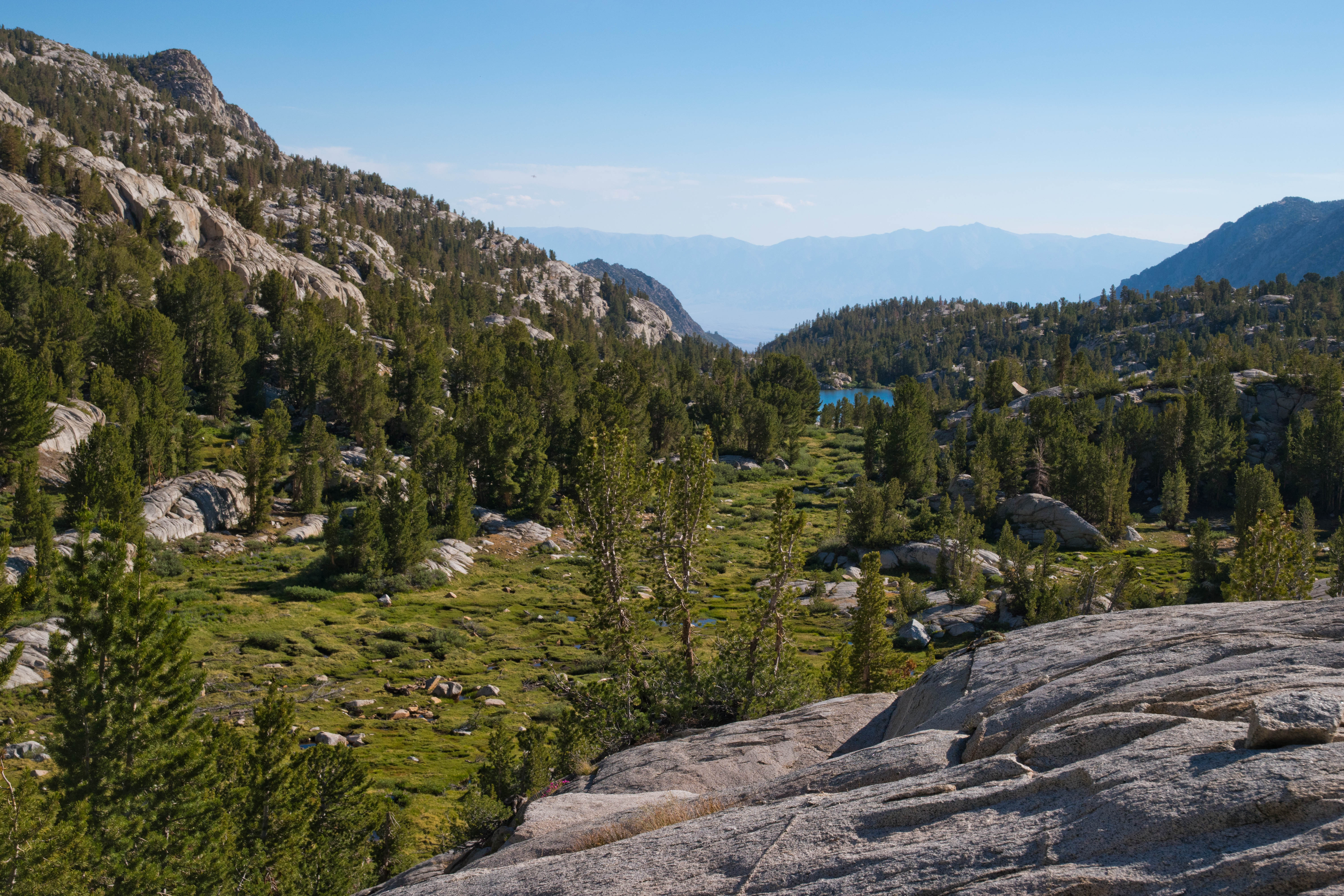
Wednesday, August 9, 2023

Eagle Rock (Tahoe)

Freel Peak and Lake Tahoe from Eagle Rock
0.8 miles round trip, 250 feet elevation gain
Difficulty: Easy, although a tad of scrambling may be needed at the summit
Access: Paved road to trailhead, no fee required

Eagle Rock is a massive outcrop on the west shore of California’s Lake Tahoe that provides lovely views of the blue waters of North America’s largest alpine lake while requiring a short hike of less than a mile round trip from the trailhead on Highway 89. This is a short but popular hike and it’s easy to see why when you’re at the summit: the sweeping views of the lake had here typically requires far more effort to reach. The trail is managed by the California Tahoe Conversancy, a California state agency that operates a number of tracts for recreation and conversation around Lake Tahoe.

I hiked Eagle Rock with Anna and a few visiting friends over July 4 weekend. The trailhead is a short drive from the Tahoe City area on the lake's West Shore and is about a 40 minute drive from South Lake Tahoe. Coming from Tahoe City, we followed Highway 89 south for 4.5 miles from the junction with Highway 28 and then came to the trailhead on the right (west) side of the road. Driving in, we could see Eagle Rock towering above the highway right before we reached the trailhead parking area. I encourage you to approach from the north, as it's far easier to pull into the roadside parking when driving southbound on Highway 89. There's room for parking for about at least ten cars here; the parking area is often full on summer weekends, but as the trail is short, turnover is pretty fast. There's no bathroom at the trailhead.

Leaving from the trailhead, the trail began to head west up the forested southern slopes of Eagle Rock. The trail was generally well graded through its early stretches but ascended steadily and reached the spine of Eagle Rock at 0.2 miles, at which point it made a wide turn to the east and began heading east along the northern slopes of the rock up towards the summit. At 0.3 miles, the trail broke out of the forest and onto a massive outcrop; the trail became very rocky here, with a bit of minor scrambling almost necessary at times to reach the top of the eastern face of the outcrop. The volcanic rock atop Eagle Rock was substantially rougher and more jagged than the smooth granite that is generally found elsewhere around Tahoe. The true summit was slightly to the west of where the trail ended, although the best views of Lake Tahoe were atop the cliffs above the east face of the rock.

The primary views from atop the cliffs of Eagle Rock extended in all directions but west. Lake Tahoe's placid blue waters lay below us to the east, separated from the rock by Highway 89 and the west shore's orderly conifer forests. From left to right, we could see many of the major peaks around the lake: Mount Pluto; the vast sweep of the Carson Range on the other side of the lake, which included the high summit of Mount Rose, the steep escarpment of Herlan Peak, and the barren summits of Freel and Jobs Peak; and the closer summits of Rubicon and Phipps Peaks in the Sierra Nevada, which rose above nearby McKinney Bay.

Highway 89 passes below Eagle Rock

Rubicon and Phipps Peaks rise above the blue waters of Tahoe
The main viewpoint was a bit crowded during our holiday weekend visit. To avoid the crowds and check out some alternative views, I made my way over to the true summit, just slightly west of the rock's main cliff face. The view of the lake from here was a bit limited but the view of the rock itself made up for it; there were also far fewer other visitors at the true summit.

Eagle Rock and Lake Tahoe
Eagle Rock is a volcanic plug- it is the eroded remnants of a former volcanic vent. The outcrop is a testament to the importance of volcanic activity in the geologic history of the Lake Tahoe basin. In fact, the formation of the lake itself is due to volcanic activity: the formation of Mount Pluto, the rounded volcano on the northern end of the lake, around 2 million years ago, resulted in lava flows that dammed the outlet of the valley between the Sierra Nevada and the Carson Ranges, creating the alpine dream that we know today as Lake Tahoe.

After enjoying the summit scenery, we descended the way we came to end our short but very scenic outing. While this hike is not one of the highlights in the Tahoe area, it was an enjoyable leg stretcher and a worthwhile hour-long excursion for visitors with some extra time during a Tahoe trip.

Wednesday, August 2, 2023

Lake Aloha

Lake Aloha
7.5 miles round trip, 1200 feet elevation gain with boat shuttle (otherwise, 12 miles round trip)
Difficulty: Moderate
Access: Paved road to trailhead, no parking fee required, Echo Lakes boat taxi fee optional

The 2021 Caldor Fire heavily affected the Echo Lakes area and the Desolation Wilderness. Check current conditions before attempting this hike.

The shimmering blue, island-dotted waters of Lake Aloha is the most iconic landscape of the Desolation Wilderness in California's Sierra Nevada and is one of the highlight hikes around Lake Tahoe. The approach from Echo Lakes- which is the most popular approach for day hikers- follows the Pacific Crest Trail and gives hikers the option to shorten the hike using a boat shuttle. This route is packed with scenic delights en route and delivers hikers to Lake Aloha with the least overall elevation gain. For those with a full day to hike out to Lake Aloha, this is certainly not to be missed when visiting the Tahoe area. 

I hiked to Lake Aloha with Anna and her mother, who was visiting us at the time, during a July visit to Lake Tahoe. The weather was unusually warm during our visit, hitting 90 degrees in the Tahoe area itself during hike, which made this hike somewhat more difficult than it actually is; the hot weather also portended the disaster that the Caldor Fire would wreck on this landscape later that same summer.

From South Lake Tahoe, we reached the trailhead by following US Highway 50 south and west from town, passing Meyers and climbing uphill towards Echo Summit. Towards the top of the long Meyers Grade hill, the unmarked Old Meyers Grade Road split off to the right from the highway; we took this right turn. Old Meyers Grade Road continued climbing uphill via a few switchbacks until leveling out after crossing Johnson Pass and coming to a junction after 0.8 miles with the poorly marked Echo Lakes Road shortly after the pass; the Echo Lakes Sno-Park parking area lies directly across from the Echo Lakes Road turnoff. We turned onto Echo Lakes Road and followed it past Berkeley Camp to Echo Chalet. The hiker parking lot above Echo Chalet was already completely full by the time we arrived just after 9 AM, so plan to arrive early on summer weekends if you hope to find parking. 

From the trailhead at Echo Chalet, there are two ways to reach Lake Aloha. The lowest effort approach is to take a boat taxi from Echo Chalet to the dock at the far end of Upper Echo Lake, which shaves off just over 2 miles each way for the hike. For those who want to reach the lake on their own two feet, the Pacific Crest Trail also runs directly past the front of Echo Chalet before following the northeast shore of Lower and Upper Echo Lakes towards Lake Aloha. As I took the boat, I'll describe that option here; based on my admittedly secondhand knowledge, the PCT option should not pack in too much more elevation gain as it should simply follow the lakeshore. The Echo Lakes boat taxi usually operates 9 AM to 5 PM between Memorial Day and Labor Day from Echo Lakes Chalet and typically costs $20/person, each way; current information on the service can be found here. There is no scheduled service; boats embark whenever there are at least three paying customers, and service back from Upper Echo Lake must be requested by 4:30 PM.

Lower Echo Lake
We boarded a boat taxi and set off across Lower Echo Lake, a long and beautiful reservoir nestled between forested slopes broken by slabs of granite. Within ten minutes, we were across Lower Echo Lake and transiting through the narrow passage connecting the Upper Lake with the Lower Lake. This scenic and shallow passageway sometimes becomes too shallow for travel by late summer, complicating plans for travelers hoping to use the boat shuttle. We passed by many vacation homes- the lake is a popular spot for Californians to retreat during the summer.

Narrow strait connecting the Echo Lakes
The boat continued across Upper Echo Lake, which was especially scenic with the pointed granite summit of Ralston Peak rising behind the lake. After 20 minutes, we arrived at the dock at the far end of Upper Echo Lake; we disembarked and followed a hundred meter-long trail that led uphill to a junction with the Pacific Crest Trail.

Ralston Peak rising above Upper Echo Lake
Upon meeting up with the Pacific Crest Trail, we turned left and followed the PCT northbound towards Lake Aloha and Canada. The PCT ascended gently through a rocky forest and broke out onto a rocky outcrop a third of a mile after leaving the boat dock. Here, we were rewarded with lovely views back over Echo Lakes, with Upper Echo Lake looking especially beautiful with its placid blue waters dotted with forested islands.

Echo Lakes from the PCT
The trail alternated between forest and open granite while making its continual ascent, entering the Desolation Wilderness at 0.7 miles, until breaking out into the open granite for good around a mile from the boat dock. At 1.1 miles, we came to the junction with the spur trail down to Tamarack Lake. We took this spur on our way in, descending along a 200-meter long trail that led down to the shore of shallow Tamarack Lake at the foot of Ralston Peak. This was a pretty although ordinary lake; Ralston Peak's sharp pyramid behind the lake was the nicest part of the view. Mosquitoes were horrendous around this lake in July.

Ralston Peak above Tamarack Lake
Returning to the PCT, we followed the trail northbound as it continued a steady climb. Views over Echo Lake and Tamarack Lake were increasingly impressive over the next mile as we ascended. On a hot and sunny day, this stretch of the trail was quite challenging as we were being baked constantly by the sun with no shade; luckily, the ascent moderated shortly after the trail went through a set of switchbacks and we returned to the forest at 1.8 miles from the boat dock after reaching the summit between the Echo Lakes basin and the Lake Aloha watershed.

Tamarack Lake viewed from the PCT
The trail wandered through a mix of pleasant conifer forests and small meadows over the next mile and a half over rolling terrain with mild ascents and descents. While less scenic than the climb up from Echo Lakes, this stretch of the hike was also easier and more shaded, which made it somewhat more pleasant. We passed numerous trail intersections over this stretch for paths branching off to Lake of the Woods and Lake Lucille; at each junction, we stayed on the PCT northbound.

Meadows and forest along the PCT in Desolation Wilderness
Although generally confined to the forest, this stretch of trail did offer occasional views to the north across Glen Alpine Valley to Mount Tallac, one of the most noteworthy peaks in the Lake Tahoe region. At one point, the trail passed just above small Lake Margery, offering one of the nicest views on this stretch of the hike.

Mount Tallac and Lake Margery
At 3.2 miles, the PCT began a gentle but sustained descent through the forest as it dropped into the basin containing Lake Aloha. The trees were dense enough here that there was little sign of the lake until we were almost at its shores; at 3.5 miles, when we could see the lake through the trees, we took a spur trail to the left of the main trail and descended to the shoreline of the lake itself. 

Lake Aloha is one of the Northern Sierra's most stunning sights. The great granite ridge of the Crystal Range, which encompasses Pyramid Peak, Mount Agassiz, and Mount Price, rose above the sparkling waters of Aloha, which was dotted with numerous stark granite islands. Snow often adorns the bases of the granite cliffs of the Crystal Range, although during the drought year of 2021 there was little snow left by July.

Pyramid, Agassiz, and Price rising above Lake Aloha
Lake Aloha is not a natural lake, but rather a reservoir formed by a dam across Pyramid Creek built in 1875 that flooded Desolation Valley. PG&E managed this dam and its associated hydroelectric project at the start, although the lake is today overseen by the El Dorado Irrigation District. As the water in Lake Aloha is drawn down for hydroelectric generation, lake levels fluctuate through the season and across years; when lake levels are low, more islands are visible in the middle of the reservoir. Desolation Valley once contained the Medley Lakes, a set of natural lakes scattered across this granite landscape, before all of the Medley Lakes were merged into the single Lake Aloha by the building of the dam. That this lake is not fully natural and is still being actively managed for human uses is a bit incongruous with the fact that Desolation Wilderness is supposed to be a federally protected wilderness area, but certainly the lake's unnatural origin does not detract much from its incredible beauty.

Island-dotted Lake Aloha
We enjoyed lunch and then backtracked to the boat dock, rushing to make sure that we made it back by the 4:30 last call for the boat taxi. The phone booth at the dock was not operational when we arrived but we had enough cell service to successfully call Echo Chalet and arrange a boat to come across the lake to pick us up.

Lake Aloha is a highlight destination in the Tahoe area. While this means that parking can be hard at Echo Chalet, surprisingly the hike itself did not feel overcrowded and there was plenty of room to spread out along the lakeshore. While you shouldn't expect solitude, you can still look forward to a reasonably calm and quiet experience at Lake Aloha despite the area's incredible scenery and popularity.

Wednesday, July 26, 2023

Hungry Packer Lake

Mount Haeckel rises above the outlet of Hungry Packer Lake
13 miles round trip, 2700 feet elevation gain
Difficulty: Moderate-strenuous
Access: Paved road to trailhead, no fee required

The austere headwall of Mount Haeckel rising from the azure waters of Hungry Packer Lake may be the most astonishing scene of this lengthy day hike into Sabrina Basin in California’s Eastern Sierra Nevada, but it is only one of many striking views encountered along this superb alpine hike. This hike climbs from popular Lake Sabrina up to the shores of mountain-ringed Blue Lake, then wanders through the rocks, meadows, streams, and lakes of Sabrina Basin until finally reaching the alpine wonderland of Sailor Lake, Moonlight Falls, and Hungry Packer Lake, which are surely among the most beautiful locales in all of California. There is plenty of work needed to achieve these rewards: the hike is rocky, long, and fairly tough, but the views of the High Sierra along with the pretty intermediate destinations of Blue Lake and Dingleberry Lake make this a highly rewarding hike.

This is a harder hike than the net 2000 feet elevation change between Lake Sabrina and Hungry Packer Lake might suggest. For one, the trail between Blue Lake and Hungry Packer Lake is full of ups and downs, delivering an extra 600 feet of cumulative elevation gain on its way there and back through Sabrina Basin. Secondly, much of this hike is very rocky, especially the upper half of the climb to Blue Lake and the trail throughout Sabrina Basin. Thirdly, the whole hike is at high elevation (Hungry Packer Lake is at over 11000 feet above sea level), so altitude sickness can be a serious concern without proper acclimatization.

I hiked through Sabrina Basin to Hungry Packer Lake during a mid-July visit to the Bishop area. This was the perfect time to visit: snow from the previous winter was almost completely melted and wildflowers were at peak bloom in the alpine meadows. The only drawbacks were relatively hot weather, thunderstorms that struck high elevations during the afternoon at this time of year, and the omnipresence of mosquitoes near the lakes. Hiking poles, sunscreen, bug spray, a mosquito head net, and proper planning with knowledge of the weather forecast are all essential to doing this hike.

The High Sierra access behind Bishop is a long way from any major city: to reach this trailhead requires nearly 5 hours of driving from Los Angeles and over 6 hours of driving from the San Francisco Bay Area. Unless you approach on Highway 6 from Tonopah, you’ll inevitably have to arrive at Bishop on US 395; from downtown Bishop, at the junction of US Highway 395 and Highway 168, turn west onto Highway 168 and follow it out of town and uphill, continuing straight along this road and passing the turnoffs for South and North Lakes. After Highway 168 ends, the road continues as a narrower paved road and arrives at the Sabrina Basin Trailhead on the left side of the road just before the road reaches a bridge over Bishop Creek below the Lake Sabrina Dam. The trailhead is not clearly marked by any signage from the road, although at the start of the trail there is an informational placard telling hikers that they are hiking into the Sabrina Basin. There is parking for less than ten cars in the pullouts near the trailhead; if the parking here is already full when you arrive (likely if you aren’t arriving, like me, at 5 AM in the morning), you’ll have to continue another quarter mile along the road to the large day-use parking lot for Lake Sabrina, where there are plenty of parking spots and pit toilets; if so, you’ll also need to factor in an extra half mile round trip to this hike.

I headed up the trail from the Lake Sabrina trailhead, which started a gentle but steady ascent through the forest. At two hundred yards from the trailhead, the trail passed a connector path leading to the Lake Sabrina Dam and then made two quick, sharp switchbacks to climb above the level of the dam. At this point, the trail flattened out and headed south, following the east shore of Lake Sabrina. Although there was a good deal of mixed brush and trees near the trail, there were generally good views of Lake Sabrina along this stretch of trail. Jagged, snow-capped granite peaks formed the backdrop to the lake, giving promise to the High Sierra scenery that would come later in the hike. 

Lake Sabrina
At a mile into the hike, I started up along the main ascent of the hike: a 1300-foot ascent over two miles from Lake Sabrina to Blue Lake. The sun was just beginning to rise at this point, with alpenglow painting the peaks behind Lake Sabrina. A waterfall tumbled down from the high cliffs above the lake, marking the descent path of Middle Fork Bishop Creek from Sabrina Basin above to the reservoir below.

Waterfall and granite peaks behind Lake Sabrina
The trail ascended steadily across an open, shrub-covered slope with wide views. Blooming wildflowers dotted the slope and I could see most of Lake Sabrina below me. At one and a quarter mile, the main trail passed a steep side trail to George Lake that peeled uphill to the left. Shortly after, the trail reentered forest and crossed over the cascading outlet stream from George Lake.

Cascade along a creek on the trail to Blue Lake
The trail stuck to the forest after the stream crossing and continued on a relentless and aggressive uphill climb. The rocky trail made life a bit more challenging here as the trail ascended steadily via switchbacks. At 2 miles into the hike, I had a brief respite from the endless uphill as a few switchbacks along the trail swung out onto an open granite outcrop with spectacular views of Lake Sabrina below, red Mount Emerson rising above the North Fork Bishop Creek valley, and the backlit White Mountains in the distance across Owens Valley.

Overlooking Lake Sabrina, with Mount Emerson rising above
The trail began heading further up the watershed at 2.2 miles, marking an end to the views of Lake Sabrina. The uphill didn't end, though, as the trail continued its rocky push towards Blue Lake. At 2.6 miles, the trail made a set of switchbacks through a tight, rocky ravine. In mid-July, this ravine was exploding with Sierra columbine, with a beautiful mix of yellow, purple, and pink variants- I'm not sure I've ever seen so much Sierra columbine in one place. While this was a quiet spot that lacked the grandeur of the granite peaks later in the hike, it was lovely and enjoyable to see such a spectacular show of columbine.

Sierra columbine in bloom

Sierra columbine

A riot of Sierra columbine
At 2.8 miles, the trail leveled out and soon came to the shores of Blue Lake, the first of the many lakes I would visit that day in the Sabrina Basin. The trail arrived at the outlet of the lake and then crossed the outlet stream, following a route across granite slabs on the other side of the stream.

Outlet of Blue Lake
The trail soon returned to the lakeshore at a spot with a much more open view of the entirety of Blue Lake. A great granite ridge that led back to the high peak of Mount Thompson rose imposingly above the lake, which had a sparkling blue color that lived up to its name.

Mount Thompson rises above Blue Lake
The trail made a sharp right turn at this lakeside viewpoint and entered the forest. At just over 3 miles from the trailhead, I passed a junction with the trail to Donkey and Baboon Lakes; I took the right fork at this junction to head towards Dingleberry Lake. The trail traveled across a flat, forested bench for a few hundred meters after the junction before coming to an exposed talus slope. There were nice views down the valley of Middle Fork Bishop Creek as I crossed this exposed stretch of the trail. 

At 3.6 miles, the trail turned back into the forest, passed a small pond and then came to a junction with the spur trail to Emerald Lakes. While the main trail to Dingleberry and Hungry Packer Lakes continued to the right, I took the side spur trail for fifty meters and then traveled followed a social path to the left to visit one of the string of lakes known as the Emerald Lakes. The trail to Emerald Lakes continued onward from here, but I found this lake to be a perfect, serene High Sierra scene, with a serrated granite summit rising directly above the grass-lined, tree-ringed, mirror-like lake.

One of the Emerald Lakes
Returning to the main trail, I continued along my way towards Dingleberry and Hungry Packer Lakes. Over the next half mile, the trail undulated over hilly granite terrain that was interspersed with forests, until coming out atop a low granite ridge above Dingleberry Lake. This low ridge gave lovely views over Dingleberry Lake as well as the wall of High Sierra spires behind it, which now included Picture Peak and Mount Haeckel.

Overlooking Dingleberry Lake
The trail followed the ridge briefly with its expansive views before descending through the forest and reaching the shoreline of Dingleberry Lake at 4.4 miles from the trailhead. As the trail reached the lake on its southern shore, I was not able to see Dingleberry Lake with a High Sierra backdrop from this angle; however, the view of lower granite peaks and pines on the opposite shore from here was still quite nice.

Dingleberry Lake
Leaving the shores of Dingleberry Lake, traveled across a fairly flat landscape of granite interspersed with forest and came to a junction where the trail split between a stock and a hiker trail; as I was traveling on foot, I took the right fork. The hiker route brought me to the banks of Middle Fork Bishop Creek at 4.6 miles. In July, the creek was still fairly full, with a thirty-foot wide span that was crossed by a series of strategically-placed rocks. Picture Peak and Mount Powell were visible rising above the creek, making this another idyllic High Sierra spot. Stream levels tend to be lower later in the season and can make the stream crossing a bit easier.

Middle Fork Bishop Creek
After crossing the creek, the hikers' trail followed Bishop Creek upstream and was soon rejoined by the stock trail, which crossed the creek at a different point. At this point, the trail began a steady ascent again, passing a lush, wildflower-dotted meadow along the way. At just under five miles from the trailhead, the trail began ascending in earnest again up a tree-dotted granite slope. Nice views opened up down the length of Middle Fork Bishop Creek valley, encompassing the meadow that I had just passed through, Dingleberry Lake, and the White Mountains on the other side of Owens Valley.

Meadows above Dingleberry Lake
The trail arrived at a junction at 5.3 miles, with the main trail heading towards Midnight Lake while the left fork led towards Hungry Packer Lake. I took the left fork, which dipped down and crossed two wildflower-lined streams in quick succession. The trail undulated up and down until reaching a view over Topsy Turvy Lake at 5.6 miles. Here, the trail turned to the right (south) and began its final ascent into the valley containing Sailor Lake, Hungry Packer Lake, and Moonlight Falls.

Topsy Turvy Lake
After a long 5.8 miles of hiking from the trailhead, the trail broke out of the trees and into the glorious alpine basin at the foot of Mount Powell and Picture Peak. The trail alternated between crossing granite benches and pristine alpine meadows here- the stretches of trail across meadow were incredibly striking and an exemplar of High Sierra scenery.

Meadows below Mount Powell near Sailor Lake
At 6 miles into the hike, I came to the junction with the trail to Moonlight Lake. Hungry Packer and Sailor Lakes were down the right fork, while Moonlight Lake and Moonlight Falls were off to the left fork. While I had no intention of hiking to Moonlight Lake, I was able to see Moonlight Falls on the other side of the valley from the trail junction and made a spur of the moment decision to add a brief side trip to the falls. The falls were actually slightly off of the Moonlight Lake Trail and required some cross-country travel to reach; I followed the Moonlight Lake Trail about fifty meters, crossing Middle Fork Bishop Creek, and then struck out across the open granite, making a beeline for the falls. I had to cross another creek and bushwhacked through a slightly marshy area but I soon found myself at the base of Moonlight Falls. The falls is a fairly minor drop down a granite ledge, but it makes for an extremely picturesque scene when paired with the granite spires of Picture Peak and Mount Haeckel rising behind it.

Moonlight Falls and Picture Peak
I found out later that I was only about a hundred meters away from Moonlight Lake as the crow flies from that viewpoint at the base of Moonlight Falls; however, as I was tight on time during my hike, I returned to the Hungry Packer Lake Trail and continued on the final stretch of this hike. The scenery here was absolutely marvelous and reached a climax when I arrived at the small but indescribably beautiful Sailor Lake at 6.2 miles from the trailhead. This lake was an alpine wonderland out of my most vivid High Sierra dreams: Picture Peak, Mount Haeckel, and Mount Powell all rose above its placid waters, with snow adorning the granite pinnacles and walls of those great surrounding peaks. Middle Fork Bishop Creek burbled happily as it tumbled down a meadow-lined path through the granite boulders, cascading in its final drop into Sailor Lake. The lake was alpine perfection: none of my words can approach doing it justice.

Sailor Lake
Marmots darted around the meadows, pausing their naps and lunches to whistle to each other as they reacted to my presence.

Marmot in the meadows near Sailor Lake
When I reached the far end of Sailor Lake, the trail began following Middle Fork Bishop Creek uphill through its meadow-lined path. Picture Peak rose directly behind the stream, creating a scene of extraordinary beauty. I was spellbound, my jaw agape at the High Sierra magic that was unfolding.

Cascading Middle Fork Bishop Creek above Sailor Lake
Picture Peak's sharp pinnacle grew larger and larger as I hiked the final uphill. At just under 6.5 miles, I arrived at a narrow pond that formed the outlet to Hungry Packer Lake. Here, the trail crossed the lake and I followed the path another fifty meters until it petered out in a meadow just short of the lakeshore of Hungry Packer Lake. Crossing that meadow, I reached the hike's final destination. Hungry Packer Lake's waters were a beautiful blue, forming a stark contrast with the whites and grays that dominated the color of the imposing granite wall across the lake. Picture Peak's massive cliffs rose directly from the lake and the high spire of Mount Haeckel was visible behind Picture Peak. It was an arresting scene and a satisfying final reward to top off the bonanza of spectacular scenery in the hike's final mile.

Picture Peak and Mount Haeckel rise above Hungry Packer Lake
It is unwise to make a general online recommendation for other people to embark on a rocky, steep, and long day hike with a chance for altitude sickness. However, hikers who are fit enough should absolutely make their way up the Sabrina Basin for its scenic delights. The alpine scenery around Moonlight Falls, Sailor Lake, and Hungry Packer Lake is as fine as any that I've seen in the High Sierra.

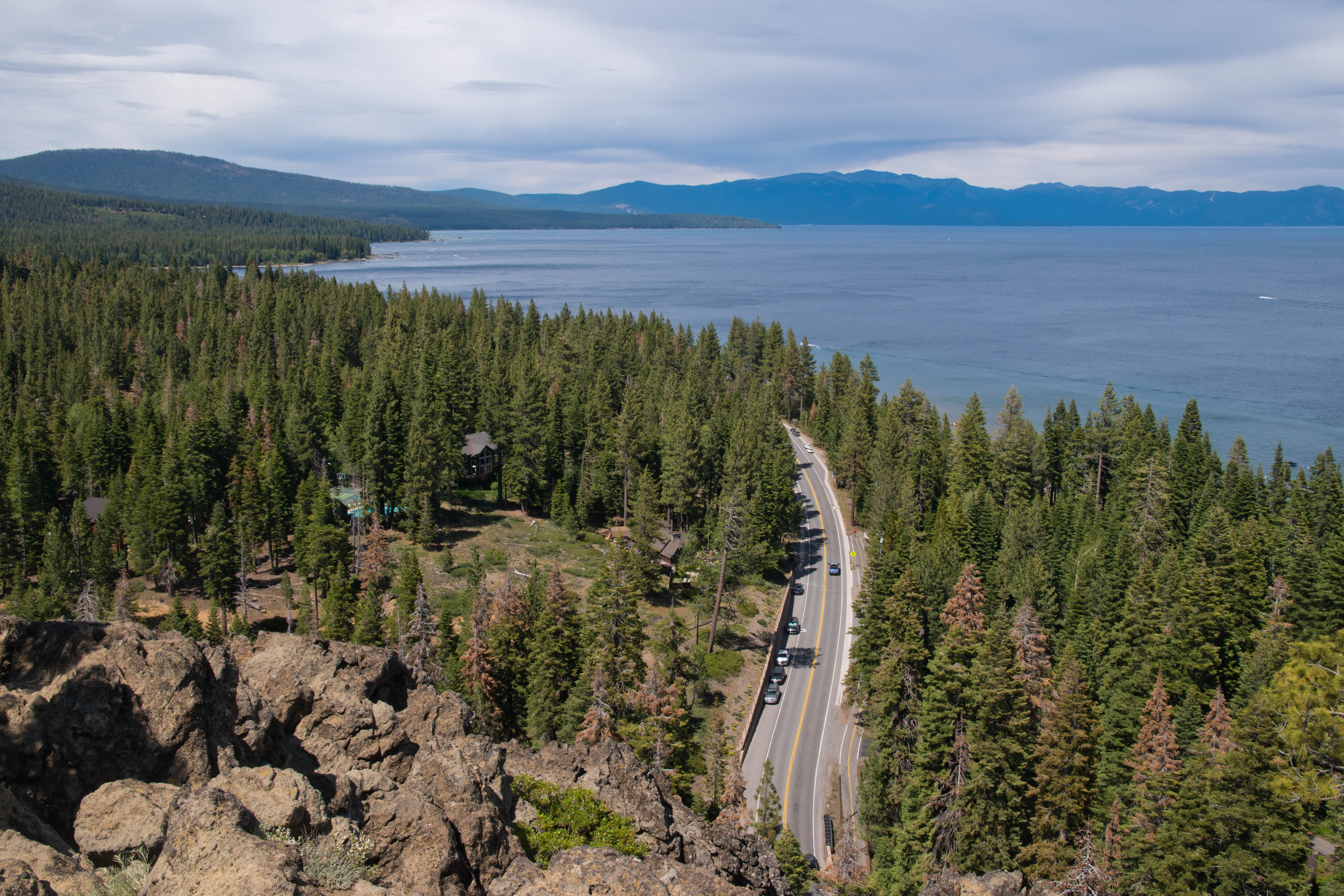
Wednesday, July 19, 2023

Devils Postpile

Devils Postpile
1.3 miles loop, 250 feet elevation gain
Difficulty: Easy
Access: Devils Postpile bus to trailhead (unless arriving before 7 AM), Devils Postpile National Monument entrance fee and bus fare required

California's Devil Postpile National Monument, nestled in the Sierra Nevada outside the town of Mammoth Lakes, is home to one of the most perfectly geometric examples of columnar basalt in the American West. Although such hexagonal rock columns are not rare in the western US, Devils Postpile is an exemplar of this type of unique volcanic rock. This is one of the top attractions in the Eastern Sierra and should not be missed; the hike to reach the formation is easy and short and includes views of both the front cliffs of the Postpile as well as a chance to study the neat geometric patterning from above. Devils Postpile can only be visited during summer, when Reds Meadow Road is open past the Mammoth Mountain Ski Resort to reach the national monument.

Due to its status as one of the top attractions around Mammoth Lakes, visitors looking to go to Devils Postpile in the summer months must ride a shuttle bus from the Mammoth Mountain resort. Buses run during the day from Mammoth Mountain, making stops at Agnew Meadows, Devils Postpile, the Rainbow Falls Trailhead, and Reds Meadow; tickets can be purchased online in advance. The Reds Meadow Road is only open to passenger cars outside of the bus system’s operating hours; visitors hoping to drive to the Devils Postpile Trailhead must pass the entrance kiosk at Minaret Summit before 7 AM.

Devils Postpile is a long way from any major city (Reno, Nevada is perhaps the closest) but is a short drive from the town of Mammoth Lakes, the primary ski and outdoor destination of the Eastern Sierra.

I visited Devils Postpile on an early July morning: as the bus system was in effect, I found myself arriving at Minaret Summit at sunrise to be able to drive to the national monument. From the center of town in Mammoth Lakes, I followed Minaret Summit Road to the northwest, crossing the saddle and passing the entrance kiosk to enter the San Joaquin watershed. The entrance kiosk was not staffed at 6 AM but it is staffed later in the day- expect to stop at the kiosk on your way out to pay entrance fees. At this point, the Minaret Summit Road became the Reds Meadow Road and began descending into the Middle Fork San Joaquin River valley. While the road was paved the entire way, the stretch of road just past Minaret Summit was hairiest: here, there were no lane divides, with two-way traffic on a windy mountain road (including occasional buses) accommodated on a single lane road. After reaching the bottom of the valley and passing the Agnew Meadows turnoff, the road became an easier drive, with defined lanes the rest of the way down to the right turnoff for Devils Postpile. Taking the turnoff, I followed the road down to a large parking lot, which was already half full just after 6 AM on the Fourth of July weekend. There was plenty of parking and bathrooms at the trailhead.

The trail to Devils Postpile left the parking area and headed south along the Middle Fork San Joaquin River, quickly entering a pleasant riverside meadow. After crossing the meadow, the trail reentered the forest but stayed by the riverbank, with partial views of the river to the right.

Middle Fork San Joaquin River
At a third of a mile from the trailhead, I came to a junction with the Upper Postpile Loop. I stayed on the lower trail, which immediately after came to the foot of a spectacular wall of hexagonal basalt columns- the Devils Postpile. On the left end of the postpile wall were a group of warped columns that had clearly been subject to more geological forces since the time of their origin. These twisted columns allowed me to gaze directly onto the bases of the hexagonal columns.

Devils Postpile
Beneath the postpile wall, a pile of broken hexagonal columnar basalt talus littered the hillside; the extreme geometric nature of these rocks made them look artificial, as if this were the dumpster for some darker-covered concrete columns rather than a natural wonder. I walked a hundred feet south along the trail, enjoying impressive direct views of the postpile throughout.

Devils Postpile
How did such a unique geological occurrence come to this valley at the headwaters of the Middle Fork San Joaquin River? The postpile's ultimate origin is shared with the origin of the rest of America's Western Cordillera: the subduction of the Farallon Plate beneath the North American Plate. This subduction event created the Rocky Mountains as well as the magma intrusions into the crust that were responsbile for Devils Postpile. About a hundred thousand years ago, one such magma intrusion erupted in the Reds Meadow Valley and formed a lake of mafic (basaltic) lava; as the lava lake cooled into rock, the lava began to contract, forming boundaries known as cooling joints that were perpendicular to the surface of the cooling lava. As these cooling joints extended through the lava, they formed hexagonal columns as the lava cooled into basalt. Later erosion by glaciers and the Middle Fork San Joaquin River exposed the columns and created the cliffs of basalt that we see today.

The trail passed by the base of the postpile and then began a short ascent, reaching a second junction with the Upper Postpile Loop at a half mile from the trailhead. This time, I took the left fork to follow the Upper Postpile Loop, which I took for the return trip to the trailhead. The Upper Postpile Loop continued ascending a small hill and immediately provided me a closer opportunity to study the columnar basalt. The columns here were at an angle, which indicated that geological forces have warped the original basalt formation: the original cooling joints (and thus the columns) would have all formed vertically.

Columnar basalt
The loop trail ascended 200 feet above the Middle Fork San Joaquin River before it began to drop downhill again, reaching an interesting view of the columnar basalt from above at 0.8 miles into the hike. Here, glacier polish had left a flat, smooth surface of hexagonal basalt tiles, where each tile was the cap of one basalt column. This was a rare and unique opportunity to see a cross-section of the geometries of these columns, which turned out to not all be hexagonal: while six-sided columns were the most common, I also spotted a number of 5 and 7-sided columns.

Smooth caps of the Devils Postpile
After marveling at these bizarrely cleanly-shaped rock columns, I finished up the Upper Postpile Loop with a final descent back to the main trail next to the Middle Fork San Joaquin River, closing the loop at just under 1 mile; from there, I followed the trail along the river just one-third of a mile north back to the trailhead and parking area. I coupled this hike with a later hike to Rainbow Falls to see the two main attractions of the national monument and enjoy its fascinating geologic history.

Wednesday, July 12, 2023

Schulman Grove Discovery Trail

Dead Sentry Tree and the Sierra Nevada
1 mile loop, 300 feet elevation gain
Difficulty: Easy
Access: Paved road to trailhead, Inyo National Forest Ancient Bristlecone Pine Forest recreation fee required

Gnarled and lonely atop the arid White Mountains of California, the bristlecone pines of Schulman Grove are the oldest known living things on earth. The Discovery Trail visits a particularly scenic stretch of the Ancient Bristlecone Pine Forest in Inyo National Forest and while it doesn't pass by Methuselah- the oldest tree on the planet- you'll see plenty of 4000-plus year old trees, including the iconic Dead Sentry Tree, perhaps one of the most photographed trees. The stunning views of the Sierra Nevada across Owens Valley make this an even more rewarding hike. Despite fairly easy stats, the hike can be a bit challenging due to elevation- the entire trail is above 10000 feet. This is the easiest way to see the Ancient Bristlecone Pine Forest and visitors should not miss out on seeing these incredible ancients.

The Ancient Bristlecone Pine Forest in the White Mountains is a long way from any large metropolitan area, although it's not that far from the town of Bishop, which is the largest population center in Owens Valley. Las Vegas is 4 hours away, Los Angeles 5 hours, and the Bay Area at least 6 hours of driving away. I hiked the Discovery Trail during a summer trip to Mammoth Lakes with Anna. From Bishop, we followed US 395 south to Big Pine, turning left onto California Highway 168 at the very northern edge of town. We followed Highway 168 for 13 miles into the White Mountains, entering a narrow canyon where the road reduced to a single lane in spots. At the junction with the White Mountain Road, we turned left and followed this paved road 10 miles north along the crest of the White Mountains past stunning views of Owens Valley and the Sierra Nevada to the right turnoff for the Ancient Bristlecone Pine Forest Visitor Center, just before the pavement end. We parked in the visitor center lot, which had room for over 30 cars. We stopped by the visitor center first to learn about the grove and to pay the entrance fee for visiting the forest (Federal Recreation Passes are accepted here).

Multiple trails branched out from the visitor center into this grove of ancients. The Methuselah Trail, a four-mile loop which visits the oldest currently known non-clonal tree on the planet, is likely to interest most visitors, but as we arrived with limited time in the afternoon, we chose to hike the Discovery Trail instead, a shorter loop that visits the first bristlecone pines discovered to be over 4000 years old. The Discovery Trail started on the north side of the parking lot, across from the visitor center.

The Discovery Trail started off with a series of gentle uphill switchbacks through the bristlecone pine forest. The bristlecones at the start of the hike are not terribly impressive compared with what was to come. Here, the trees tended to be taller, straighter, leafier, and thinner: in other words, they looked far more similar to the traditional idea of a tree than their beautifully grotesque elders do. The Sierra Nevada on the other side of Owens Valley was visible from the start, although views would improve as we ascended.

Sierra Nevada and the bristlecone pines of Schulman Grove
As we gradually ascended the hill above the visitor center via switchbacks, the trees became more gnarled, trading their striaght trunks for increasingly spherical clusters of branches. These more wizened trees are typically older than their more put-together looking counterparts: the slow growth of these trees promotes a denser wood that in turn enhances the trees' longevity.

In the White Mountains, the soil erodes at the rate of about a foot per millenium; thus, the degree of exposure of a bristlecone's roots can hint at its age. Using this metric, it's easy to tell that some of the trees here are well over 3000 years old. 

Aged bristlecone pine with exposed roots
Among the oldest bristlecone pines, many barely cling on to life. What initially seems to be the dead trunk will often have just a few inches of live bark supporting small patches of needles and cones. 

After a steady ascent via switchbacks over the first third of a mile of the hike, the trail arrived along the spine of the ridge; here, the trail ascended via stairsteps along the ridge amidst some of the oldest and most spectacular trees in the grove.

Ancient trees atop the ridge
Schulman Grove is named after Edmund Schulman, a dendrochronologist from the University of Arizona who first measured the incredible age of bristlecone pines at this very spot in the White Mountains. Before Schulman arrived in the White Mountains in the 1950s, the giant sequoias of the Sierra Nevada were thought to be the oldest living trees: after all, the largest trees on earth, which were known to exceed 3000 years, had something to show for their extended age! The wizened, windswept, and stubby bristlecone pines were not initially thought to match sequoias in age. However, as dendrochronology- the science of using tree rings to establish a record of environmental changes over millenia- took off in the 1950s, Schulman came to the White Mountains to check out the bristlecone pines. On this very ridge, Schulman took a core of a tree now known as Pine Alpha and to his amazement counted over 4000 rings- the first recorded tree over four millenia old! By taking cores from long-dead trees here that had been well preserved by the dry and harsh climate, Schulman was able to construct a dendrochronological record spanning the past ten millenia. Pine Alpha is not identified for its safety, but is one of the trees that is found atop the ridge along this very trail.

Ancient trees near Schulman's discovery site of Pine Alpha

Bristlecone bark
At just over a half mile from the trailhead, we reached the high point of the hike. Here, the trail crossed a gully where the rock underfoot transitioned from limestone to some metaigneous rock. Bristlecone pines grow especially well on limestone: in fact, the presence of limestone at high elevations in the Great Basin is a unifying factor between where these trees are found here in the White Mountains and further in the east in the Snake Range of Nevada, which together represent two of the most significant occurences of these trees. Bristlecones were scattered across the limestone slopes but the forest abruptly ended when we crossed onto the talus slope of red rock.

Sierra Nevada and the Schulman Grove on limestone slopes
Although the trees along the trail ended briefly, there was still much to see from this high, 10500-foot perch in the White Mountains. The grand Sierra Nevada and its soaring granite crest rose to the south and the west, towering above the desert floor of Owens Valley that lay between the Sierra and the White Mountains. Looking south we could see Sierra giants like Mount Williamson, the pyramidal guardian peak of Manzanar; the range stretched out of sight, culminating at Mount Whitney before fading down to the Mojave Desert.

The most impressive part of this Sierra view, however, was clearly the Palisades, a granite wall rising to the southeast that culminated in 14249-foot North Palisade, the third highest peak in the Sierra Nevada. Multiple permanent snowfields filled the cirques beneath the peaks of the Palisades; the most impressive of these ice bodies is the Palisades Glacier, which simultaneously has the distinction of being the largest glacier in the Sierra Nevada and one of the southernmost glaciers in the United States. Much of the view of the glacier was blocked from this angle by Temple Crag, a rock monolith lying beneath North Palisade, but it was still exciting to catch a glimpse of one of the final remnants of the incredible geological phenomena that shaped much of the Sierra Nevada.

Palisades and the Palisade Glacier
As the trail began to descend the rocky talus slope, we came upon two isolated bristlecone pines that were well separated from their limestone-loving brethren. The uphill tree still sported a healthy complement of needles, while the lower tree was clearly dead. However, this lower tree- known as the Dead Sentry Tree- had a particularly twisted and gnarled look, with each branch spiraling skyward from its rugged base. This exceedingly pictureque tree is undoubtedly the most photographed spot along this hike and is also one of the world's most famous and visually recognizable trees, even if most people are unaware of its name. Although often mistaken for being Methuselah, the oldest tree on earth, Dead Sentry is in fact dead and not the oldest living tree.

Dead Sentry Tree

Dead Sentry
Past Dead Sentry, the trail continued to descend before heading south to return towards the visitor center. The final stretch of the hike had just a few bristlecones, most of which were less noteworthy, although there were still plenty of views uphill to the numerous bristlecones that we had seen earlier along the ridge. The trail brought us back to the parking lot to wrap up the one-mile loop.

This is one of the shortest and most easily accessible hikes for seeing bristlecone pines anywhere and both the trees and the mountain views along this hike are beyond spectacular. While hikers who are game for more may prefer more intense hikes in the White Mountains, all visitors to the Ancient Bristlecone Pine Forest should walk through this grove once and marvel at the tenacity of life. Don't miss out if you're visiting the Eastern Sierra.